 HSL4_Brecht-Noord_1.jpg (41317 bytes)
|
The Railfaneurope.net Picture Gallery
Directory: /pix/be/misc/HSL
Last update: Sat Nov 15 21:59:44 CET 2014
|
|
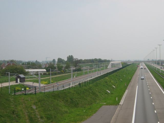
HSL4 (Antwerpen-Hazeldonk Grens), seen North of Station Noorderkempen, from the bridge for Veldstraat, looking towards the Netherlands.
Brecht. 7th May 2006.
P.L.Guillemin (plguillemin@yahoo.fr) |
|
HSL4 (Antwerpen-Hazeldonk Grens), seen North of Station Noorderkempen, from the bridge for Veldstraat, looking towards the Netherlands.
Brecht. 7th May 2006.
P.L.Guillemin (plguillemin@yahoo.fr) |
|
HSL4 (Antwerpen-Hazeldonk Grens), seen North of Station Noorderkempen, from the bridge for Veldstraat, looking towards the Netherlands.
Brecht. 7th May 2006.
P.L.Guillemin (plguillemin@yahoo.fr) |
|
HSL4 (Antwerpen-Hazeldonk Grens), seen North of Station Noorderkempen, from the bridge for Veldstraat, looking towards the Netherlands.
Brecht. 7th May 2006.
P.L.Guillemin (plguillemin@yahoo.fr) |
|
HSL4 (Antwerpen-Hazeldonk Grens), seen North of Station Noorderkempen, from the bridge for Veldstraat, looking towards the Netherlands.
Brecht. 7th May 2006.
P.L.Guillemin (plguillemin@yahoo.fr) |
|
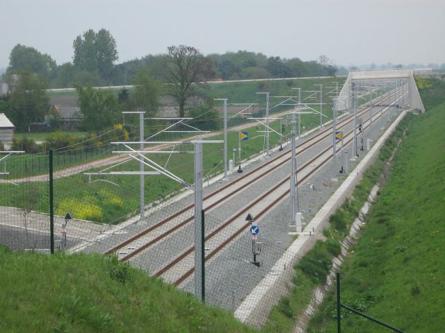
HSL4 (Antwerpen-Hazeldonk Grens), seen South of Station Noorderkempen, from the bridge for Bethovenstraat, looking towards Antwerp.
Brecht. 7th May 2006.
P.L.Guillemin (plguillemin@yahoo.fr) |
|
HSL4 (Antwerpen-Hazeldonk Grens), seen South of Station Noorderkempen, from the bridge for Bethovenstraat, looking towards Antwerp.
Brecht. 7th May 2006.
P.L.Guillemin (plguillemin@yahoo.fr) |
|
HSL4 (Antwerpen-Hazeldonk Grens), seen South of Station Noorderkempen, from the bridge for Bethovenstraat, looking towards Antwerp.
Brecht. 7th May 2006.
P.L.Guillemin (plguillemin@yahoo.fr) |
|
HSL4 (Antwerpen-Hazeldonk Grens), seen very close to its North end, looking towards the nearby Belgian-Dutch border.
Transportzone Meer (Gemeente Hoogstraten). 7th May 2006.
P.L.Guillemin (plguillemin@yahoo.fr) |
|
HSL4 (Antwerpen-Hazeldonk Grens), seen very close to its North end, looking towards the nearby Belgian-Dutch border.
Transportzone Meer (Gemeente Hoogstraten). 7th May 2006.
P.L.Guillemin (plguillemin@yahoo.fr) |
|
HSL4 (Antwerpen-Hazeldonk Grens), seen very close to its North end, looking towards Antwerp and the wind-farm of Meer.
Transportzone Meer (Gemeente Hoogstraten). 7th May 2006.
P.L.Guillemin (plguillemin@yahoo.fr) |
|
HSL4 (Antwerpen-Hazeldonk Grens), seen at its North end, just South of the Belgian-Dutch border.
One can appreciate the difference between Belgian and Dutch 25kV (high-speed) catenary masts... Further behind stands the famous (Northbound) service area of Hazeldonk (NL), whose McDonald's welcomes people driving into the Netherlands on Motorway E19. Transportzone Meer (Gemeente Hoogstraten). 7th May 2006.
P.L.Guillemin (plguillemin@yahoo.fr) |
|
HSL4 (Antwerpen-Hazeldonk Grens), seen at its very North end, on the Belgian-Dutch border.
Save for trials, this border-point remains closed. Transportzone Meer (Gemeente Hoogstraten). 7th May 2006.
P.L.Guillemin (plguillemin@yahoo.fr) |
|
HSL4 (Antwerpen-Hazeldonk Grens), seen from Mieksebaan, looking towards Antwerp.
Overbroek (Gemeente Brecht). 7th May 2006.
P.L.Guillemin (plguillemin@yahoo.fr) |
|
HSL4 (Antwerpen-Hazeldonk Grens), seen from Mieksebaan, looking towards Antwerp.
Overbroek (Gemeente Brecht). 7th May 2006.
P.L.Guillemin (plguillemin@yahoo.fr) |
|
HSL4 (Antwerpen-Hazeldonk Grens), seen from Mieksebaan, looking towards the Netherlands.
Overbroek (Gemeente Brecht). 7th May 2006.
P.L.Guillemin (plguillemin@yahoo.fr) |
|
Zaterdag 13 mei 2006 12h48 kilometerpunt 50 op nieuwe hogesnelheidslijn Antwerpen-Nederland
Samedi 13 mai 2006 12h48 point kilométrique 50 sur la nouvelle ligne ŕ grande vitesse (LGV)
Saturday 13 may 2006 12h48 kilometerpoint 50 on new highspeedline Antwerp-Holland Photo: Erwin Lamens |
|
Zaterdag 13 mei 2006 12h49 hogesnelheidslijn gezien richting Nederland te Ekeren
Samedi 13 mai 2006 12h49 ligne ŕ grande vitesse vue sens Pays Bays ŕ Ekeren
Saturday 13 may 2006 12h49 highspeedline seen direction Holland at Ekeren Photo: Erwin Lamens |
|
Zaterdag 13 mei 2006 12h56 hogesnelheidslijn gezien richting Nederland te Ekeren blauwe borden duiden zone stroomovergang aan tussen 3000 en 25000 volt
Samedi 13 mai 2006 12h56 ligne ŕ grande vitesse vue sens Pays Bays ŕ Ekeren
Saturday 13 may 2006 12h56 highspeedline seen direction Holland at Ekeren Photo: Erwin Lamens |
|
Zaterdag 13 mei 2006 12h56 hogesnelheidslijn richting Antwerpen te Ekeren
Samedi 13 mai 2006 12h56 ligne ŕ grande vitesse vue direction Anvers ŕ Ekeren
Saturday 13 may 2006 12h56 highspeedline seen direction Antwerp at Ekeren Photo: Erwin Lamens |
|
Zaterdag 13 mei 2006 12h56 hogesnelheidslijn gezien richting Nederland te Ekeren blauwe borden duiden zone stroomovergang aan tussen 3000 en 25000 volt
Samedi 13 mai 2006 12h56 ligne ŕ grande vitesse vue sens Pays Bays ŕ Ekeren
Saturday 13 may 2006 12h56 highspeedline seen direction Holland at Ekeren Photo: Erwin Lamens |
|
Zaterdag 13 mei 2006 13h46 hogesnelheidslijn gezien richting Antwerpen te Ekeren-Donk einde van hogesnelheidslijn voorbij de grote boom is de zone van "stroomovergang"
Samedi 13 mai 2006 13h46 ligne ŕ grande vitesse vue sens Anvers ŕ Ekeren-Donk
Saturday 13 may 2006 13h46 highspeedline seen direction seen direction Antwerp at Ekeren-Donk Photo: Erwin Lamens |
|
Hogesnelheidslijn 4 richting Nederland te Ekeren op zaterdag 13 mei 2006 om 13h47 lijn staat onder spanning met 25000 volt, testritten weldra ? Highspeedline 4 direction Netherlands at Ekeren on saturday 13 may 2006 at 13h47 line is under tension now with 25000 volts, testruns soon ? Photo: Erwin Lamens |
|
Zaterdag 13 mei 2006 13h47 hogesnelheidslijn gezien richting Nederland te Ekeren-Donk de lijn stijgt richting bruggen "Ekeren" en "Brasschaat" (Kleine barreel)
Samedi 13 mai 2006 13h47 ligne ŕ grande vitesse vue sens Pays Bays ŕ Ekeren-Donk
Saturday 13 may 2006 13h47 highspeedline seen direction Holland at Ekeren-Donk Photo: Erwin Lamens |
|
Zaterdag 13 mei 2006 13h49 hogesnelheidslijn gezien richting Nederland te Ekeren-Donk de lijn stijgt richting bruggen "Ekeren" en "Brasschaat" (Kleine barreel) Cab signal duidelijk zichtbaar
Samedi 13 mai 2006 13h49 ligne ŕ grande vitesse vue sens Pays Bays ŕ Ekeren-Donk
Saturday 13 may 2006 13h49 highspeedline seen direction Holland at Ekeren-Donk Photo: Erwin Lamens |
|
Zaterdag 13 mei 2006 13h49 hogesnelheidslijn gezien richting Antwerpen te Ekeren-Donk
Samedi 13 mai 2006 13h49 ligne ŕ grande vitesse vue sens Anversŕ Ekeren-Donk
Saturday 13 may 2006 13h49 highspeedline seen direction Antwerp at Ekeren-Donk Photo: Erwin Lamens |
|
Tracks seen North of Halle, looking towards Brussels.
• Left and Middle: L96 (Brussels-Mons) (160km/h), for domestic services (IC, IR, L, P), conventional international trains and freighters;
Halle (Hal). 5th February 2005.
P.L.Guillemin (plguillemin@yahoo.fr) |
|
Tracks seen North of Halle, looking towards the station (+Mons, Tournai and Lille).
• Left: LGV1 (Brussels-French border), for faster international services;
Halle (Hal). 5th February 2005.
P.L.Guillemin (plguillemin@yahoo.fr) |
|
Tracks at the station of Halle, looking towards Mons, Tournai and Lille.
• Left: LGV1 (Brussels-French border), mostly covered at this stage;
Halle (Hal). 5th February 2005.
P.L.Guillemin (plguillemin@yahoo.fr) |
|
Tracks seen South of the station of Halle, looking towards Mons, Tournai and France.
• Right: L94, branching off to Tournai (via Ath);
One can spot the 3 bridges (1 for each line) built above the Charleroi Canal. Halle (Hal). 5th February 2005.
P.L.Guillemin (plguillemin@yahoo.fr) |
|
LGV1 (Brussels-French border), seen North of Lembeek station, looking towards Halle and Brussels.
At this stage, TBL still applies, but OHLE is already under 25kV-50Hz AC.
Lembeek. 5th February 2005.
P.L.Guillemin (plguillemin@yahoo.fr) |
|
LGV1 (further left), seen North of Lembeek station, looking towards France.
At this stage, LGV1 rises through a long viaduct, flying over L96 (Brussels-Mons, further right) and nearing the Flemish-Wallonian "border". Lembeek. 5th February 2005.
P.L.Guillemin (plguillemin@yahoo.fr) |
|
LGV1 seen from Zuidersstraat, South of Lembeek station, looking towards France.
At this stage, LGV1 (25kV-50Hz AC) flies over L96 (3kV DC), getting very close the Flemish-Wallonian "border". Lembeek. 5th February 2005.
P.L.Guillemin (plguillemin@yahoo.fr) |
|
LGV1 seen South of Lembeek, looking towards France.
At this stage, LGV1 (25kV-50Hz AC) flies over L96 (3kV DC), steering more Westwards. The TVM-TBL change-over closely coincides with the Flemish-Wallonian "border". Lembeek. 5th February 2005.
P.L.Guillemin (plguillemin@yahoo.fr) |
|
HSL2 (Leuven-Ans), seen at its West end, from the Tiensesteenweg, looking towards Ans and Ličge.
The HSL runs between L36 (Bruxelles-Ličge, left) and L139 (Leuven-Ottignies, right). Leuven. 25th September 2005.
P.L.Guillemin (plguillemin@yahoo.fr) |
|
HSL2 (Leuven-Ans), seen at its West end, from the Tiensesteenweg, looking towards Ans and Ličge.
The HSL runs between L36 (Bruxelles-Ličge, left) and L139 (Leuven-Ottignies, right). Leuven. 25th September 2005.
P.L.Guillemin (plguillemin@yahoo.fr) |
|
HSL2 (Leuven-Ans), seen at its West end, looking towards Leuven and Brussels.
One can spot an AM-80 on the Eastbound track of L36, further right. Leuven. 25th September 2005.
P.L.Guillemin (plguillemin@yahoo.fr) |
|
HSL2 (Leuven-Ans), seen at its West end, looking towards Ans and Ličge.
At this stage, the HSL flies over the chord which links L36 and L139. Leuven. 25th September 2005.
P.L.Guillemin (plguillemin@yahoo.fr) |
|
HSL2 (Leuven-Ans), seen at its West end, looking towards Ans and Ličge.
At this stage, the HSL flies over the chord which links L36 and L139. Leuven. 25th September 2005.
P.L.Guillemin (plguillemin@yahoo.fr) |
|
HSL2 (Leuven-Ans), seen at its West end, looking towards Leuven and Brussels.
At this stage, the HSL flies over the chord which links L36 and L139. Leuven. 25th September 2005.
P.L.Guillemin (plguillemin@yahoo.fr) |
|
HSL2 (Leuven-Ans), seen at its West end, looking towards Ans and Ličge.
One can spot L36 (Brussels-Ličge) further left. Leuven. 25th September 2005.
P.L.Guillemin (plguillemin@yahoo.fr) |
|
HSL2 (Leuven-Ans), seen at its West end, looking towards Ans and Ličge.
At this stage, the HSL is still under 3kV DC. Leuven. 25th September 2005.
P.L.Guillemin (plguillemin@yahoo.fr) |
|
HSL2 (Leuven-Ans), seen at its West end, looking towards Leuven and Brussels.
At this stage, the HSL is still under 3kV DC. Leuven. 25th September 2005.
P.L.Guillemin (plguillemin@yahoo.fr) |
|
HSL2 (Leuven-Ans), seen at its West end, looking towards Ans and Ličge.
At this stage, the HSL is still under 3kV DC, but TVM430/TBL2 is already there... Leuven. 25th September 2005.
P.L.Guillemin (plguillemin@yahoo.fr) |
|
HSL2 (Leuven-Ans), seen at its West end, looking towards Ans and Ličge.
TVM430/TBL2 begin there... Leuven. 25th September 2005.
P.L.Guillemin (plguillemin@yahoo.fr) |
|
LGV2 (Leuven-Ans), seen North of Waremme.
Pic looks East, towards Ličge. At this stage, the HSL runs along Motorway E40. Waremme (Rue de la Costale). 1st January 2006.
P.L.Guillemin (plguillemin@yahoo.fr) |
|
LGV2 (Leuven-Ans), seen North of Waremme.
Pic looks East, towards Ličge. At this stage, the HSL runs along Motorway E40. Waremme (Rue de la Costale). 1st January 2006.
P.L.Guillemin (plguillemin@yahoo.fr) |
|
LGV2 (Leuven-Ans), seen North of Waremme, close to the service area of Bettincourt, on Motorway E40.
Pic looks West, towards Brussels. Waremme (Rue de la Costale). 1st January 2006.
P.L.Guillemin (plguillemin@yahoo.fr) |
|
LGV2 (Leuven-Ans), seen North of Waremme, alongside Motorway E40.
Pic looks West, towards Brussels. Waremme (Rue d'Oleye). 1st January 2006.
P.L.Guillemin (plguillemin@yahoo.fr) |
|
LGV2 (Leuven-Ans), seen North of Waremme, alongside Motorway E40.
Pic looks West, towards Brussels. Waremme (Rue d'Oleye). 1st January 2006.
P.L.Guillemin (plguillemin@yahoo.fr) |
|
LGV2 (Leuven-Ans), seen North of Waremme, alongside Motorway E40.
Pic looks West, towards Brussels. Waremme stands in the background. Waremme (Rue d'Oleye). 1st January 2006.
P.L.Guillemin (plguillemin@yahoo.fr) |
|
LGV2 (Leuven-Ans), seen North of Waremme, alongside Motorway E40.
Pic looks East, towards Ličge. Waremme (Rue d'Oleye). 1st January 2006.
P.L.Guillemin (plguillemin@yahoo.fr) |
|
LGV2 (Leuven-Ans), seen North of Waremme, alongside Motorway E40.
Pic looks East, towards Ličge. Waremme (Rue d'Oleye). 1st January 2006.
P.L.Guillemin (plguillemin@yahoo.fr) |
|
Looking to the end of the picture we see the two tunneltracks coming from North-South Connection climbing towards new build bridges, in a small year trains will run here in and out this tunnel next to Belgian Railwaystation Antwerpen-Dam. A small year ago the public could walk inside the tunnels. Digital photo by Erwin Lamens, mailto:erwin.jeannot@skynet.be |
|
Transition catenary Bierbeek , 27/06/2005. Photo by : Denis Verheyden Visit DEF for full-sized versions of my pictures. |
|
Voltage changeover (1) Bierbeek , 27/06/2005. Photo by : Denis Verheyden Visit DEF for full-sized versions of my pictures. |
|
NMBS-SNCB High Speed Line 2 at the entry of Leuven, 04-08-2003
Picture was taken from a train (M6 Stock) in Leuven Digital photo by Davy Gijbels (dgijbels@hotmail.com)
|
|
NMBS-SNCB High Speed Line 2 on the brigde by Leuven, 04-08-2003
Picture was taken from a train (M6 Stock) in Leuven Digital photo by Davy Gijbels (dgijbels@hotmail.com)
|
|
Voltage changeover (2) Bierbeek , 27/06/2005. Photo by : Denis Verheyden Visit DEF for full-sized versions of my pictures. |
|
Zaterdag 13 mei 2006 nieuw tractiestation "Noorderdokken" voor hogesnelheidslijn L4 naar Nederland rechts in beeld goederenlijn 27 A van en naar de Antwerpse haven, Ekeren-Donk (B)
Samedi 13 mai 2006 nouvelle station de traction "Noorderdokken" pour la ligne ŕ grande vitesse L4
Saturday 13 may 2006 new tractionstation "Noorderdokken" for highspeedline L4 to Holland Photo: Erwin Lamens |
 HSL4_Brecht-Noord_2.jpg (68735 bytes)
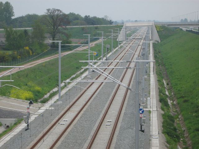 HSL4_Brecht-Noord_3.jpg (67840 bytes)
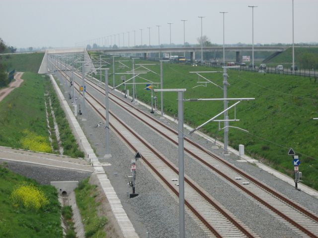 HSL4_Brecht-Noord_4.jpg (68014 bytes)
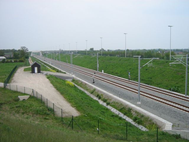 HSL4_Brecht-Noord_5.jpg (58923 bytes)
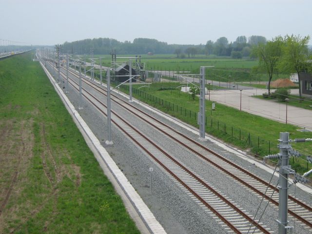 HSL4_Brecht-Zuid_1.jpg (70503 bytes)
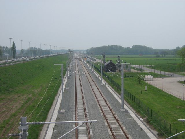 HSL4_Brecht-Zuid_2.jpg (51981 bytes)
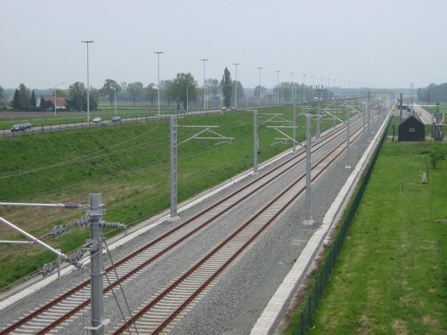 HSL4_Brecht-Zuid_3.jpg (65037 bytes)
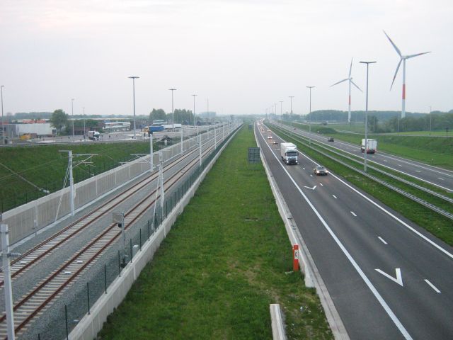 HSL4_Meer_a1.jpg (58426 bytes)
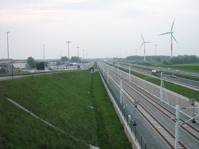 HSL4_Meer_a2.jpg (44765 bytes)
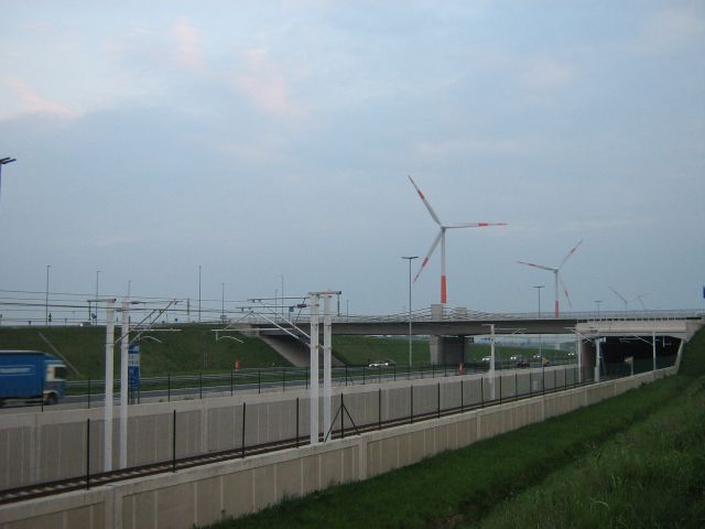 HSL4_Meer_b1.jpg (38330 bytes)
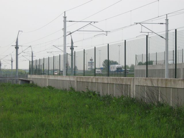 HSL4_Meer_c1.jpg (57235 bytes)
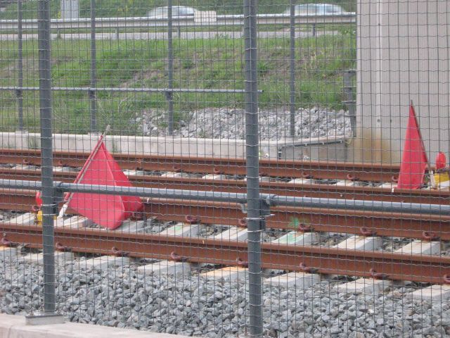 HSL4_Meer_d1.jpg (95323 bytes)
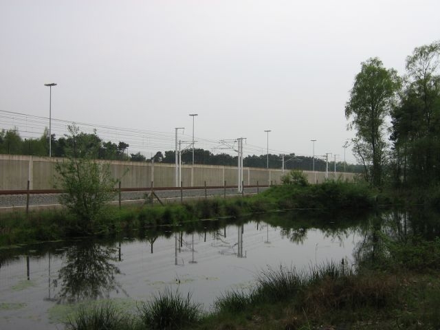 HSL4_Overbroek_1.jpg (122311 bytes)
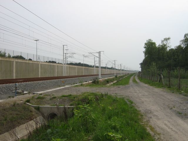 HSL4_Overbroek_2.jpg (134231 bytes)
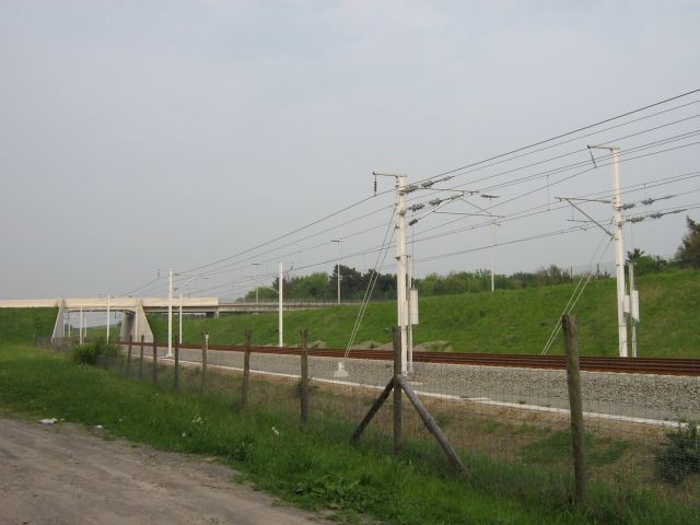 HSL4_Overbroek_3.jpg (116797 bytes)
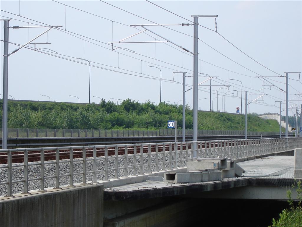 HSL_L4_1R.jpg (122076 bytes)
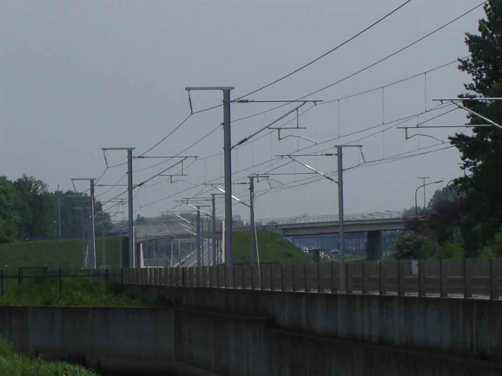 HSL_L4_2R.jpg (73961 bytes)
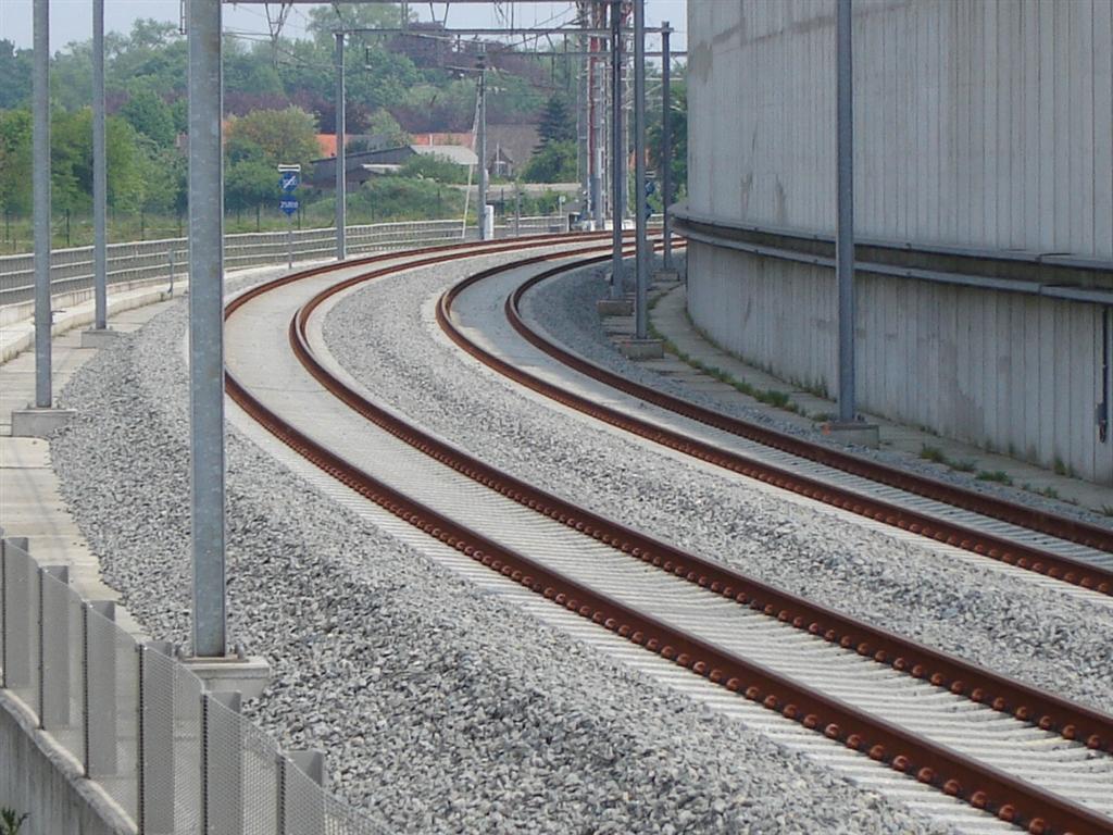 HSL_L4_3R.jpg (162428 bytes)
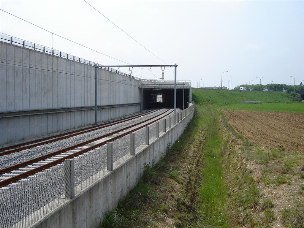 HSL_L4_4R.jpg (145106 bytes)
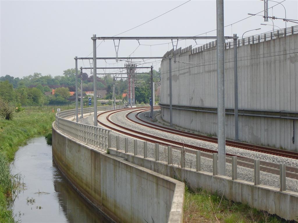 HSL_L4_5R.jpg (123068 bytes)
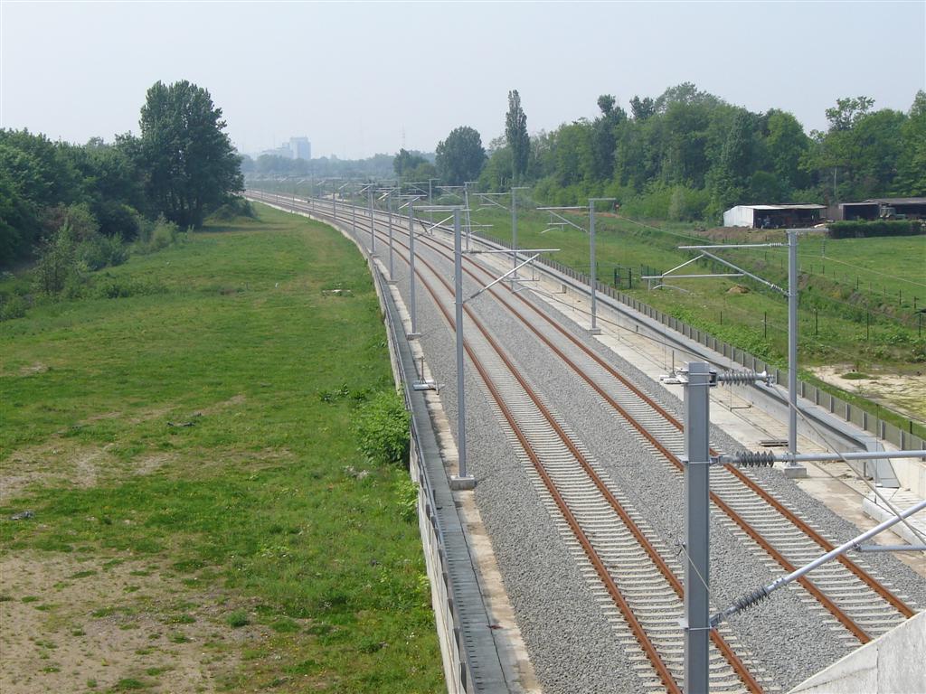 HSL_L4_6R.jpg (163530 bytes)
 HSL_L4_7.jpg (92904 bytes)
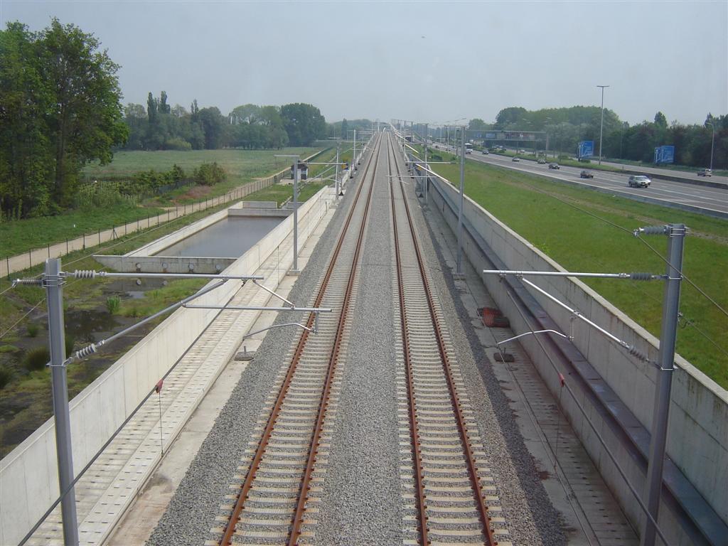 HSL_L4_7R.jpg (143762 bytes)
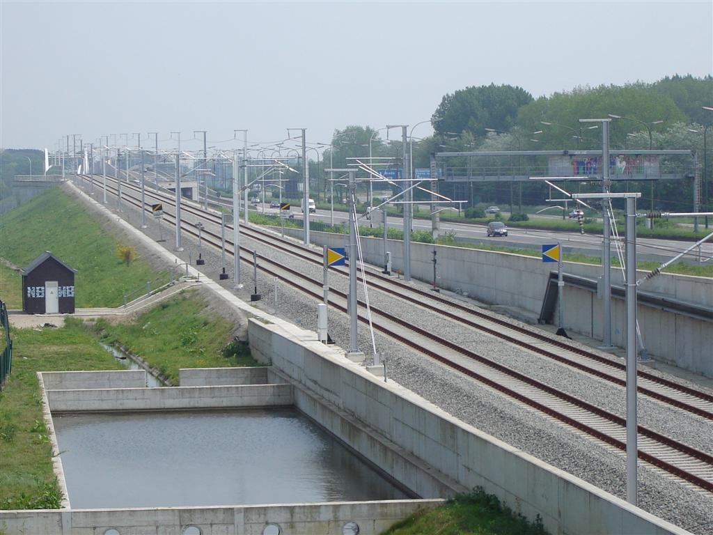 HSL_L4_8R.jpg (133110 bytes)
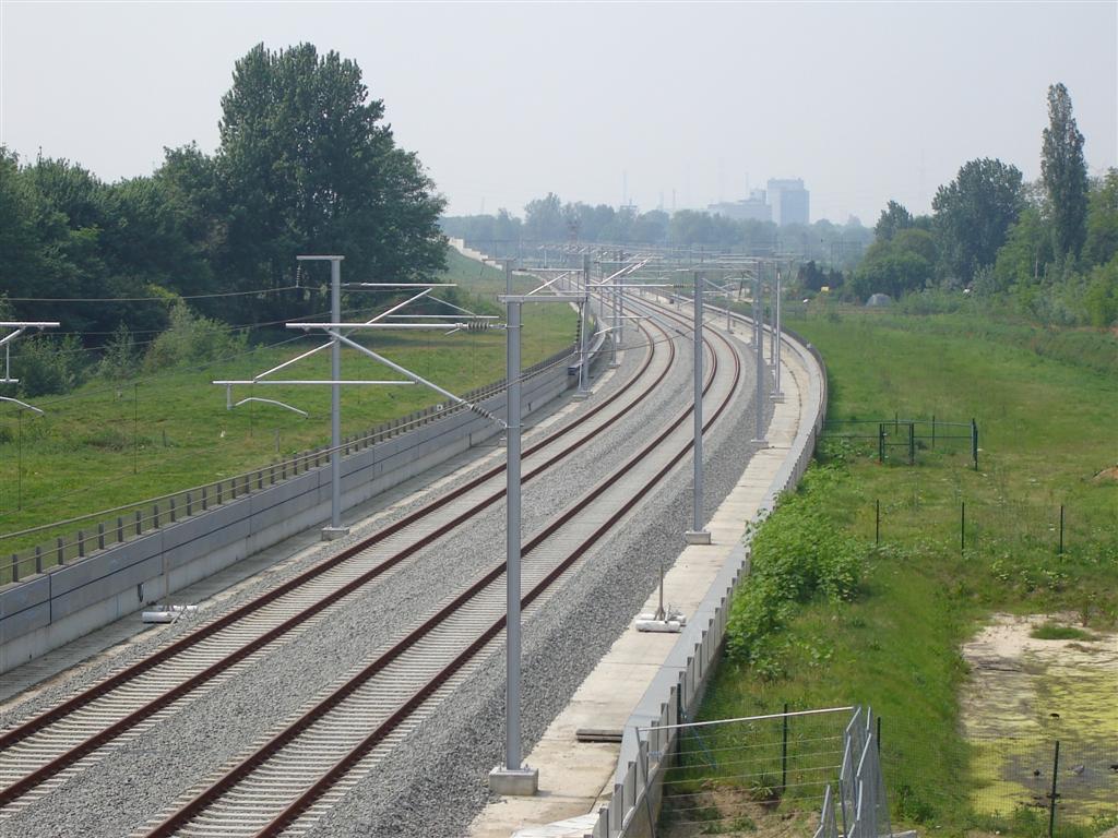 HSL_L4_9R.jpg (149031 bytes)
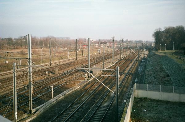 LGV1-L96_f1.jpg (59713 bytes)
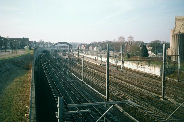 LGV1-L96_f2.jpg (58780 bytes)
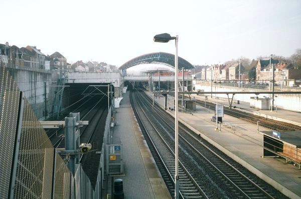 LGV1-L96_f3.jpg (61265 bytes)
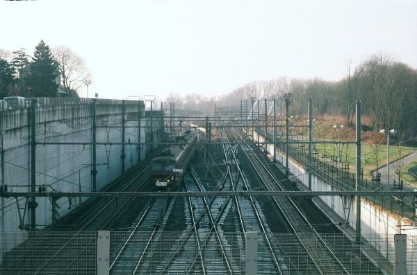 LGV1-L96_f4.jpg (56840 bytes)
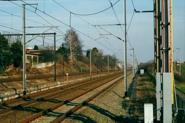 LGV1-L96_g3.jpg (72339 bytes)
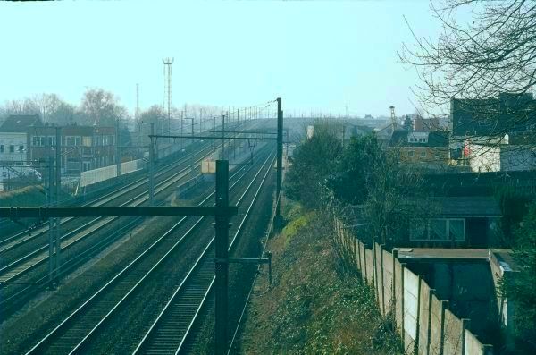 LGV1-L96_g4.jpg (62946 bytes)
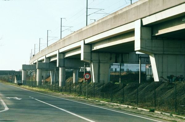 LGV1-L96_g5.jpg (54048 bytes)
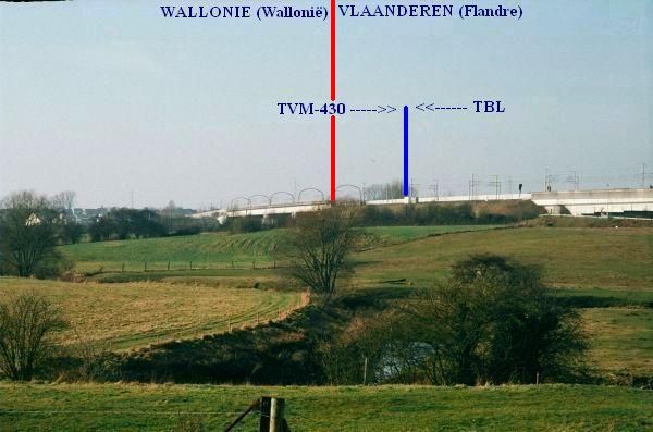 LGV1-L96_g6.jpg (41532 bytes)
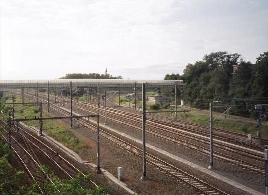 LGV2_Leuven_1.jpg (40004 bytes)
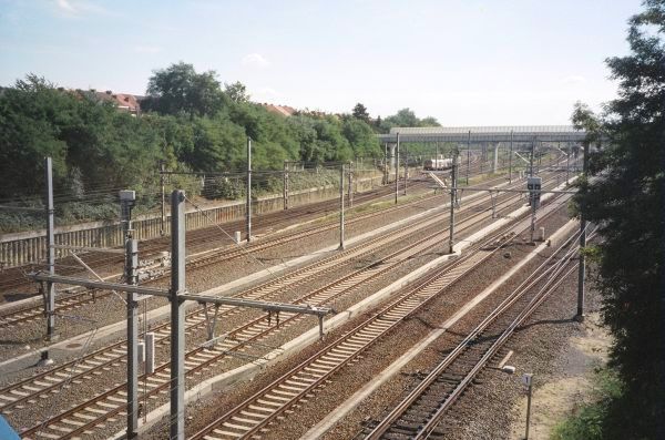 LGV2_Leuven_2.jpg (76122 bytes)
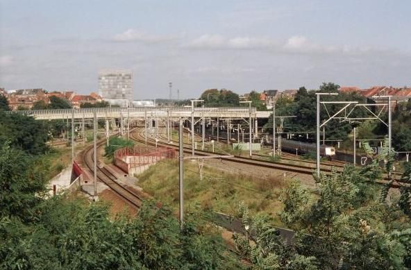 LGV2_Leuven_3.jpg (52032 bytes)
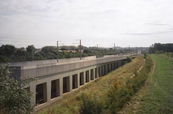 LGV2_Leuven_4.jpg (47529 bytes)
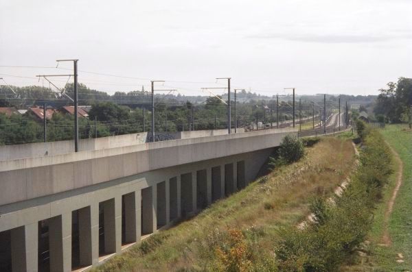 LGV2_Leuven_5.jpg (45942 bytes)
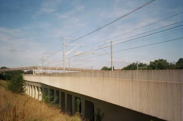 LGV2_Leuven_6.jpg (42055 bytes)
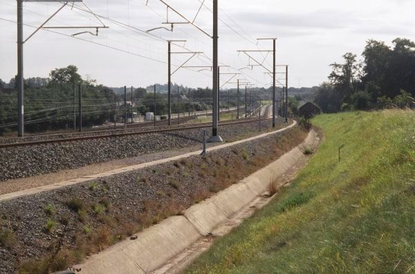 LGV2_Leuven_7.jpg (63366 bytes)
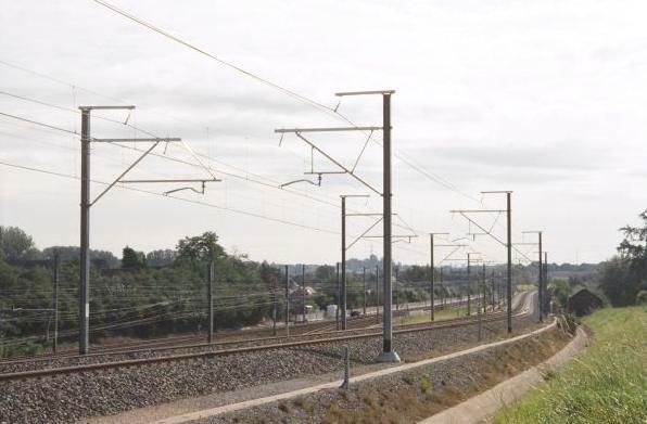 LGV2_Leuven_8.jpg (34513 bytes)
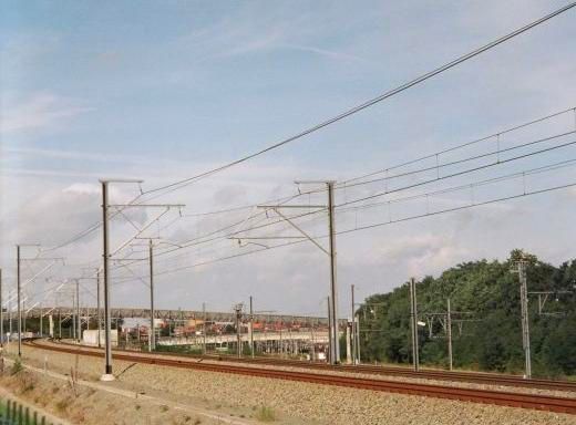 LGV2_Leuven_9.jpg (30293 bytes)
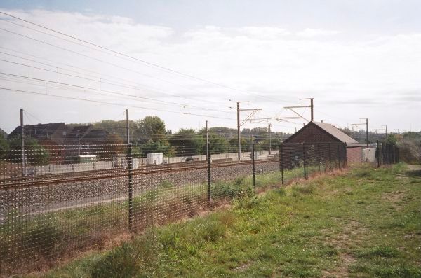 LGV2_Leuven_a10.jpg (57112 bytes)
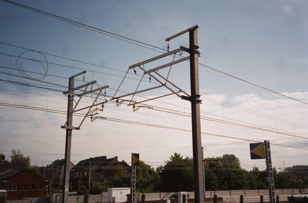 LGV2_Leuven_a11.jpg (47944 bytes)
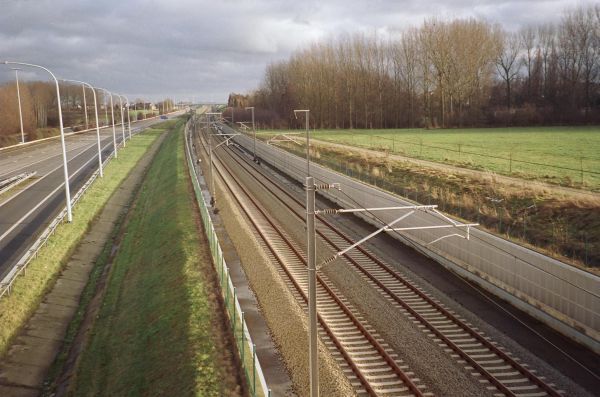 LGV2_Waremme_a1.jpg (56523 bytes)
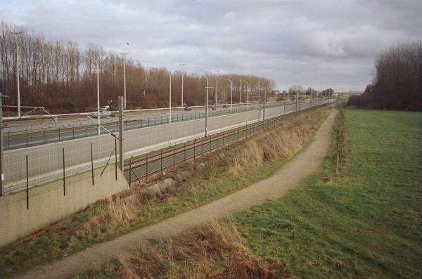 LGV2_Waremme_a2.jpg (47680 bytes)
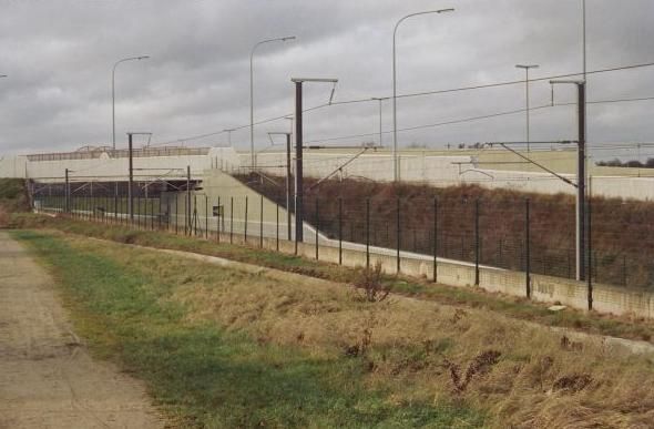 LGV2_Waremme_a3.jpg (36673 bytes)
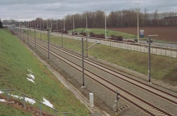 LGV2_Waremme_b1.jpg (43149 bytes)
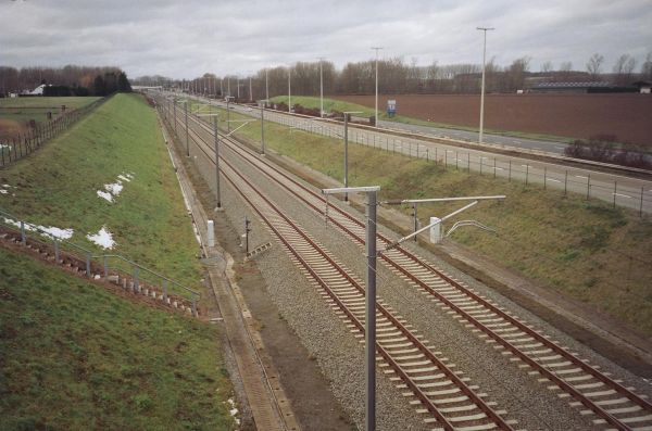 LGV2_Waremme_b2.jpg (55775 bytes)
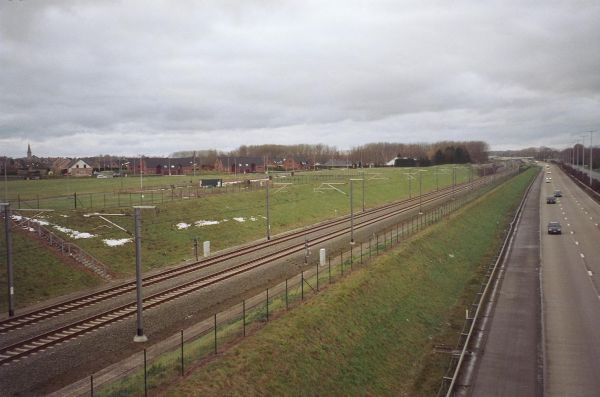 LGV2_Waremme_b3.jpg (40529 bytes)
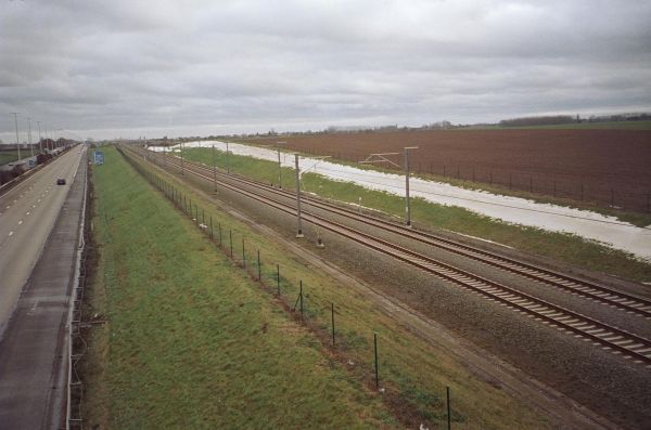 LGV2_Waremme_c1.jpg (43696 bytes)
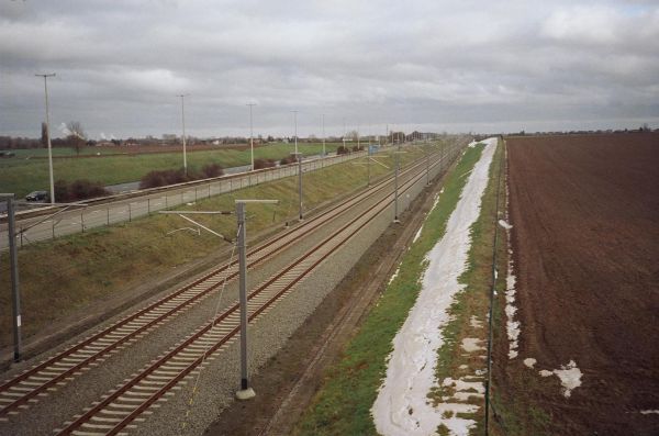 LGV2_Waremme_c2.jpg (46702 bytes)
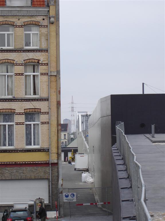 LGV_Antwerpen_-_Amsterdam.jpg (65738 bytes)
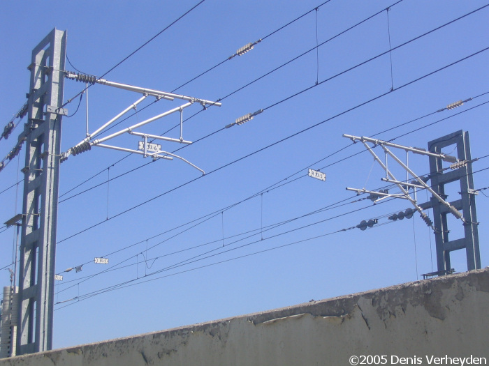 bovenl1r.jpg (140939 bytes)
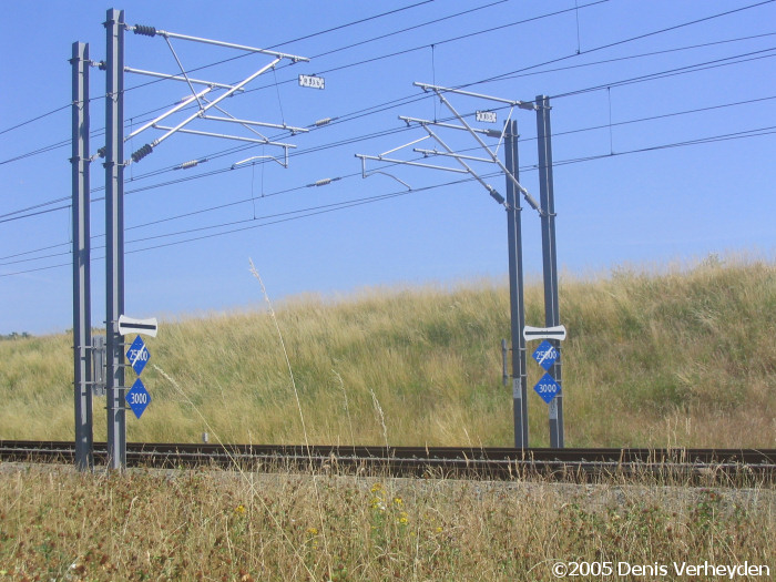 bovenl2r.jpg (151734 bytes)
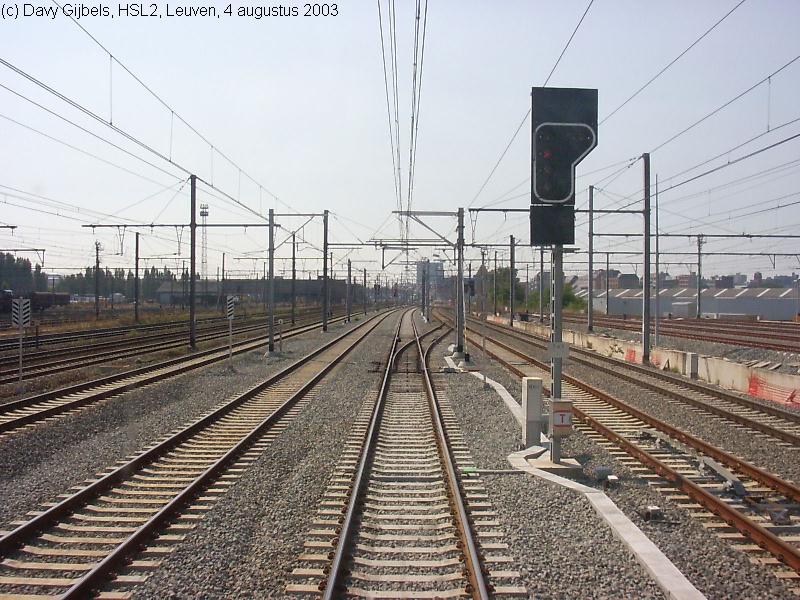 hsl2_1.jpg (121701 bytes)
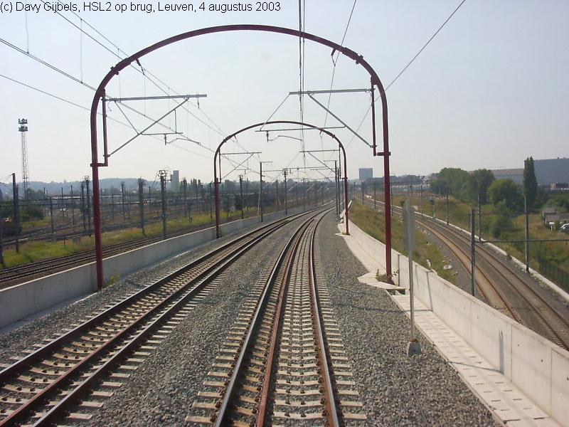 hsl2_2.jpg (106586 bytes)
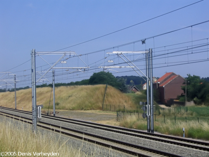 panto_opr.jpg (145060 bytes)
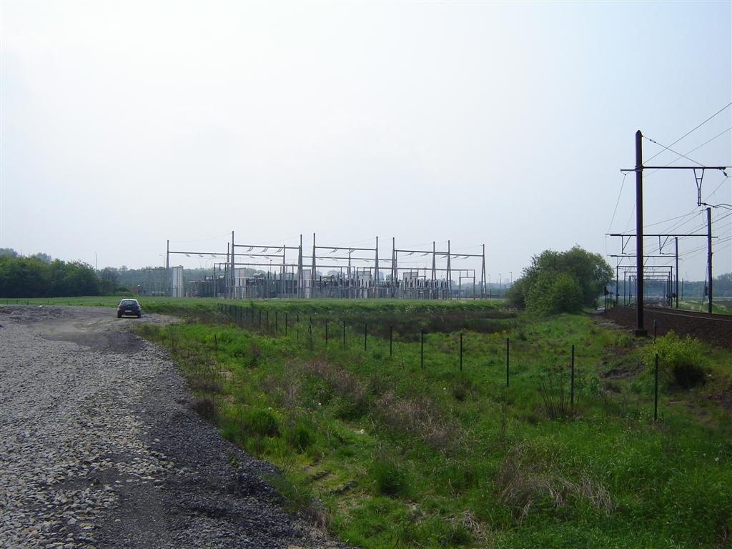 tractiestation_HSL_R.jpg (116381 bytes)