 gb-twmetro-misc-70kmh.jpg (162921 bytes)
|
The Railfaneurope.net Picture Gallery
Directory: /pix/gb/metro/Newcastle/signalling
Last update: Sat Nov 15 20:02:37 CET 2014
|
|
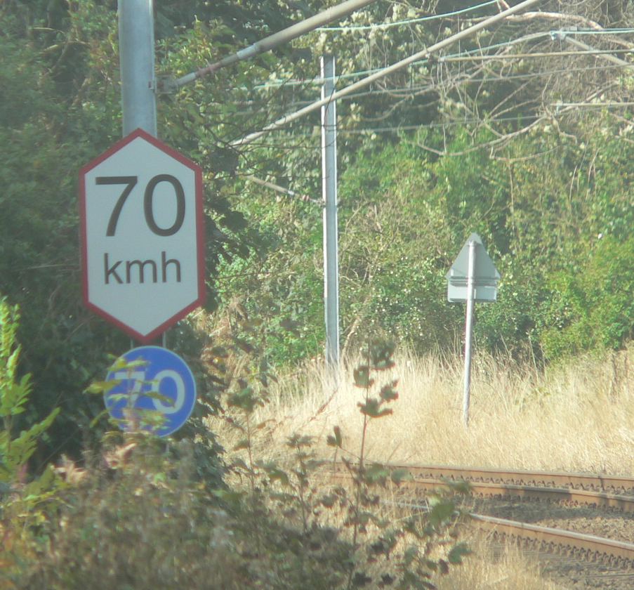
The lozenge shaped sign is a speed restriction sign of 70km/h on the Tyne and Wear Metro. I'm not certain what the white on blue circular sign beneath is, but as the metro has adapted other standard road signs it might be a minimum speed indicator.
Photo by Chris McKenna 10/10/2005. |
|
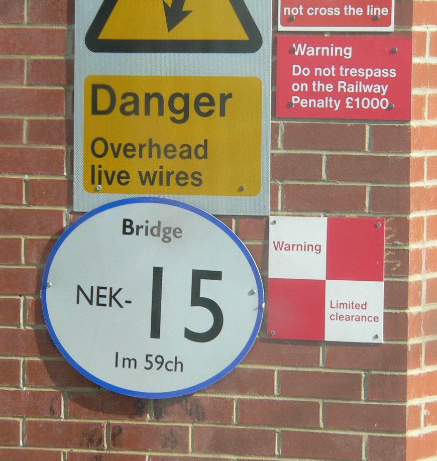
These white oval signs with blue edging are commonly found identifying bridges on the Tyne and Wear Metro. This particular sign was photographed at Pallion station on the Sunderland-South Hylton section of the Yellow line. The 1 mile 59 chains (from South Hylton) indicates that although it is exclusively used by Metro services it is owned by Network Rail - the Metro system uses metric measurements.
Photo by Chris McKenna 10/10/2005. |
|
The view through the rather grubby front window of Tyne and Wear Metro train 4089 as it crosses the River Wear between St Peters and Sunderland stations. The section of track between Pelaw and Sunderland is shared between the Metro and mainline operators Northern Rail - this speed restriction sign is therefore "bilingual". The top, circular, sign is for mainline services and is displayed in miles per hour, with the different speeds presumably for different classes of train. The bottom, lozenge-shaped, sign is for Metro services and is in kilometres per hour.
Photo by Chris McKenna 10/10/2005. |
|
The Tyne and Wear Metro has adopted the standard UK road sign warning of traffic lights ahead for use as a warning of signals ahead. Unlike on the road network though, the distance plate gives the distance in metres rather than imperial units (miles or yards).
Photo by Chris McKenna 10/10/2005. |
|
A standard two-aspect Tyne and Wear Metro signal. This one is for Newcastle-bound trains at Pelaw station.
Photo by Chris McKenna 08/10/2005. |
|
A three-aspect Tyne and Wear Metro signal. This one is for South Shields and Sunderland/South Hylton-bound trains at Pelaw station. It also allows access to the sidings at the eastern end of the station. Before the extension to Sunderland in 2002 Pelaw was the southern terminus of the Yellow line, so the sidings would have been in much more frequent use than they are today, although Pelaw is still used as a reversing point for some services.
Photo by Chris McKenna 08/10/2005. |
 gb-twmetro-misc-bridgemarker.jpg (156925 bytes)
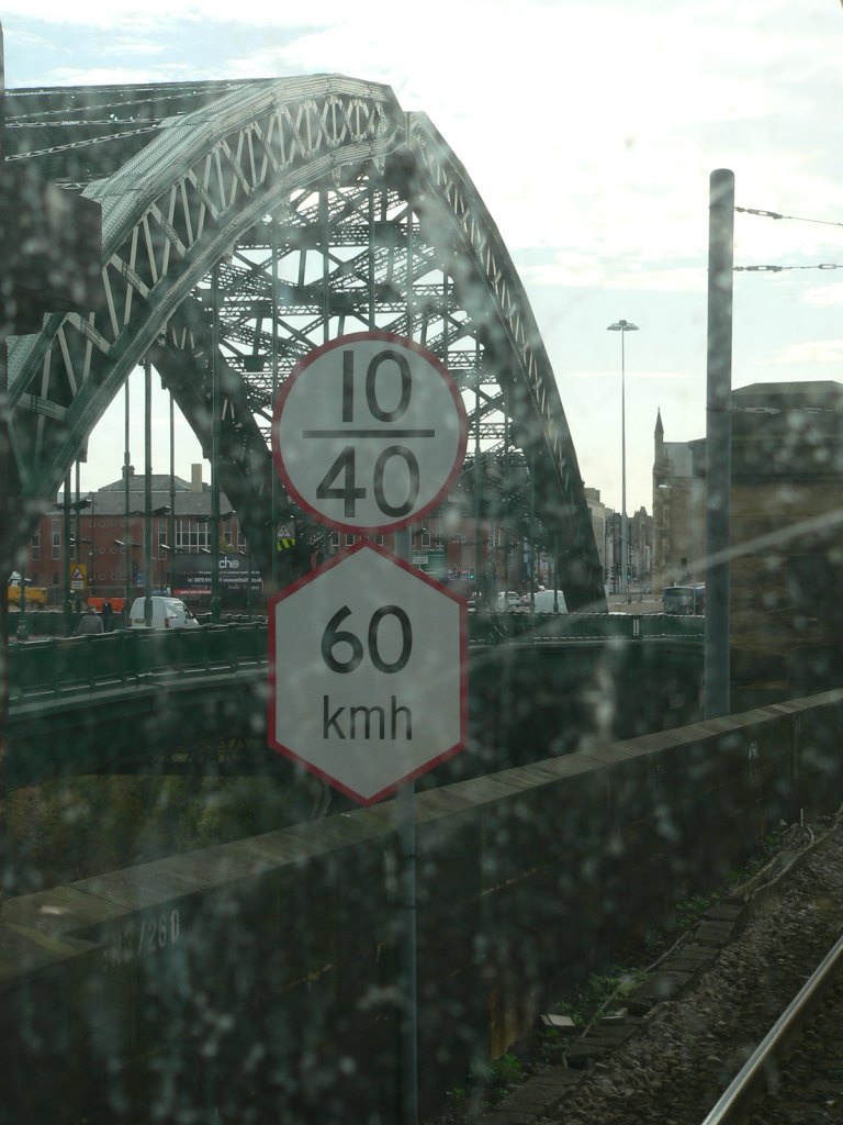 gb-twmetro-misc-nr+metro-speedboards.jpg (139940 bytes)
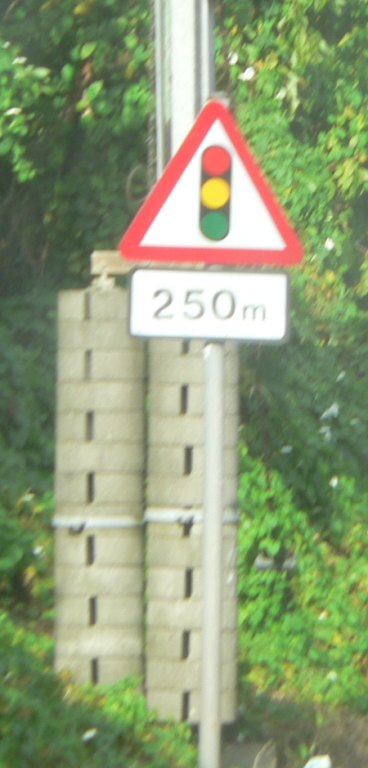 gb-twmetro-misc-signal250m.jpg (65150 bytes)
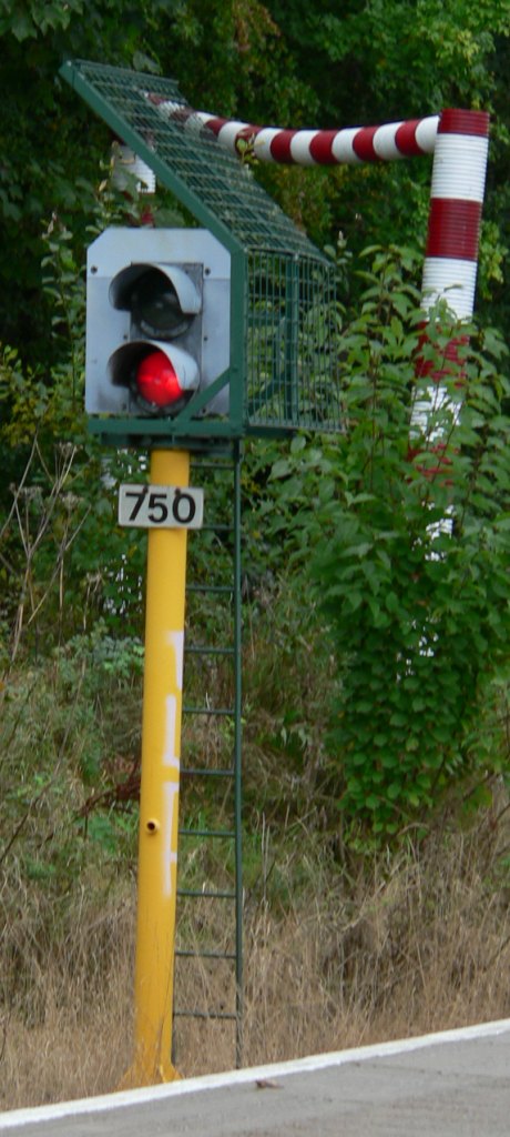 gb-twmetro-signal01.jpg (127022 bytes)
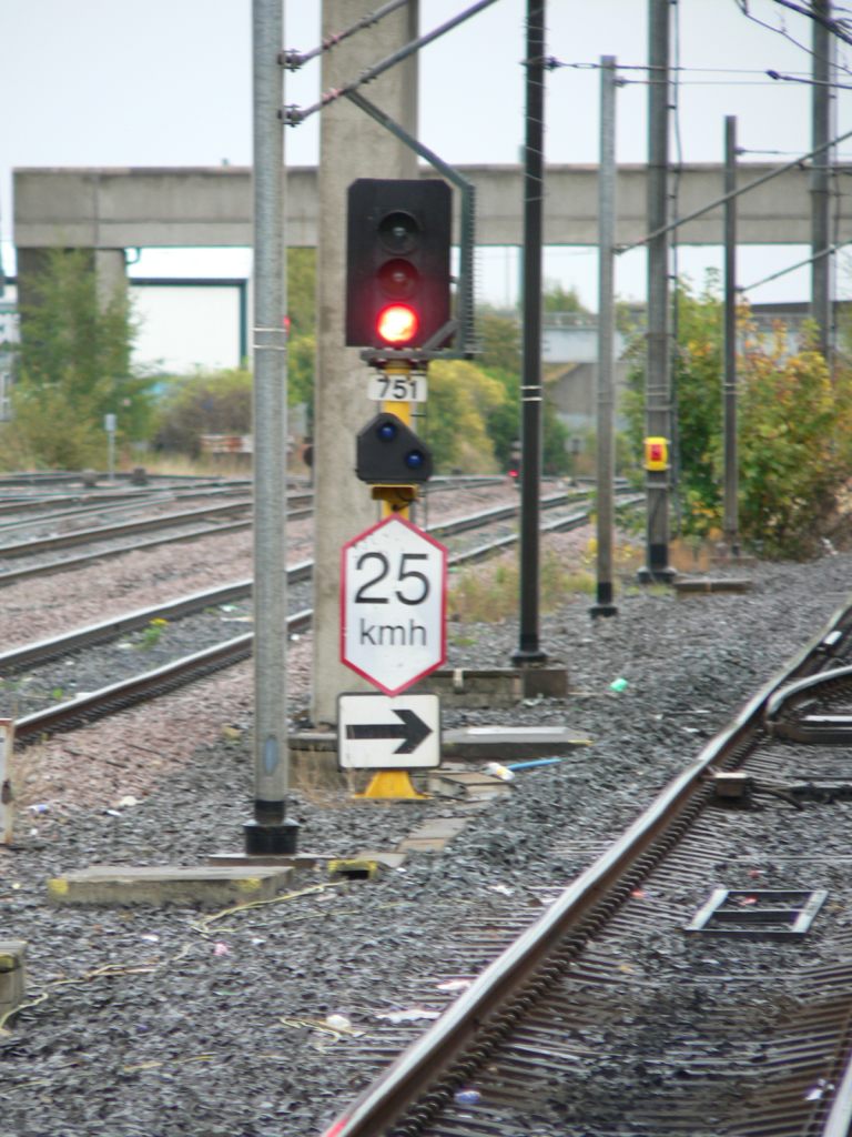 gb-twmetro-signal02.jpg (161912 bytes)