 GlenfromeRoadBridge-01.jpg (160446 bytes)
|
The Railfaneurope.net Picture Gallery
Directory: /pix/gb/misc/bridge/Bristol
Last update: Sat Nov 15 20:07:28 CET 2014
|
|
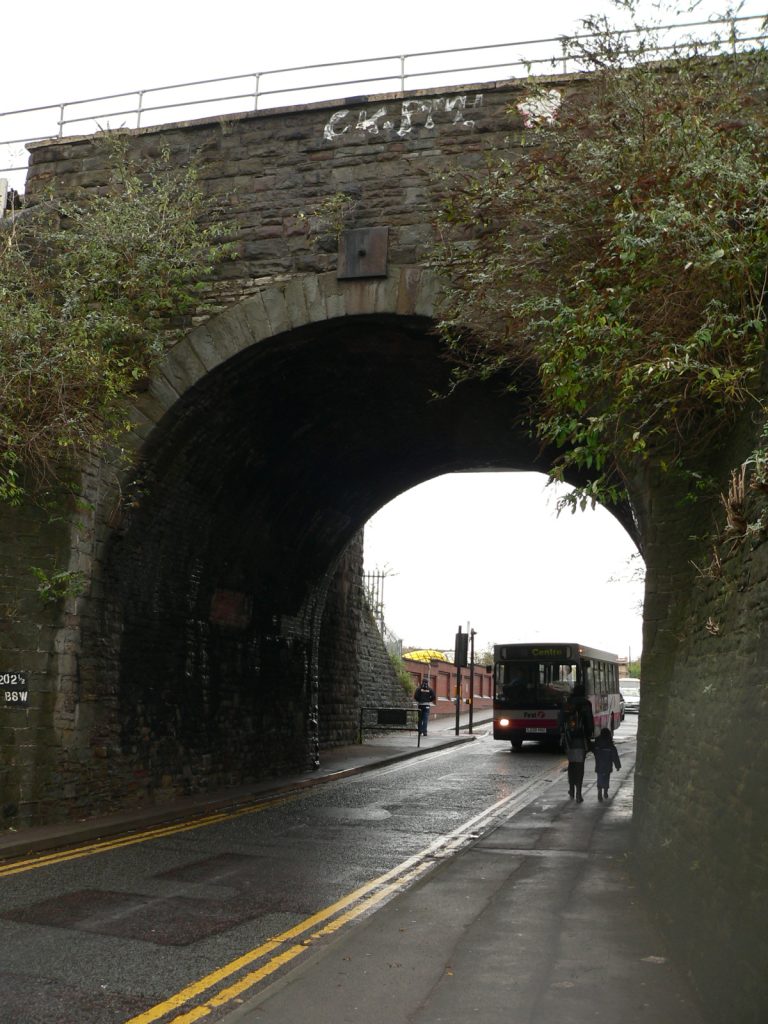
The rail bridge over Glenfrome Road in the Ashley Down area of Bristol 2 miles 2˝ chains north of Bristol Temple Meads, known for some reason as "Wee Lane" on the Railtrack bridge identification plate. This bridge is located a few hundred yards south eastof Narroways Junction where the Severn Beach Line diverges from the main line between Bristol Temple Meads and Bristol Parkway, known as "BSW", presumably standing for Bristol to South Wales. It was originally constructed by the Bristol and South Wales Union Railway. This photograph is taken looking north east.
Photo by Chris McKenna 01/12/2006. |
|
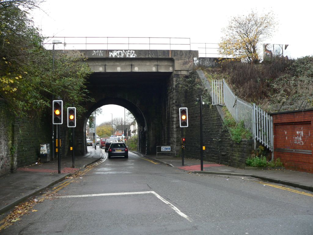
The rail bridge over Glenfrome Road in the Ashley Down area of Bristol 2 miles 2˝ chains north of Bristol Temple Meads, known for some reason as "Wee Lane" on the Railtrack bridge identification plate. This bridge is located a few hundred yards south eastof Narroways Junction where the Severn Beach Line diverges from the main line between Bristol Temple Meads and Bristol Parkway, known as "BSW", presumably standing for Bristol to South Wales. It was originally constructed by the Bristol and South Wales Union Railway. This photograph is taken looking south west.
Photo by Chris McKenna 01/12/2006. |
|
The Railtrack bridge identification plate for the rail bridge over Glenfrome Road in the Ashley Down area of Bristol 2 miles 2˝ chains north of Bristol Temple Meads, known for some reason as "Wee Lane" on the bridge identification plate. This bridge is located a few hundred yards south eastof Narroways Junction where the Severn Beach Line diverges from the main line between Bristol Temple Meads and Bristol Parkway, known as "BSW", presumably standing for Bristol to South Wales. It was originally constructed by the Bristol and South Wales Union Railway. This photograph is taken looking south west.
Photo by Chris McKenna 01/12/2006. |
|
The Gloucester Road arches in Bristol that carry the Severn Beach Line between Montpelier and Redland stations over the A38 Gloucester Road and the adjacent North Road and Kinglsey Road. This merged view looking from the south shows the main spans over the A38 Gloucester Road and the eastern arch over North Road.
Photo by Chris McKenna 6/12/2006. |
|
The Gloucester Road arches in Bristol that carry the Severn Beach Line between Montpelier and Redland stations over the A38 Gloucester Road and the adjacent North Road and Kinglsey Road. This photograph shows the underneath of the main span over Gloucester Road.
Photo by Chris McKenna 6/12/2006. |
|
The Gloucester Road arches in Bristol that carry the Severn Beach Line between Montpelier and Redland stations over the A38 Gloucester Road and the adjacent North Road and Kinglsey Road. This merged view shows the main span from the north.
Photo by Chris McKenna 6/12/2006. |
|
The Gloucester Road arches in Bristol that carry the Severn Beach Line between Montpelier and Redland stations over the A38 Gloucester Road and the adjacent North Road and Kinglsey Road. This photograph shows the main span from the southwest.
Photo by Chris McKenna 6/12/2006. |
|
The ID plate for the bridge that carries Hampton Road over the Severn Beach Line between Redland and Clifton Down stations shows it to be 3 miles 55ľ chains from Bristol Temple Meads. I don't know what the "CNX" stands for.
Photo by Chris McKenna 6/12/2006. |
|
Looking east from Hampton Road bridge at the Severn Beach Line between Clifton Down and Redland stations. Signal B358 in the foreground protects the single track section ahead.
Photo by Chris McKenna 6/12/2006. |
|
Looking east from Hampton Road bridge at the Severn Beach Line between Clifton Down and Redland stations. The single platform at Redland station is just viisble in the distance through the trees.
Photo by Chris McKenna 6/12/2006. |
|
The Gloucester Road arches in Bristol that carry the Severn Beach Line between Montpelier and Redland stations over the A38 Gloucester Road and the adjacent North Road and Kinglsey Road. This merged view shows the western span that takes the railway over Kingsley Road.
Photo by Chris McKenna 6/12/2006. |
|
The Gloucester Road arches in Bristol that carry the Severn Beach Line between Montpelier and Redland stations over the A38 Gloucester Road and the adjacent North Road and Kinglsey Road. This merged view shows all three of the spans that take the railway over roads, on the left is Kinglsey Road, Gloucester Road is in the centre and North Road on the right.
Photo by Chris McKenna 6/12/2006. |
|
The Gloucester Road arches in Bristol that carry the Severn Beach Line between Montpelier and Redland stations over the A38 Gloucester Road and the adjacent North Road and Kinglsey Road. This merged view shows the spans over North Road (left) and Gloucester Road from the north.
Photo by Chris McKenna 6/12/2006. |
|
A merged view looking at the in use (far) and disused railway bridges over Stapleton Road in the Easton area of Bristol, the northern end of Stapleton Road station is a few yards beyond the left (south) ends of the bridges.
Photo by Chris McKenna 01/12/2006. |
|
A merged view looking at the in use (far) and disused railway bridges over Stapleton Road in the Easton area of Bristol, the northern end of Stapleton Road station is a few yards beyond the left (south) ends of the bridges.
Photo by Chris McKenna 01/12/2006. |
|
A merged view looking at the in use (far) and disused railway bridges over Stapleton Road in the Easton area of Bristol, the northern end of Stapleton Road station is a few yards beyond the left (south) ends of the bridges.
Photo by Chris McKenna 01/12/2006. |
|
A merged view looking at the in use (far) and disused railway bridges over Stapleton Road in the Easton area of Bristol, the northern end of Stapleton Road station is a few yards beyond the right (south) ends of the bridges.
Photo by Chris McKenna 01/12/2006. |
 GlenfromeRoadBridge-02.jpg (159216 bytes)
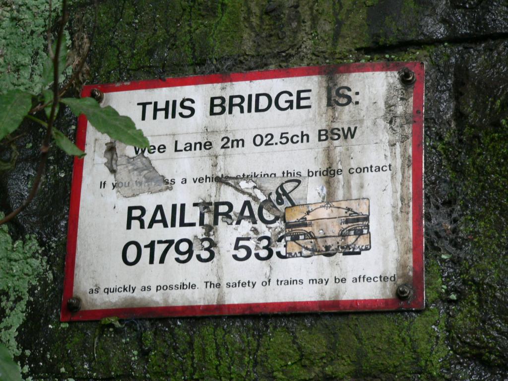 GlenfromeRoadBridge-03.jpg (164745 bytes)
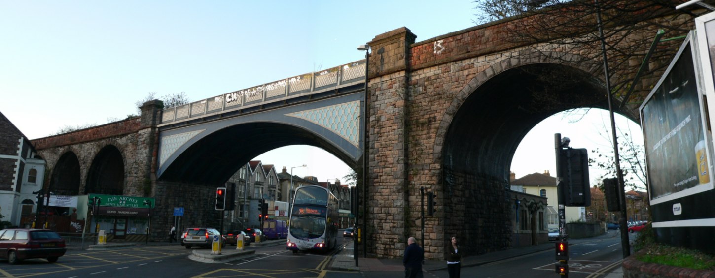 GloucesterRoad+NorthRoad-fromsouth-01.jpg (160989 bytes)
 GloucesterRoad-frombelow-01.jpg (157200 bytes)
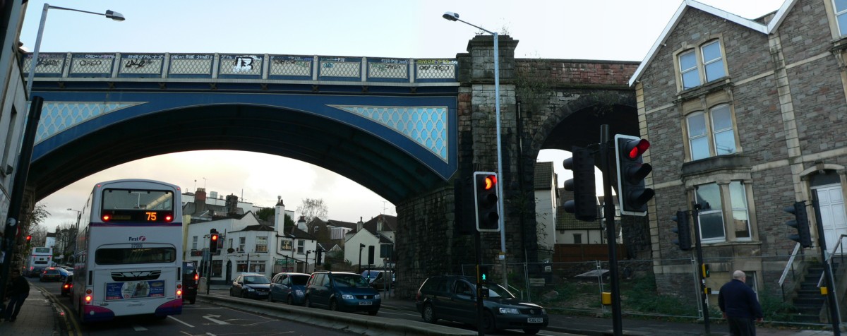 GloucesterRoad-fromnorth-01.jpg (154348 bytes)
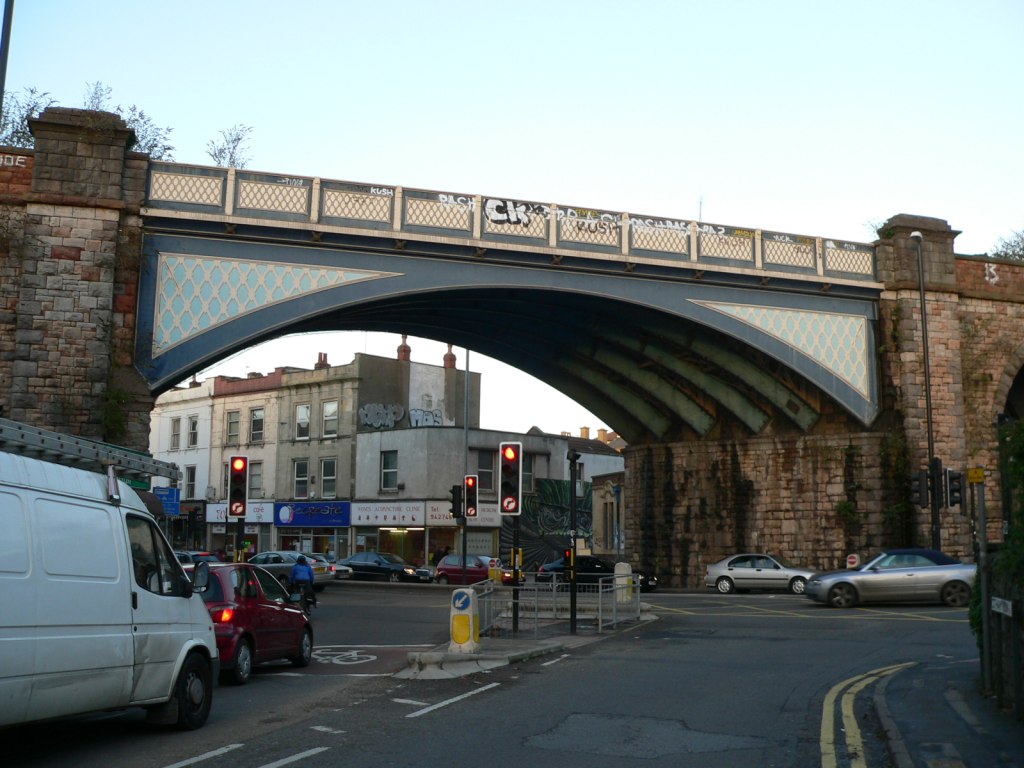 GloucesterRoad-fromsouthwest-01.jpg (159410 bytes)
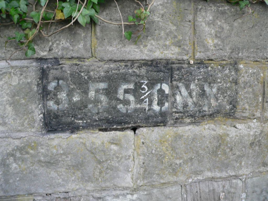 HamptonRoadbridge-ID.jpg (162027 bytes)
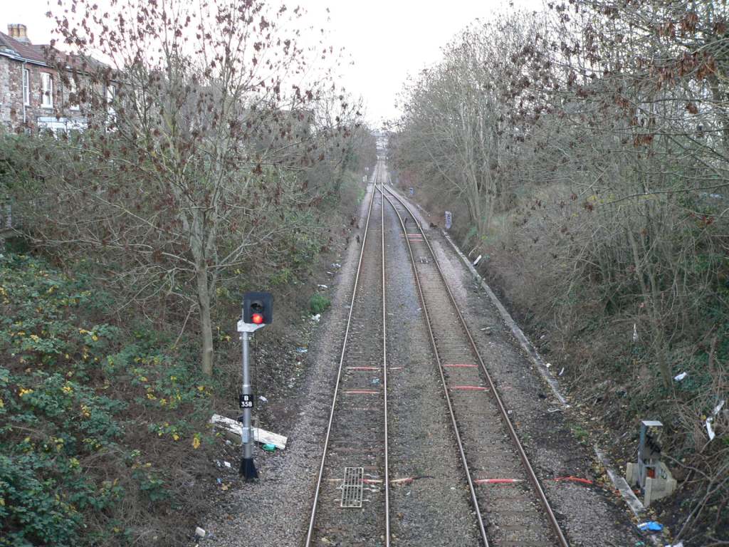 HamptonRoadbridge-east-01.jpg (163380 bytes)
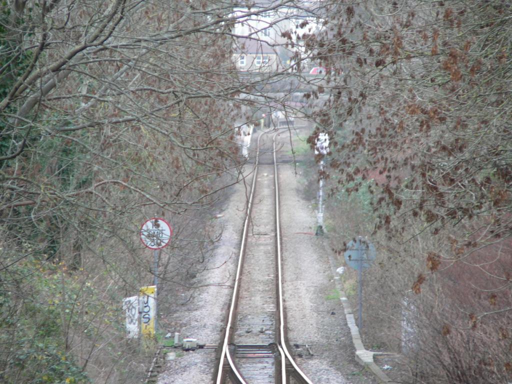 HamptonRoadbridge-east-02.jpg (161769 bytes)
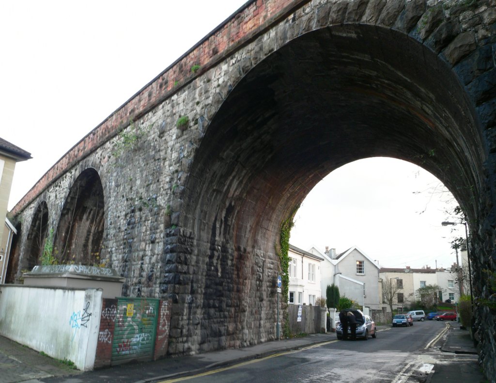 KingsleyRd-fromnorth-01.jpg (164151 bytes)
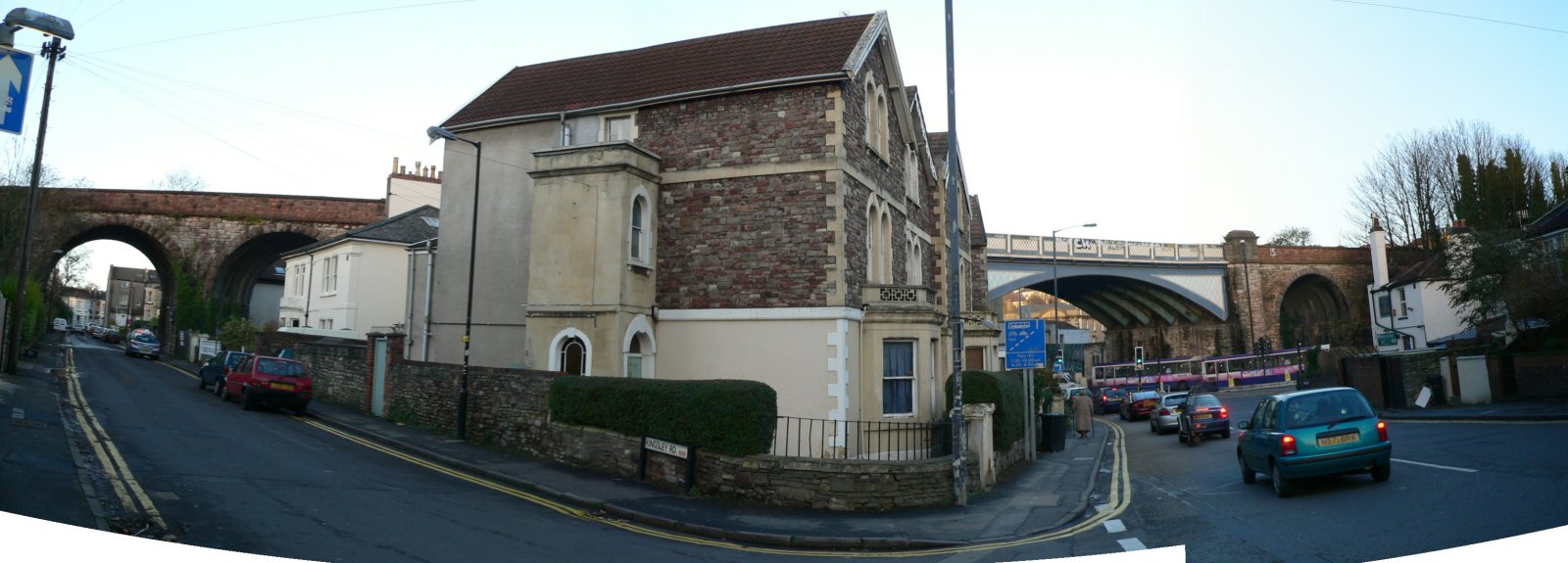 KingsleyRoad+GloucesterRoad-fromsouth-01.jpg (163432 bytes)
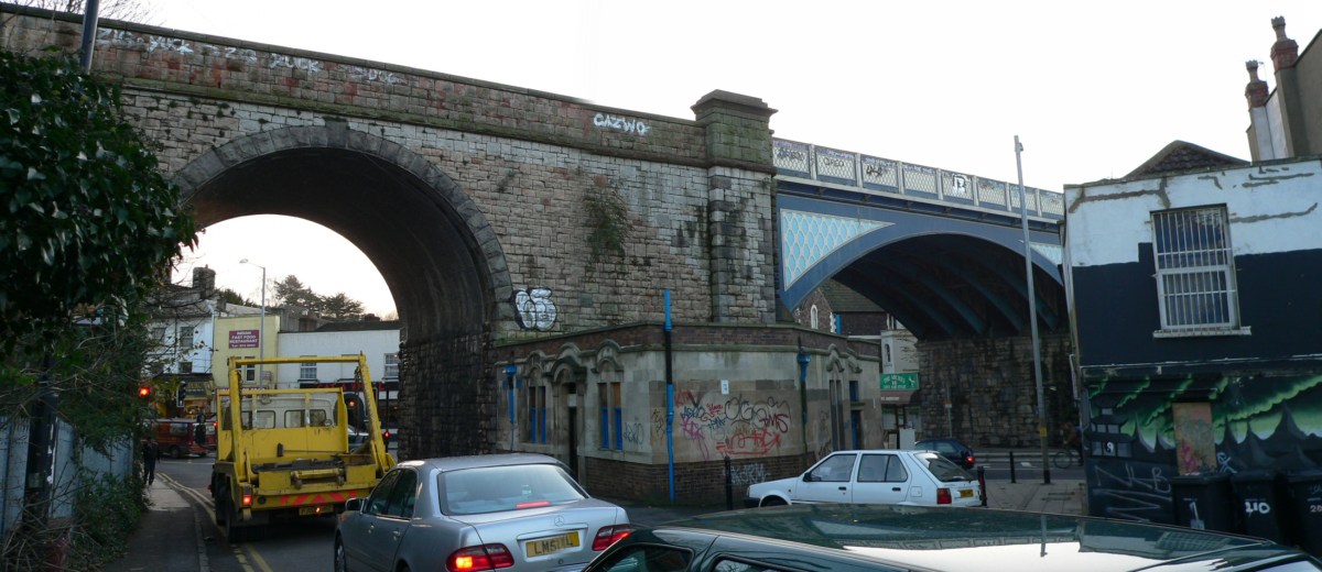 NorthRoad-fromnorth-01.jpg (155924 bytes)
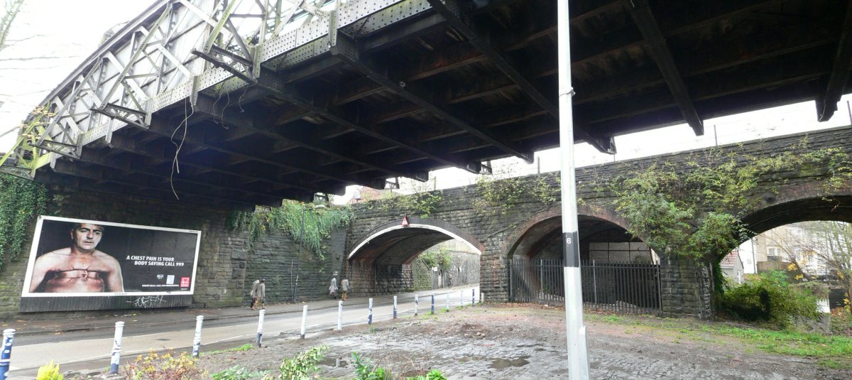 StapletonRoad-bridgesfrombelow-01.jpg (159809 bytes)
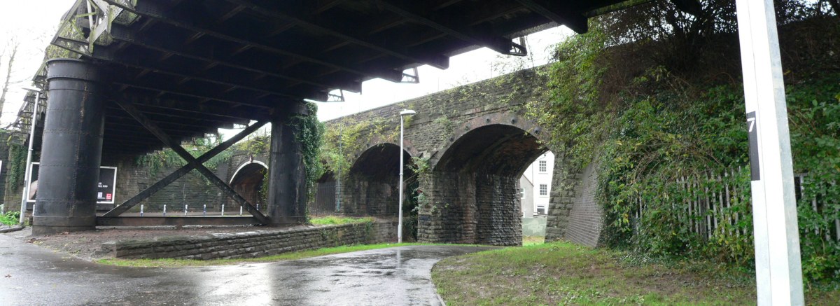 StapletonRoad-bridgesfrombelow-02.jpg (158184 bytes)
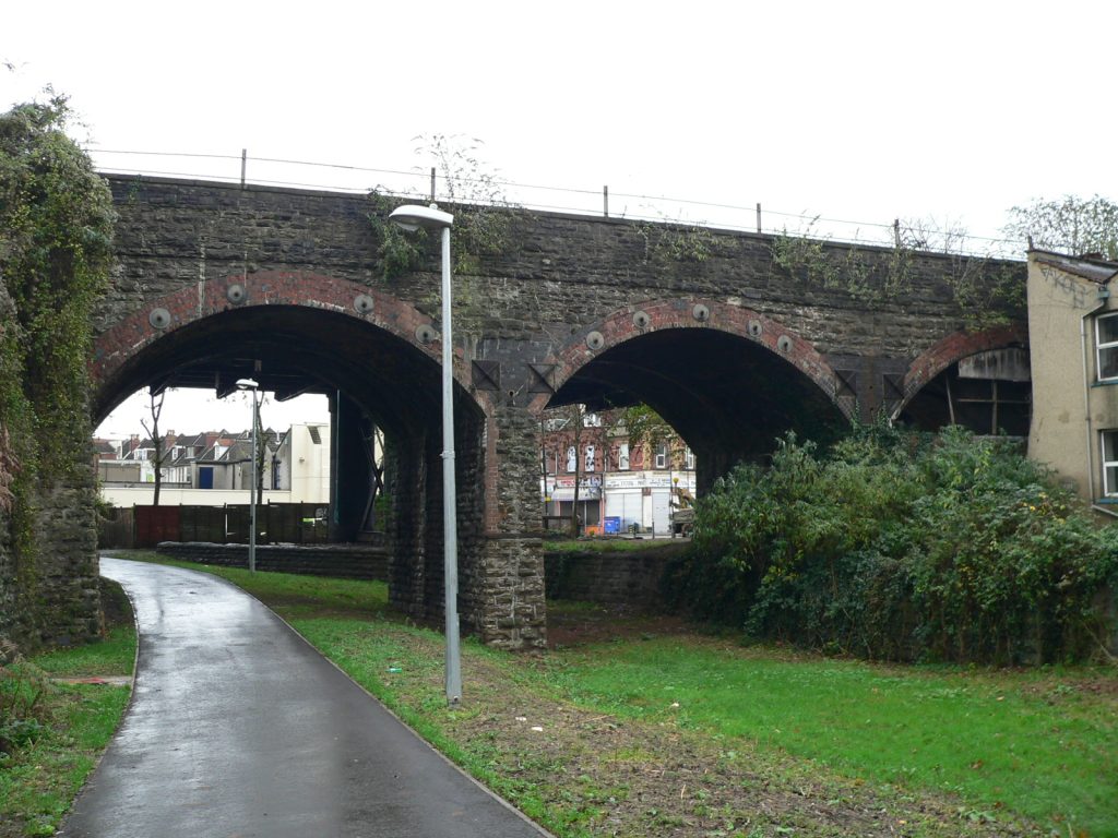 StapletonRoad-bridgesfromwest-01.jpg (158416 bytes)