 StapletonRoad-EastonTimeSignsTrail-01.jpg (162545 bytes)
|
The Railfaneurope.net Picture Gallery
Directory: /pix/gb/station/Bristol/Stapleton_Road
Last update: Sat Nov 15 20:21:17 CET 2014
|
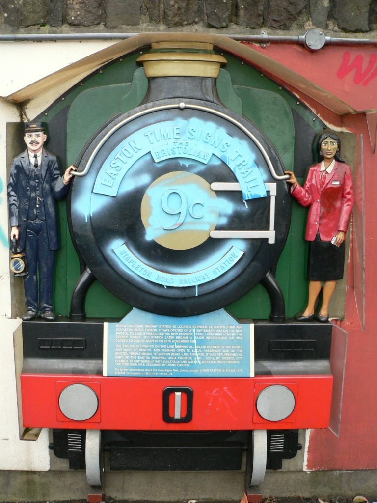
Stapleton Road railway staiton is one of the points on the Easton Time Signs Trail, a walk around historical points of interest in the Easton area of Bristol. This representation of a steam train, The Bristolian is on the northbound/westbound platform. The plaque reads:
Stapleton Road railway station is located between St Mark's Road and Stapleton Road, Easton. It was opened on 8th September 1863 on the new Bristol to South Wales Line via New Passage Ferry, later replaced by the Severn Tunnel. The staiton later became a major interchange but was closed to goods traffic on 29th November 1965. It also notes that further information about the Time-Signs Trail can be obtained by emailing livingeaston@btinternet.co.uk.
Photo by Chris McKenna 01/12/2006. |
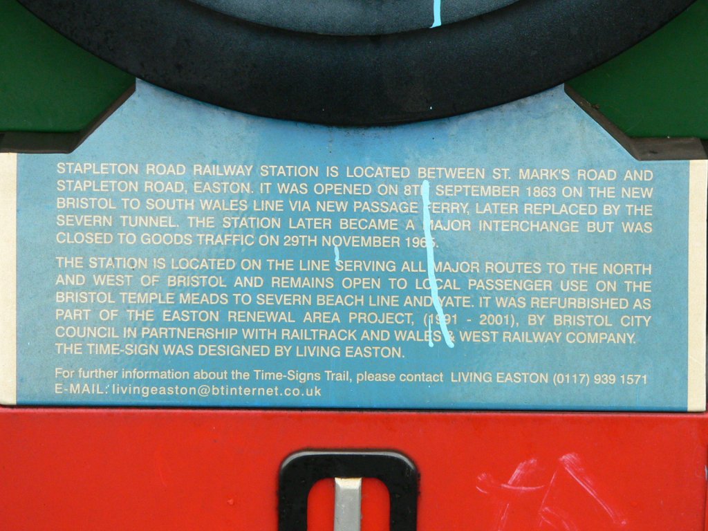
Stapleton Road railway staiton is one of the points on the Easton Time Signs Trail, a walk around historical points of interest in the Easton area of Bristol. This is a close up of the plaque beneath the representation of a steam train, The Bristolian, on the northbound/westbound platform. The plaque reads:
Stapleton Road railway station is located between St Mark's Road and Stapleton Road, Easton. It was opened on 8th September 1863 on the new Bristol to South Wales Line via New Passage Ferry, later replaced by the Severn Tunnel. The staiton later became a major interchange but was closed to goods traffic on 29th November 1965. It also notes that further information about the Time-Signs Trail can be obtained by emailing livingeaston@btinternet.co.uk.
Photo by Chris McKenna 01/12/2006. |
|
Looking north at the overgrown space between the disused platforms at Stapleton Road staion in the Easton area of Bristol. When they were in use the footbridge extended over these lines, but now a path-width section has been filled in to provide level access to the southbound in-use platform on the left. This photograph was taken from that path.
Photo by Chris McKenna 01/12/2006. |
|
Looking south at the overgrown space between the disused platforms at Stapleton Road staion in the Easton area of Bristol. When they were in use the footbridge extended over these lines, but now a path-width section has been filled in to provide level access to the southbound in-use platform on the right. This photograph was taken from that path.
Photo by Chris McKenna 01/12/2006. |
|
Looking north along the easternmost disused platform at Stapleton Road station in the Easton area of Bristol.
Photo by Chris McKenna 01/12/2006. |
|
Looking north along the easternmost disused platform at Stapleton Road station in the Easton area of Bristol.
Photo by Chris McKenna 01/12/2006. |
|
Looking north along the easternmost disused platform at Stapleton Road station in the Easton area of Bristol.
Photo by Chris McKenna 01/12/2006. |
|
A merged view from the present eastern end of the footbridge at Stapleton Road station in Bristol. Currently the main line between Bristol Temple Meads and Bristol Parkway/South Wales is two lines, but it was previously a four track section of railway. As such the stations on the line also had four platforms, the two disused ones at Statpleton Road are seen in the foreground of this image. Beyond the fence in the middle and right of this view is what appears to be a long-disused goods yard.
Photo by Chris McKenna 01/12/2006. |
|
Looking south at the footbridge at Stapleton Road railway station in Bristol. The a-symetrical shape of the bridge is because it originally spanned a futher two tracks to the east (left in this view) of the two that remain.
Photo by Chris McKenna 01/12/2006. |
|
Looking along the footbridge at Stapleton Road railway station in Bristol from the western (northbound platform) end. The bridge originally carried on beyond the current eastern end over a second pair of tracks.
Photo by Chris McKenna 01/12/2006. |
|
Graffiti on the pedestrian footbridge at Stapleton Road station in Bristol. Judging by other graffiti etc around the station, the message, "The killing goes on", relates to Britain's involvment in the Iraq War.
Photo by Chris McKenna 01/12/2006. |
|
The current eastern (southbound platform) of the passenger footbridge at Stapleton Road railway station in Bristol. The bridge originally carried on from here over a second pair of tracks.
Photo by Chris McKenna 01/12/2006. |
|
A merged view of platform 1 at Stapleton Road station in the Easton area of Bistol, which features a mural by local arist Bill Guilding that represents local history from the past and present. The staiton is the last station on the mainline from Bristol Temple Meads to Bristol Parkway/South Wales before the Severn Beach Line diverges at Narroways Junction, a short distance north of the station. Consequently it was formerlly an interchange between local services on both lines, but today only Severn Beach Line trains call throughout the day with local services on the mainline only stopping during the peak hours.
Photo by Chris McKenna 01/12/2006. |
|
The northern end of Stapleton Road railway station in the Easton area of Bristol. The train that has just departed is First Great Western Class 143 DMU 143619 on a Bristol Temple Meads to Avonmouth service.
Photo by Chris McKenna 01/12/2006. |
|
The northern end of Stapleton Road railway station in the Easton area of Bristol. The bridges ahead (in use on the left and disused on the right) take/took two tracks each over the A432 Stapleton Road that runs nearly parallel to the M32 at this point. The fence on the right was originally a platform face onto one of the now removed pairs of lines. The yellow-painted stub of bull-head rail embedded in the platform in the foreground marks the position of an access hatch to services below.
Photo by Chris McKenna 01/12/2006. |
|
Looking north from the footbridge at Stapleton Road railway station in Bristol. In addition to the two tracks in use today, there used to a futher pair of tracks to the right on what is now the overgrown area behind the black fence.
Photo by Chris McKenna 01/12/2006. |
|
Looking north from the footbridge at Stapleton Road railway station in Bristol. In addition to the two tracks in use today, there used to a futher pair of tracks to the right on what is now the overgrown area behind the black fence.
Photo by Chris McKenna 01/12/2006. |
|
Looking north from the footbridge at Stapleton Road railway station in Bristol. In addition to the two tracks in use today, there used to a futher pair of tracks to the right on what is now the overgrown area behind the black fence.
Photo by Chris McKenna 01/12/2006. |
|
Looking north from the footbridge at Stapleton Road railway station in Bristol. The person clad in high visibility clothing on the lineside is acting as the lookout protection for a small gang of maintenance workers further up the line.
Photo by Chris McKenna 01/12/2006. |
|
Just north of Stapleton Road railway station in Bristol is a pair of bridges over Stapleton Road. This one, the eastern of the pair, has been long disused following the lifting of two of the original four tracks of the railway between Bristol Temple Meads and Filton Junction (where the lines to Bristol Parkway and Avonmouth/South Wales diverge).
Photo by Chris McKenna 01/12/2006. |
|
A merged view of the area of unused ground adjacent to Stapleton Road station in the Easton area of Bistol, this is probably the site of the station goods yard.
Photo by Chris McKenna 01/12/2006. |
|
The sign on the platform at Stapleton Road railway station in the Easton area of Bristol. The circular logo depicting the Clifton Suspension Bridge identifies this station as being on the Severn Beach Line from Bristol Temple Meads to Severn Beach in South Gloucestershire. Clifton Down station, on the Severn Beach Line, is a short walk from Isambard Kingdom Brunel's famous bridge.
Photo by Chris McKenna 01/12/2006. |
|
The southern end of Stapleton Road railway station in the Easton area of Bristol. The barriers mark the end of the in-use length of platforms, with the disused portions beyond being around half the total length. The signal is a repeater for B235, located at the opposite (northern) end of the station, made necessary by the presence of the station footbridge.
Photo by Chris McKenna 01/12/2006. |
|
The southern, disused end of Stapleton Road railway station in the Easton area of Bristol.
Photo by Chris McKenna 01/12/2006. |
|
The southern, disused end of Stapleton Road railway station in the Easton area of Bristol.
Photo by Chris McKenna 01/12/2006. |
|
The southern, disused end of Stapleton Road railway station in the Easton area of Bristol.
Photo by Chris McKenna 01/12/2006. |
|
A merged view looking south from the footbridge at Stapleton Road station in Bristol. Currently the main line between Bristol Temple Meads and Bristol Parkway/South Wales is two lines, but it was previously a four track section of railway. As such the stations on the line also had four platforms, the two disused ones at Statpleton Road are seen on the left of this image, and only about half the length of the current platforms are in use for passengers. The signal on the right is a bridge repeater for signal B235 at the north end of the station that protects Narroways Junction, where the Severn Beach Line diverges from the mainline. Stapleton Road station was precviously the key interchange between trains on both lines, but presently only trains on the Severn Beach stop throughout the day and the main interchange is at Bristol Temple Meads.
Photo by Chris McKenna 01/12/2006. |
|
A merged view looking south from the footbridge at Stapleton Road station in Bristol along the line to Lawrence Hill and Bristol Temple Meads.
Photo by Chris McKenna 01/12/2006. |
|
Just north of Stapleton Road railway station in Bristol is a pair of bridges over Stapleton Road. In the foreground the older bridge is still in use. The the background the eastern of the pair has been long disused following the lifting of two of the original four tracks of the railway between Bristol Temple Meads and Filton Junction (where the lines to Bristol Parkway and Avonmouth/South Wales diverge).
Photo by Chris McKenna 01/12/2006. |
|
A merged view looking north from the northern end of Stapleton Road railway station in the Easton area of Bristol. Immediately north of the station are two bridges over Stapleton Road, the old arched bridge on the left is still in use while the newer steel bridge on the right has been disused for a long while, possibly since the mid-1960s, following the lifting of the eastern two of four tracks.
Photo by Chris McKenna 01/12/2006. |
|
Looking north from the northern end of Stapleton Road railway statioin in the Easton area of Bristol.
Photo by Chris McKenna 01/12/2006. |
|
Looking north from the northern end of Stapleton Road railway statioin in the Easton area of Bristol. The person clad in high visibility clothing on the lineside is acting as the lookout protection for a small gang of maintenance workers further up the line.
Photo by Chris McKenna 01/12/2006. |
|
Looking south from the southern end of Stapleton Road railway station in the Easton area of Bristol.
Photo by Chris McKenna 01/12/2006. |
 StapletonRoad-EastonTimeSignsTrail-02.jpg (160064 bytes)
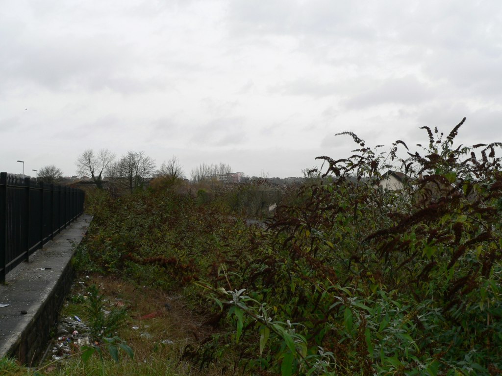 StapletonRoad-disusedplatforms-01.jpg (160974 bytes)
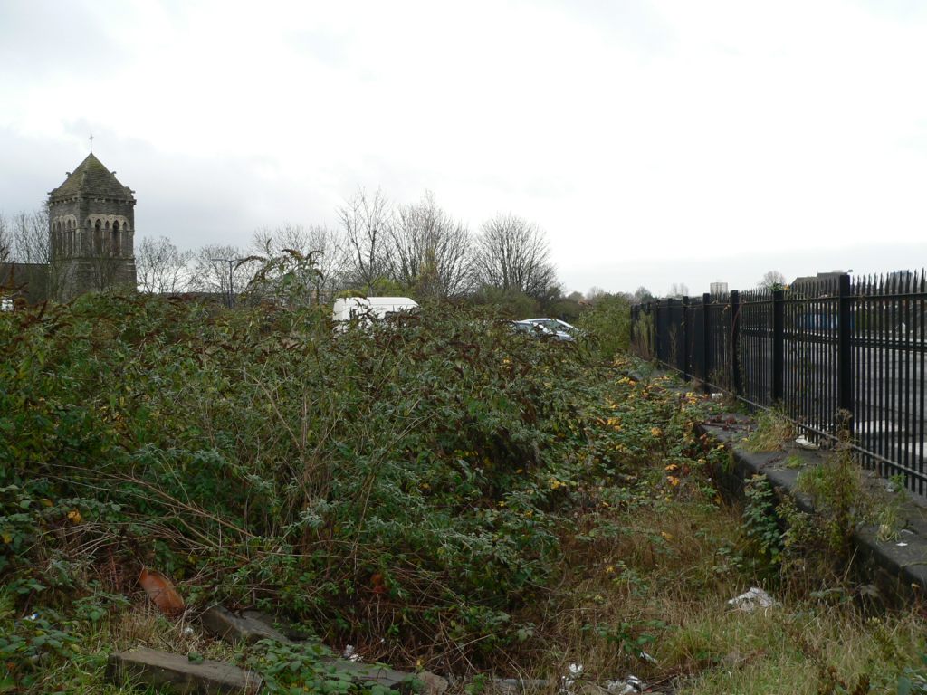 StapletonRoad-disusedplatforms-02.jpg (161916 bytes)
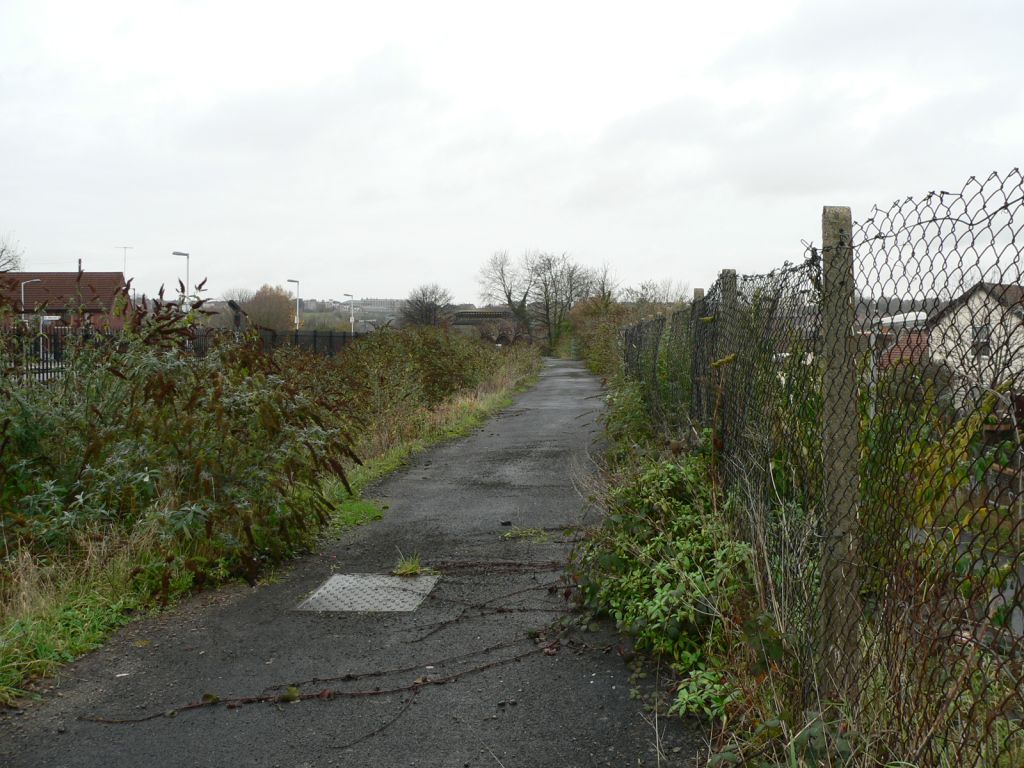 StapletonRoad-disusedplatforms-03.jpg (158993 bytes)
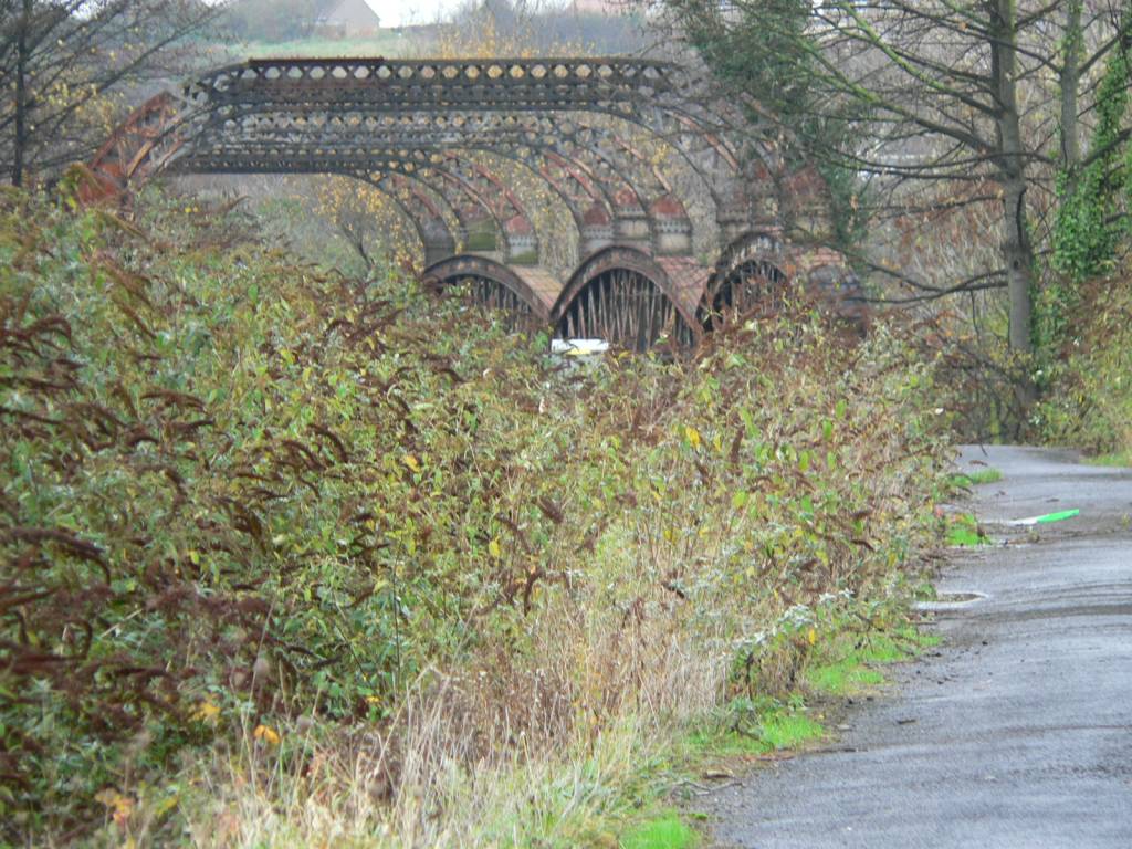 StapletonRoad-disusedplatforms-04.jpg (162971 bytes)
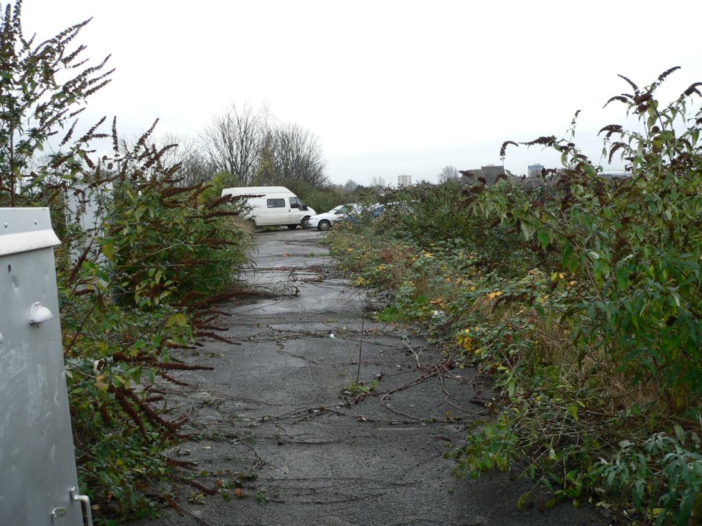 StapletonRoad-disusedplatforms-05.jpg (163609 bytes)
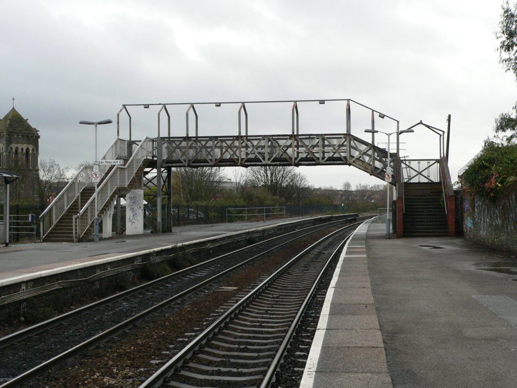 StapletonRoad-footbridge-01.jpg (160094 bytes)
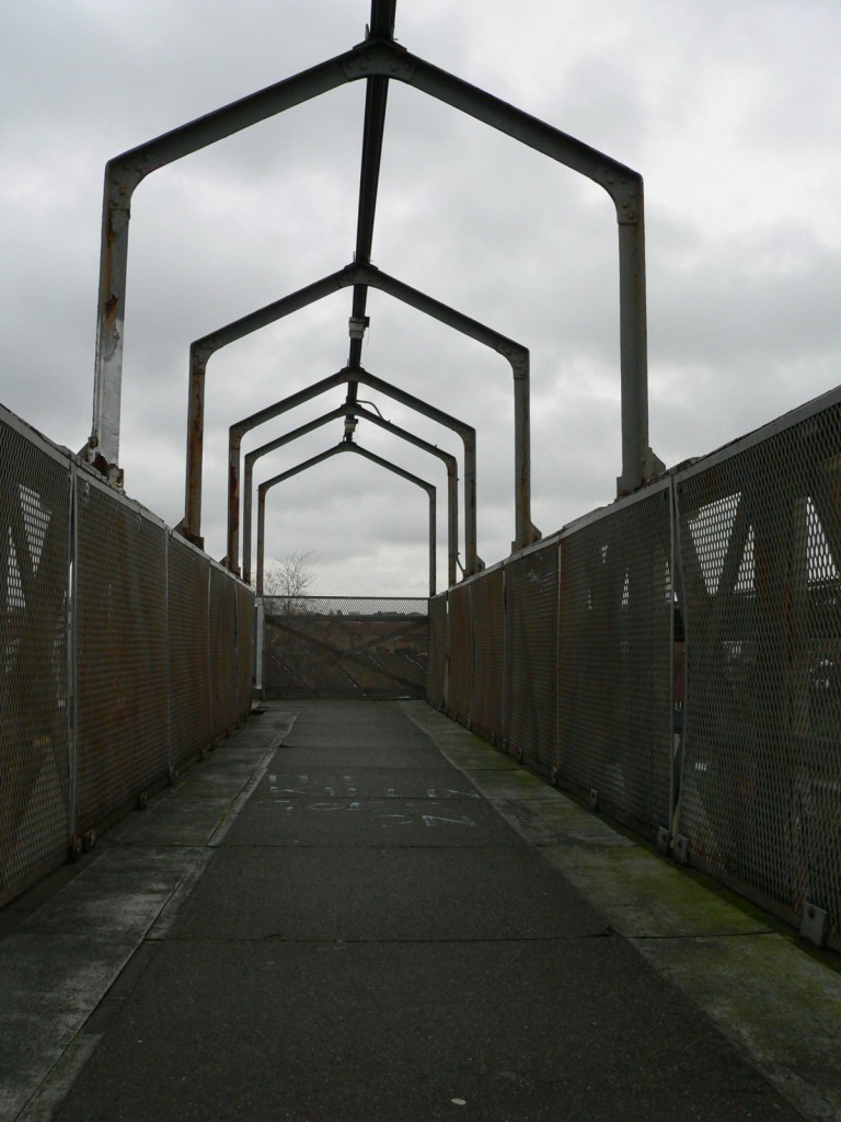 StapletonRoad-footbridge-02.jpg (159185 bytes)
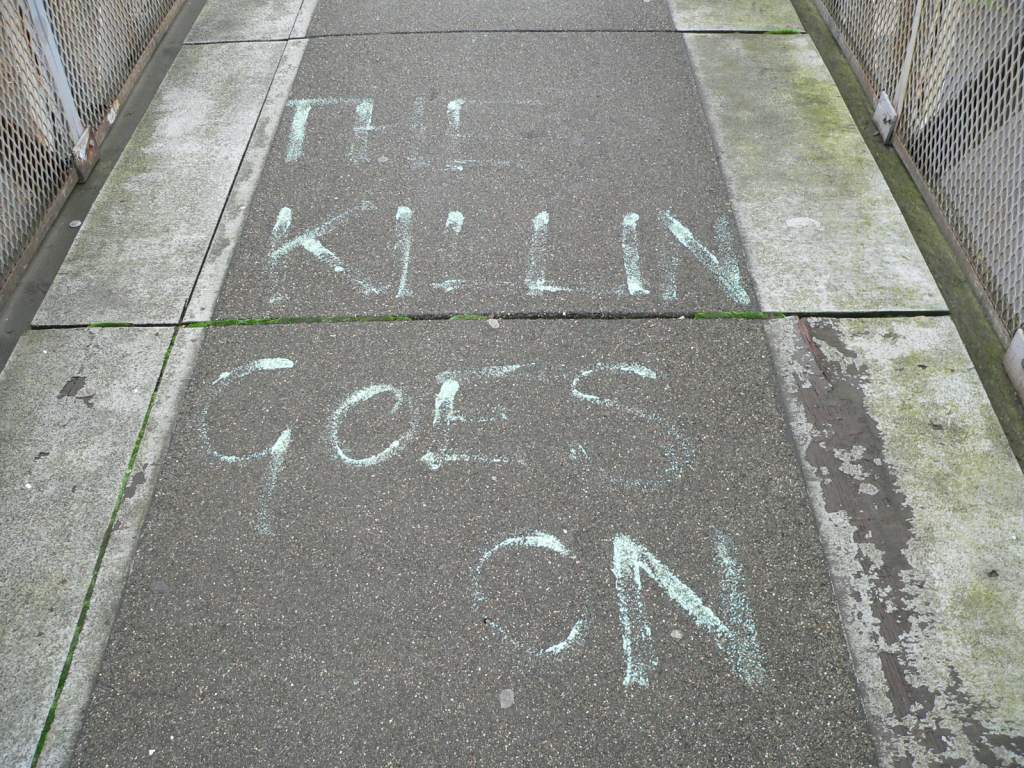 StapletonRoad-footbridge-03.jpg (163111 bytes)
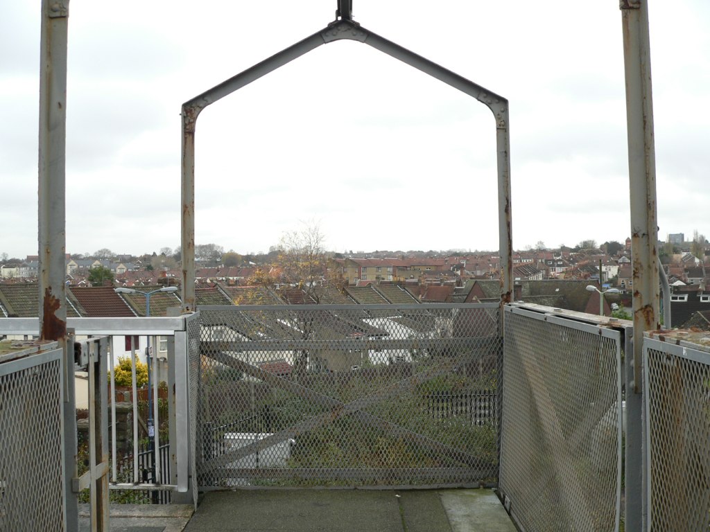 StapletonRoad-footbridge-04.jpg (163288 bytes)
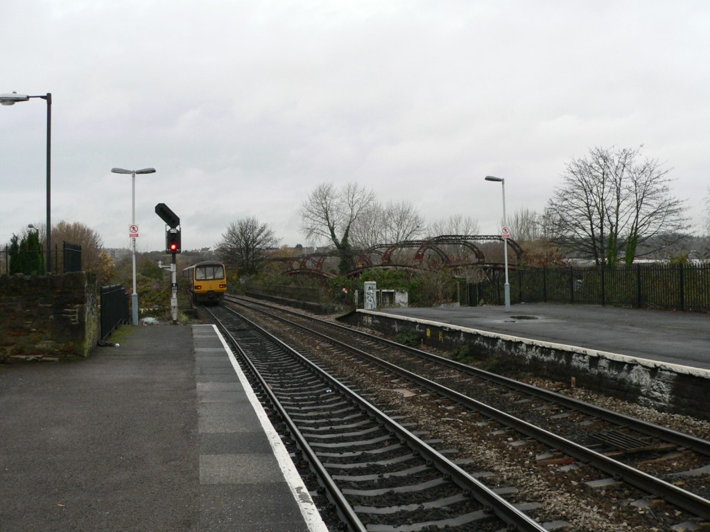 StapletonRoad-northend-01.jpg (156194 bytes)
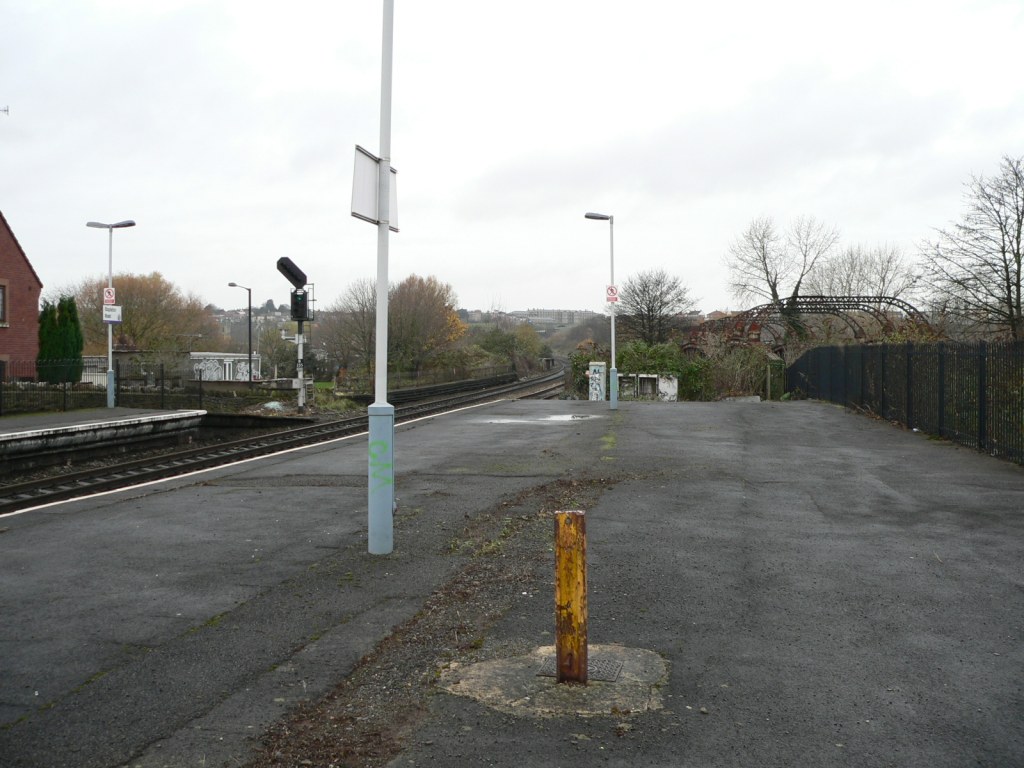 StapletonRoad-northend-03.jpg (157754 bytes)
 StapletonRoad-northfrombridge-01.jpg (155666 bytes)
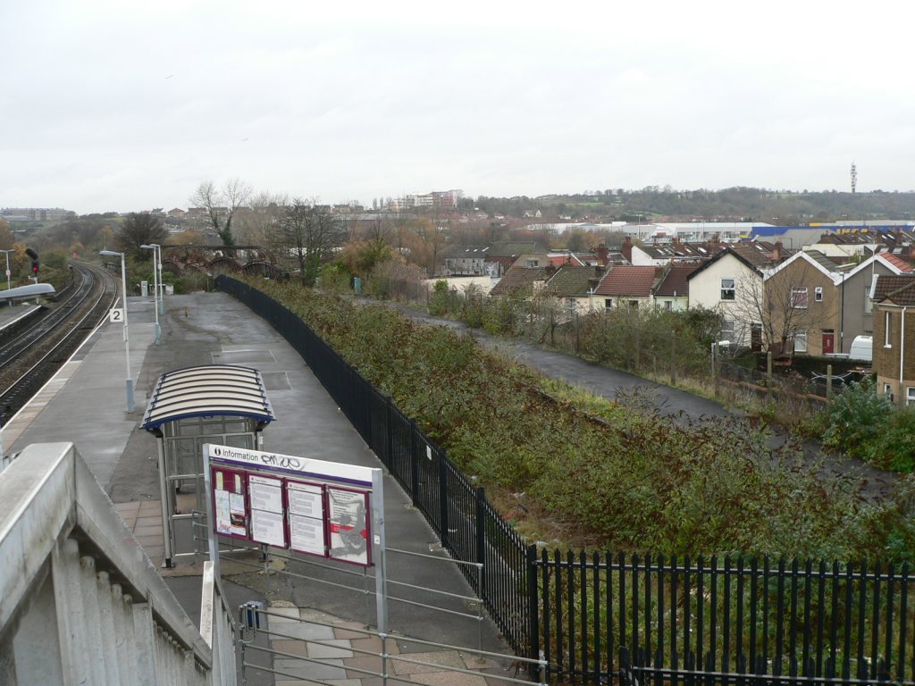 StapletonRoad-northfrombridge-02.jpg (163003 bytes)
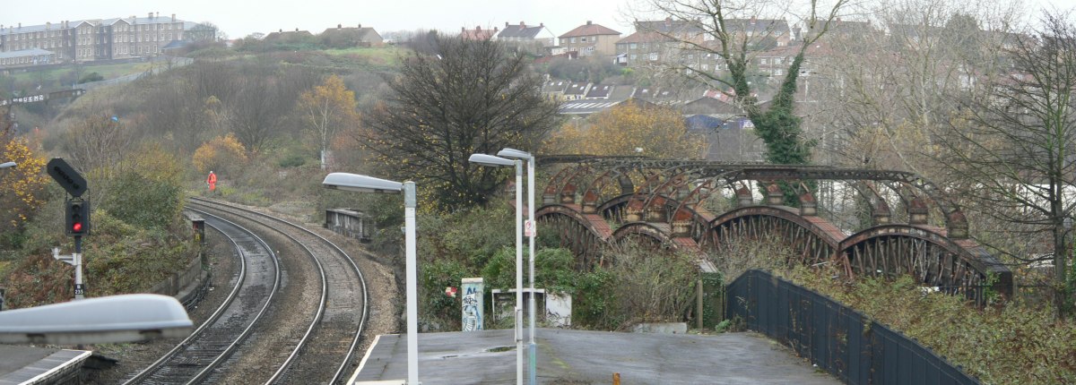 StapletonRoad-northfrombridge-03.jpg (157988 bytes)
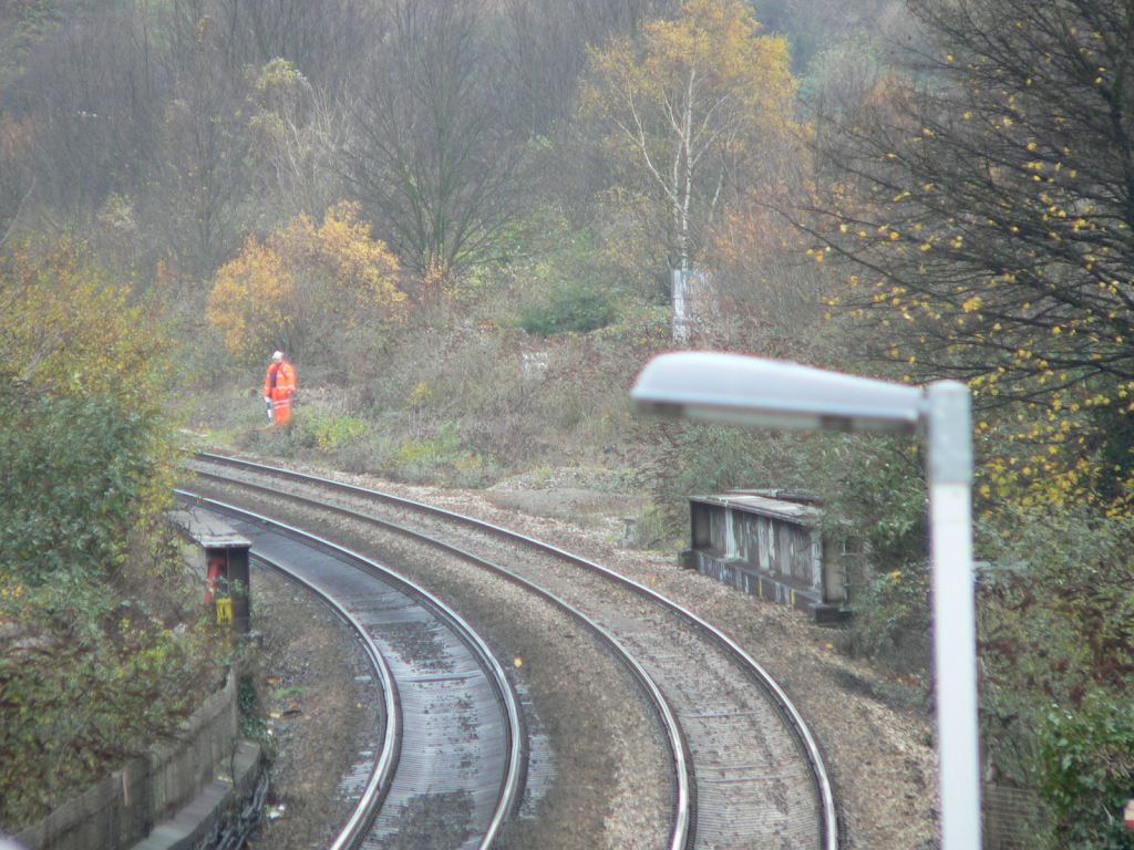 StapletonRoad-northfrombridge-04.jpg (160994 bytes)
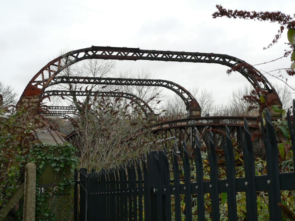 StapletonRoad-oldbridge-01.jpg (161909 bytes)
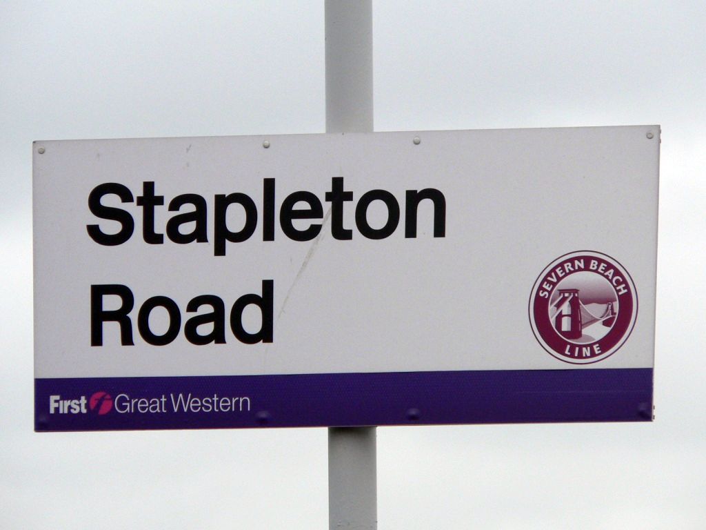 StapletonRoad-sign-01.jpg (79241 bytes)
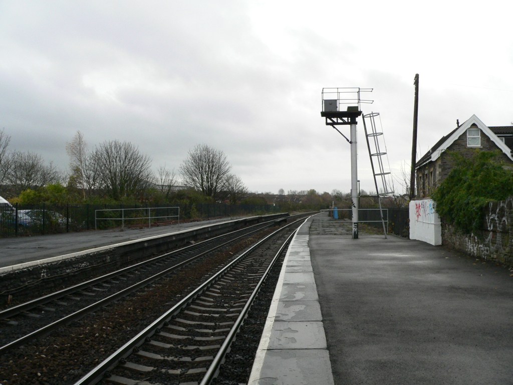 StapletonRoad-southend-01.jpg (156597 bytes)
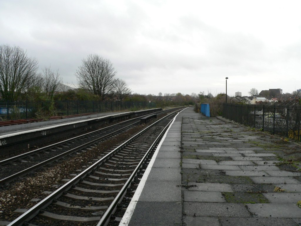 StapletonRoad-southend-02.jpg (160146 bytes)
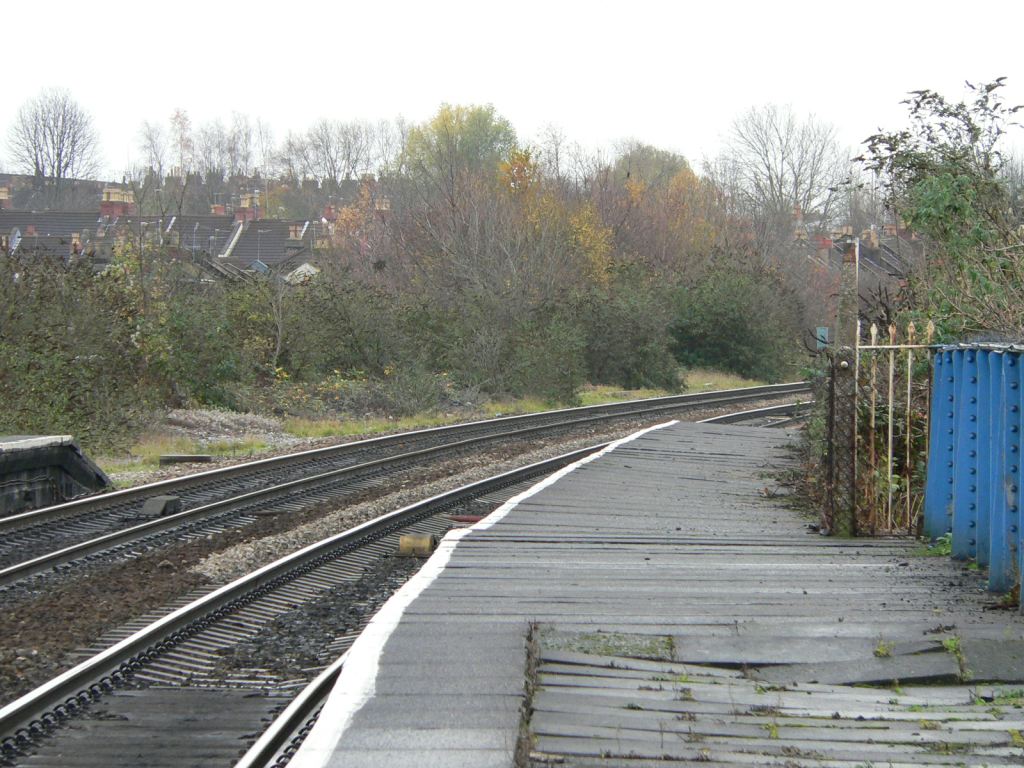 StapletonRoad-southend-03.jpg (162177 bytes)
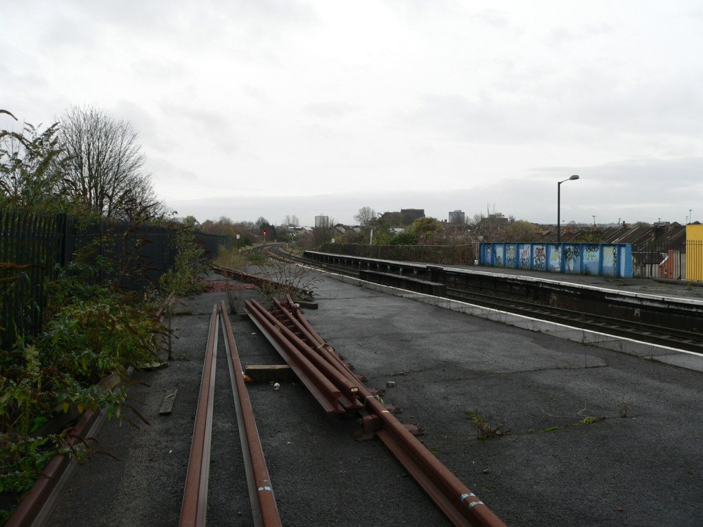 StapletonRoad-southend-04.jpg (156783 bytes)
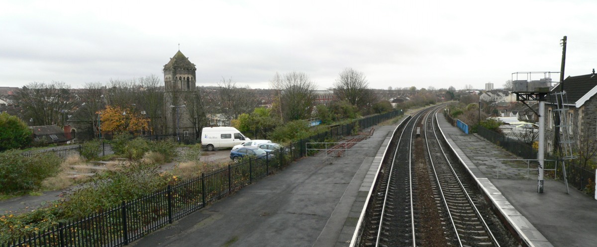 StapletonRoad-southfrombridge-01.jpg (159358 bytes)
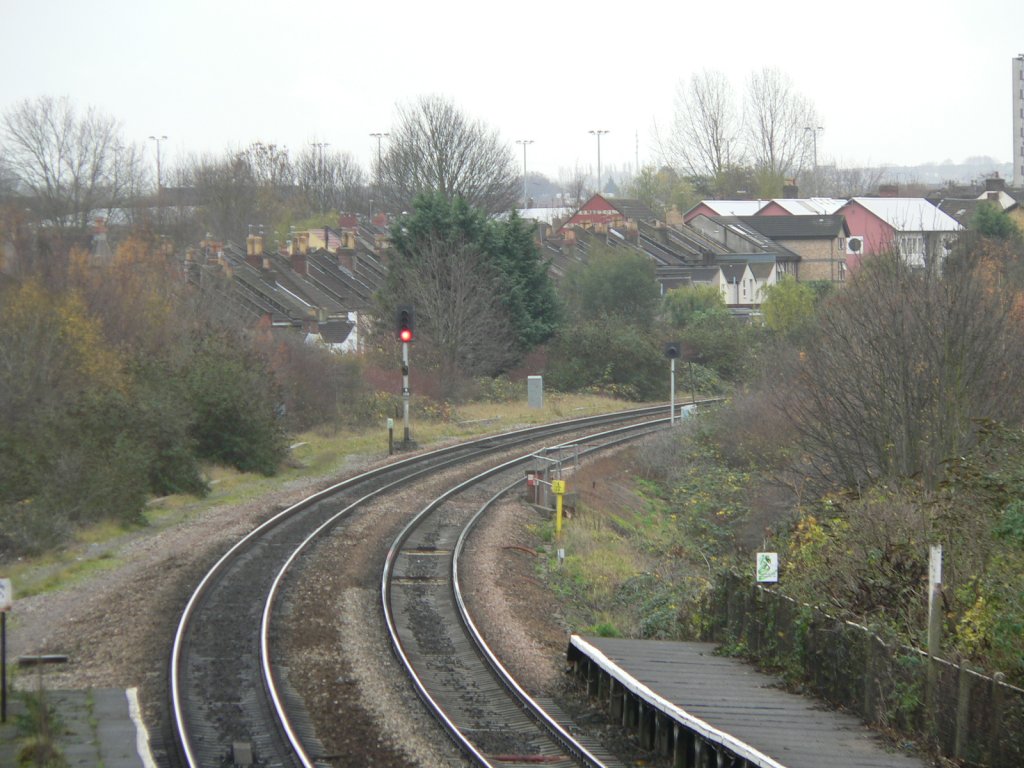 StapletonRoad-southfrombridge-02.jpg (158995 bytes)
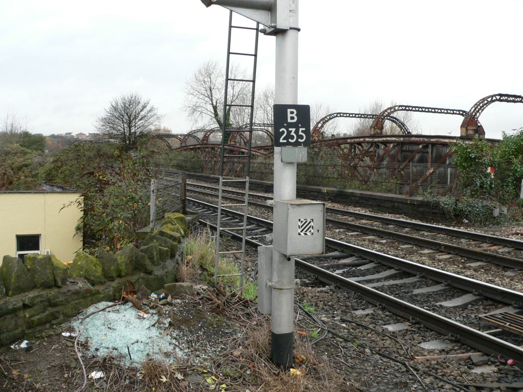 StapletonRoad-viewnorth-01.jpg (159455 bytes)
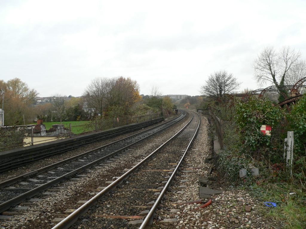 StapletonRoad-viewnorth-03.jpg (161775 bytes)
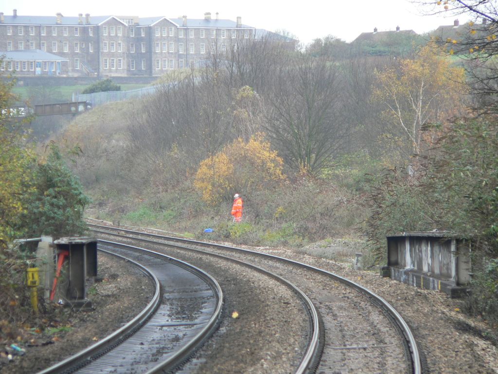 StapletonRoad-viewnorth-04.jpg (162536 bytes)
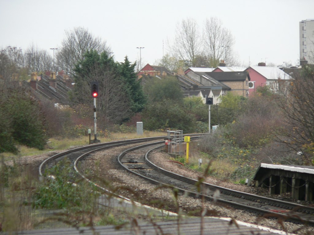 StapletonRoad-viewsouth-01.jpg (158015 bytes)