 WQ-041E-01.jpg (157364 bytes)
|
The Railfaneurope.net Picture Gallery
Directory: /pix/gb/misc/Weymouth_Quay/041-065
Last update: Sat Nov 15 20:06:55 CET 2014
|
|
Looking east from point 41 on the map - under Town Bridge, the narrowest point on the route. Note how the level of the road surface slopes down to the rails from both sides.
Photo by Chris McKenna 06/09/2006. |
|
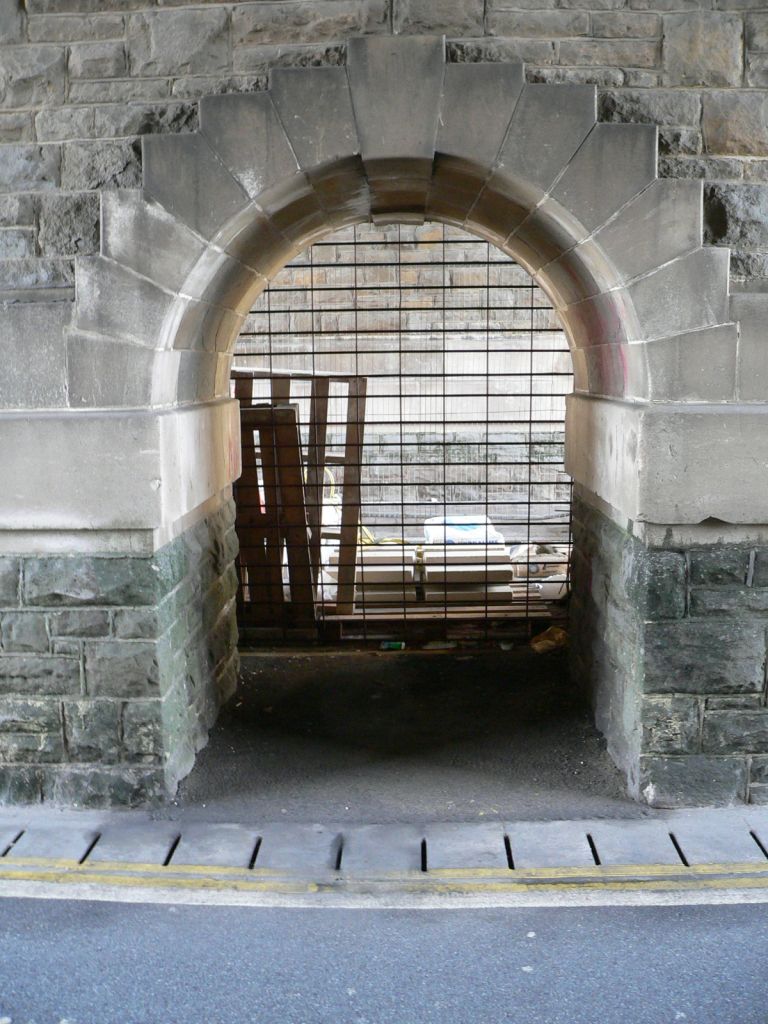
Looking north from point 41 on the map - a pedestrian refuge and link between the two spans under Town Bridge, the narrowest point on the route. The work being carried out under the north span looks like pedestrianisation and/or new paving.
Photo by Chris McKenna 06/09/2006. |
|
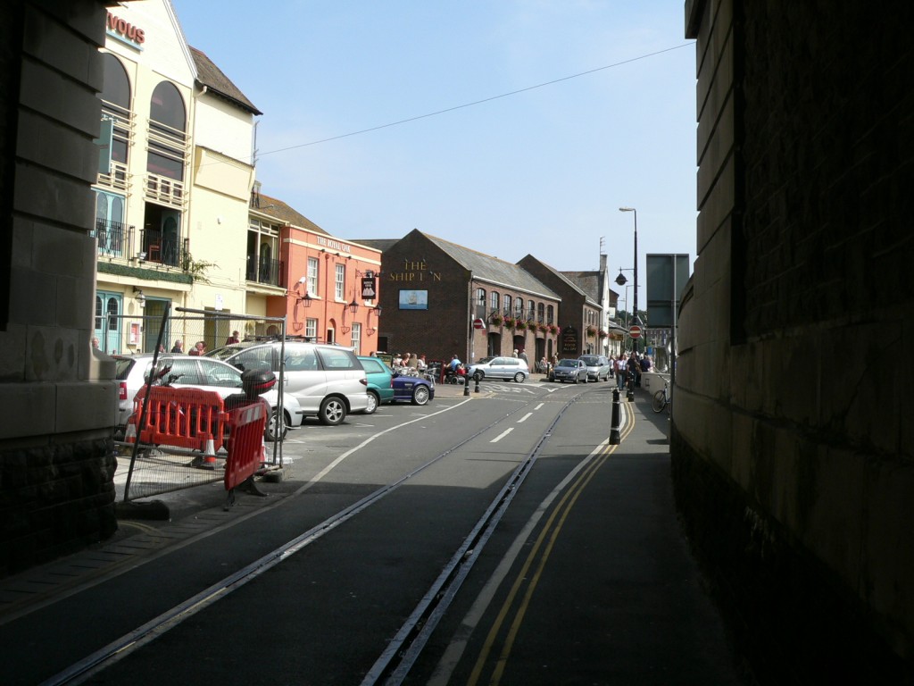
Looking west from point 41 on the map - beneath Town Bridge. Note how the level of the road surface slopes down to the rails from both sides.
Photo by Chris McKenna 06/09/2006. |
|
The rails at point 41 on the map - beneath the Town Bridge, although there is some water at the bottom of the gap, the rails here are the least filled on the route.
Photo by Chris McKenna 06/09/2006. |
|
Looking east from point 42 on the map, this is the junction between Commercial Road (behind camera), Custom House Quay (ahead) and St Mary Street (left). The railway carries straight on.
Photo by Chris McKenna 06/09/2006. |
|
Looking west towards Town Bridge from point 42 on the map, the only bridge over the railway.
Photo by Chris McKenna 06/09/2006. |
|
Looking east along Custom House Quay from point 43 on the map.
Photo by Chris McKenna 06/09/2006. |
|
Looking west from point 43 on the map, this is the junction between Commercial Road (ahead), Custom House Quay (foreground) and St Mary Street (right). The railway carries straight on beneath Town Bridge.
Photo by Chris McKenna 06/09/2006. |
|
Looking east from point 44 on the map along Custom House Quay. Note just how close to the railway the buildings on the left are.
Photo by Chris McKenna 06/09/2006. |
|
Looking northwest from point 44 on the map. Even though the line is mothballed, drivers are still instructed to "Park clear of train as marked", and at this point on the route it seems they do.
Photo by Chris McKenna 06/09/2006. |
|
Looking west from point 44 on the map. Even though the line is mothballed, drivers are still instructed to "Park clear of train as marked", and at this point on the route it seems they do - although this will have more to do with road traffic than trains.
Photo by Chris McKenna 06/09/2006. |
|
A closeup of the sign at point 44 on the map. Even though the line is mothballed, drivers are still instructed to "Park clear of train as marked", and at this point on the route it seems they do.
Photo by Chris McKenna 06/09/2006. |
|
Looking west along Custom House Quay from point 45 on the map.
Photo by Chris McKenna 06/09/2006. |
|
Looking east along Custom House Quay from point 46 on the map, where the line runs very close to the buildings. Note that the condition of the rails here is much better than at the northern end of the branch.
Photo by Chris McKenna 06/09/2006. |
|
Looking west along Custom House Quay from point 46 on the map, I suspect these buildings are among the closest to a railway line in the country.
Photo by Chris McKenna 06/09/2006. |
|
Looking east along Custom House Quay from point 47 on the map. The raised platform on the right is the former goods loading area and one of only two stretches of double tracking on the entire branch; although the rails closest to the platform have been tarmaced over.
Photo by Chris McKenna 06/09/2006. |
|
Looking west along Custom House Quay from point 47 on the map. Note at the very bottom of the photograph, the rails look like they have been realigned at some point here.
Photo by Chris McKenna 06/09/2006. |
|
Looking east along Custom House Quay from point 48 on the map. The raised platform on the right is the former goods loading area and one of only two stretches of double tracking on the entire branch; although the rails closest to the platform have been tarmaced over.
Photo by Chris McKenna 06/09/2006. |
|
Looking east along Custom House Quay from point 48 on the map. The raised platform on the right is the former goods loading area and one of only two stretches of double tracking on the entire branch; although the rails closest to the platform have been tarmaced over. There is no evidence left of any switching mechanism, and there never has been any signals - perhaps the 4mph was felt to negate the need for the latter?
Photo by Chris McKenna 06/09/2006. |
|
Looking east along Custom House Quay from point 49 on the map. The raised platform on the right is the former goods loading area and one of only two stretches of double tracking on the entire branch; although the rails closest to the platform have been tarmaced over. Note how close to the buidlings on the left the railway gets.
Photo by Chris McKenna 06/09/2006. |
|
Looking east along Custom House Quay from point 50 on the map. The raised platform on the right is the former goods loading area and one of only two stretches of double tracking on the entire branch; although the rails closest to the platform have been tarmaced over. Note how close to the buidlings on the left the railway gets.
Photo by Chris McKenna 06/09/2006. |
|
Looking west along Custom House Quay from point 50 on the map. The raised platform on the left is the former goods loading area and one of only two stretches of double tracking on the entire branch; although the rails closest to the platform have been tarmaced over.
Photo by Chris McKenna 06/09/2006. |
|
Looking east along the former goods loading platform at Custom House Quay (point 50). The wide guage rails were for the loading cranes.
Photo by Chris McKenna 06/09/2006. |
|
Looking east along Custom House Quay from point 52 on the map. The raised platform on the right is the former goods loading area and one of only two stretches of double tracking on the entire branch; although the rails closest to the platform have been tarmaced over. Note how close to the buidlings on the left the railway gets.
Photo by Chris McKenna 06/09/2006. |
|
Looking west along Custom House Quay from point 52 on the map. The raised platform on the left is the former goods loading area and one of only two stretches of double tracking on the entire branch; although the rails closest to the platform have been tarmaced over.
Photo by Chris McKenna 06/09/2006. |
|
Looking east along Custom House Quay from point 52 on the map. The raised platform on the right, behind the parked cards and van, is the former goods loading area and one of only two stretches of double tracking on the entire branch; although the rails closest to the platform have been tarmaced over.
Photo by Chris McKenna 06/09/2006. |
|
Looking west along Custom House Quay from point 53 on the map. The former goods loading platform is on the left, behind the parked cars. This was one of only two stretches of double tracking on the entire branch; although the rails closest to the platform have been tarmaced over. This pub is probably one of the very few in the country that are not a stations to have a railway right outside the front door - and even most station pubs wont be this close to the tracks!
Photo by Chris McKenna 06/09/2006. |
|
Looking east along Custom House Quay from point 54 on the map. The former goods loading platform is on the right, behind the parked cars. This was one of only two stretches of double tracking on the entire branch; although the rails closest to the platform have been tarmaced over. Just beyond the last car the rails come together briefly before they split again as they enter what is now the ferry passenger terminal for sailings to the Channel Islands.
Photo by Chris McKenna 06/09/2006. |
|
Looking west along Custom House Quay from point 54 on the map. The raised platform on the left, behind the parked cars, is the former goods loading area and one of only two stretches of double tracking on the entire branch; although the rails closest to the platform have been tarmaced over.
Photo by Chris McKenna 06/09/2006. |
|
The rails at point 55 on the map, looking east. This is the eastern end of the double tracking for the goods loading platform (behind the parked car). A short distance ahead the line again becomes double for the passenger terminal.
Photo by Chris McKenna 06/09/2006. |
|
Looking east from point 56 on the map. This is the narrow gap between the goods platform (the post on the right marks the eastern end) and the passenger terminal ahead.
Photo by Chris McKenna 06/09/2006. |
|
Looking west along the former goods loading platform at Custom House Quay (point 57). The rail just about visible in the tarmac is the landward pair for the loading crane or cranes, that are now no more.
Photo by Chris McKenna 06/09/2006. |
|
Looking west from point 58 on the map, the eastern end of the former goods platform at Custom House Quay. The track that bypassed the goods loop - presumably originally intended for runaround purposes, is now the only one that survives.
Photo by Chris McKenna 06/09/2006. |
|
Looking east from point 59 on the map. This is the entrance to the passenger terminal and the now-closed Weymouth Quay station. Although most of the trackwork still exists here, the space is given over to a car park.
Photo by Chris McKenna 06/09/2006. |
|
Looking west from point 59 on the map. This is the exit the passenger terminal and the now-closed Weymouth Quay station. Visible behind the people on the left is the former goods loading platform at Custom House Quay. This used to have two-tracks, but only one now remains.
Photo by Chris McKenna 06/09/2006. |
|
Looking east from point 60 on the map. This is the entrance to the passenger terminal and the now-closed Weymouth Quay station. Although the platform and most of the trackwork still exists here, the space is given over to a car park. Pedestrians should beware when crossing the zebra crossing in the foreground - the highway code does not specify whether they or the trains have right of way, although as the last confirmed use of the branch was in 1999 the point is moot!
Photo by Chris McKenna 06/09/2006. |
|
Looking east from point 61 on the map. This is the ferry foot-passenger terminal and the now-closed Weymouth Quay station. Although the platform and most of the trackwork still exists here, the space is given over to a car park.
Photo by Chris McKenna 06/09/2006. |
|
Looking west from point 61 on the map. This is the exit from the passenger terminal and the now-closed Weymouth Quay station. It is clear from the trackwork that there used to be three lines into the station.
Photo by Chris McKenna 06/09/2006. |
|
Looking west from point 62 on the map. This is the ferry foot-passenger terminal and the now-closed Weymouth Quay station. Although the platform and most of the trackwork still exists here, the space is given over to a car park.
Photo by Chris McKenna 06/09/2006. |
|
Looking east from point 63 on the map. This is the ferry foot-passenger terminal and the now-closed Weymouth Quay station. Although the platform and most of the trackwork still exists here, the space is given over to a car park. The tracks carry on beyond the covered way ahead, but as that is a restricted area I was not able to photograph further - nor would trains on the branch today be able to access the runaround line I'm standing in the middle of.
Photo by Chris McKenna 06/09/2006. |
|
Looking west from point 63 on the map. This is the ferry foot-passenger terminal and the now-closed Weymouth Quay station. Although the platform and most of the trackwork still exists here, the space is given over to a car park. The bluey-green corrugated iron structure, which I think is a covered way for foot passengers to the ferries, is built on and uses most of the width of the platform. Even if a train were to run here today, I doubt that health and safety would permit them to disembark here.
Photo by Chris McKenna 06/09/2006. |
|
Looking east from point 63 on the map. This is the ferry foot-passenger terminal and the now-closed Weymouth Quay station. Although the platform and most of the trackwork still exists here, the space is given over to a car park. The tracks carry on beyond the covered way ahead, but as that is a restricted area I was not able to photograph further - nor would trains on the branch today be able to access the runaround line I'm standing in the middle of.
Photo by Chris McKenna 06/09/2006. |
|
Looking east from point 65 on the map. This is the ferry foot-passenger terminal and the now-closed Weymouth Quay station. Although the platform and most of the trackwork still exists here, the space is given over to a car park. The tracks carry on beyond the covered way ahead, but as that is a restricted area I was not able to photograph further - nor would trains on the branch today be able to access the runaround line. As of 2006 this is the end of the line.
Photo by Chris McKenna 06/09/2006. |
|
Looking west from point 65 on the map, the end of the line. This is the ferry foot-passenger terminal and the now-closed Weymouth Quay station. Although the platform and most of the trackwork still exists here, the space is given over to a car park.
Photo by Chris McKenna 06/09/2006. |
 WQ-041N-01.jpg (159005 bytes)
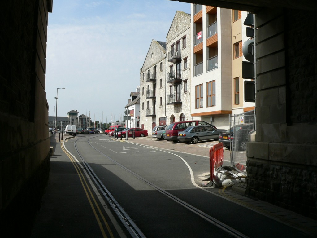 WQ-041W-01.jpg (157759 bytes)
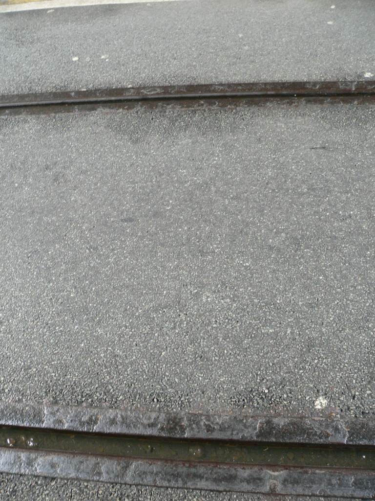 WQ-041rails-01.jpg (163419 bytes)
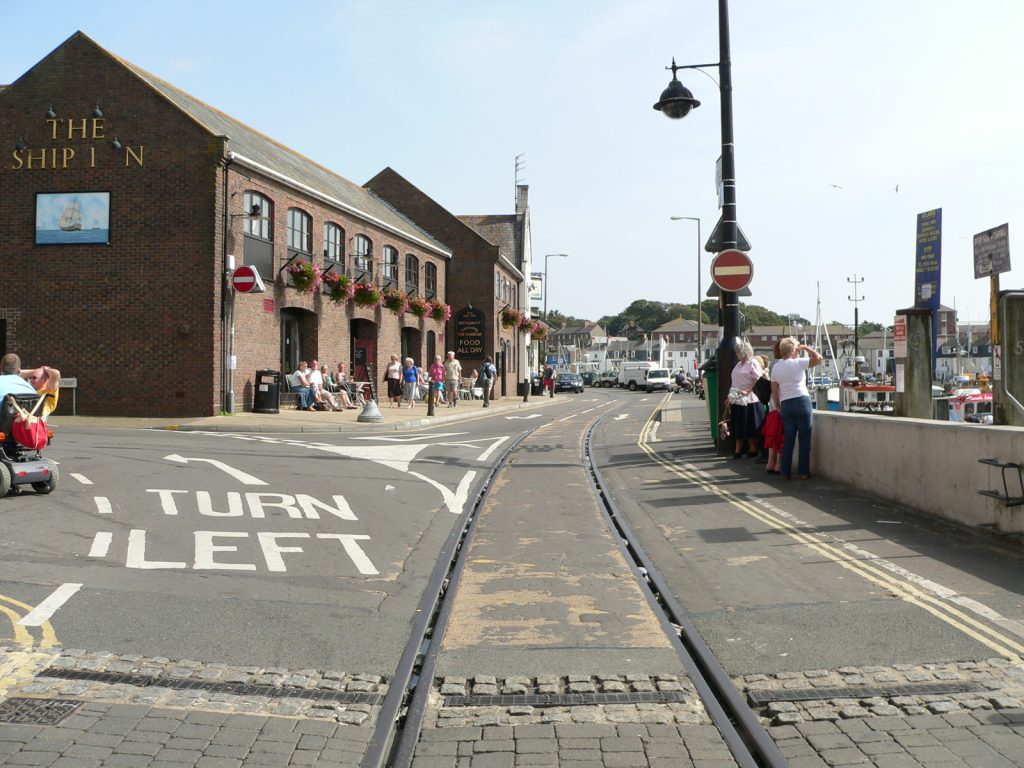 WQ-042E-01.jpg (159070 bytes)
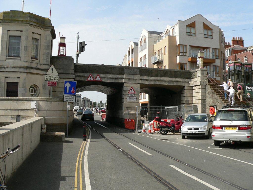 WQ-042W-01.jpg (163417 bytes)
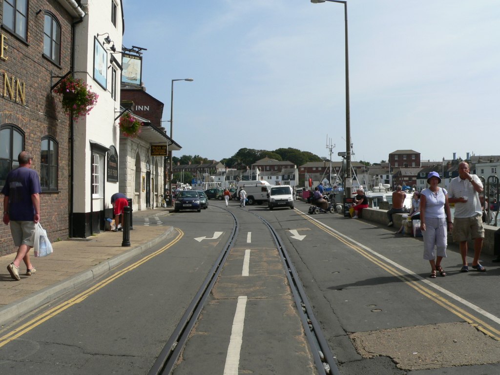 WQ-043E-01.jpg (160519 bytes)
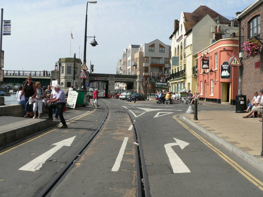 WQ-043W-01.jpg (160681 bytes)
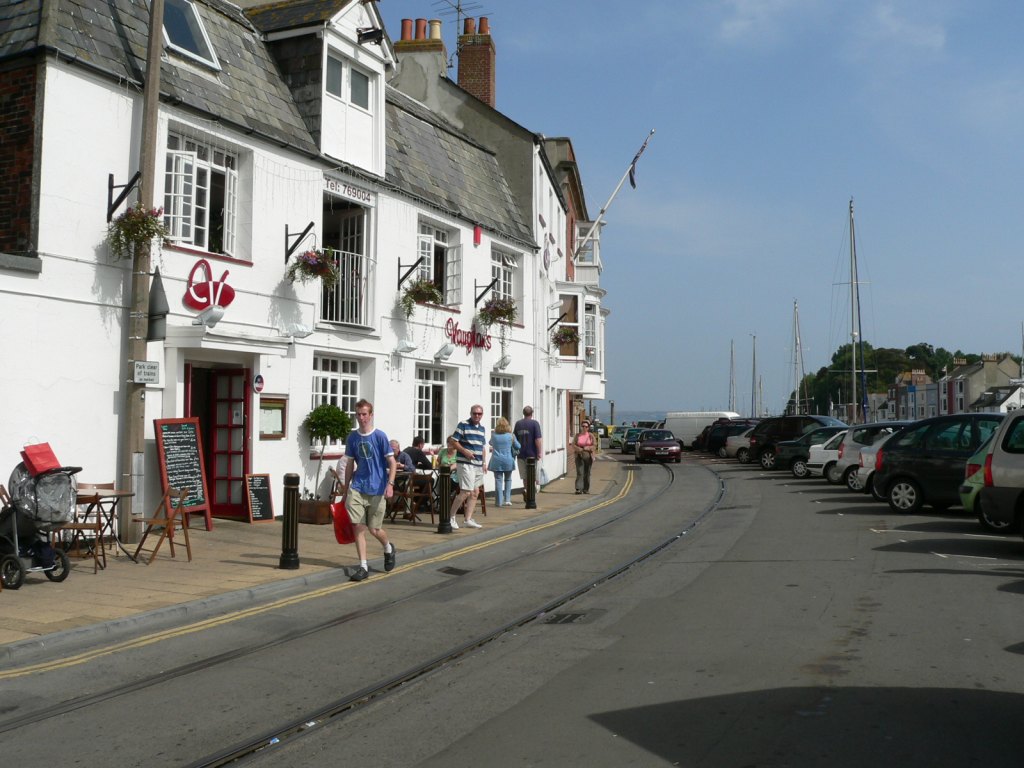 WQ-044E-01.jpg (160506 bytes)
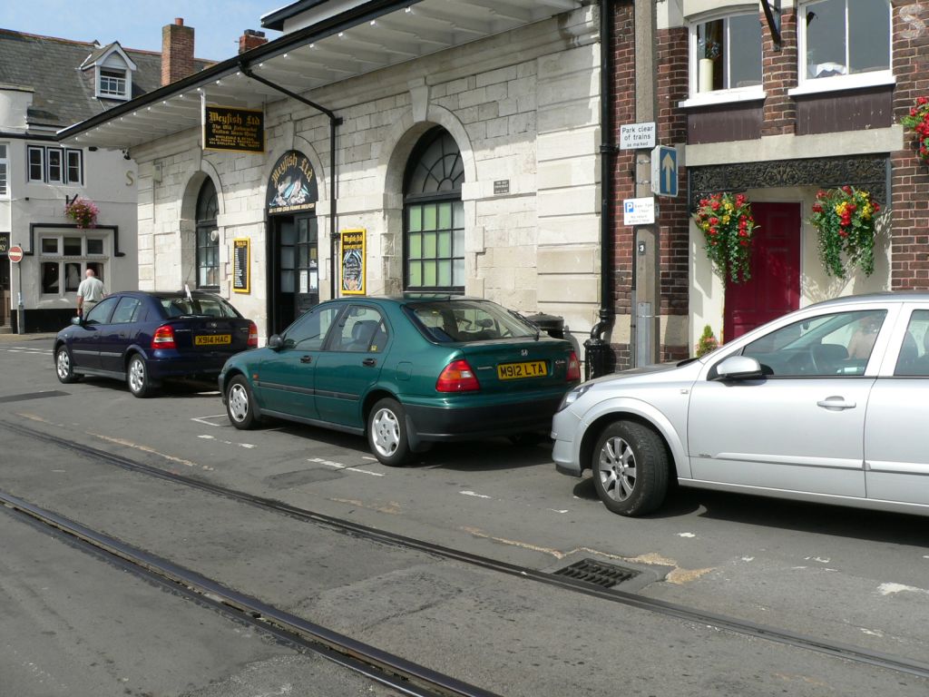 WQ-044NW-01.jpg (160154 bytes)
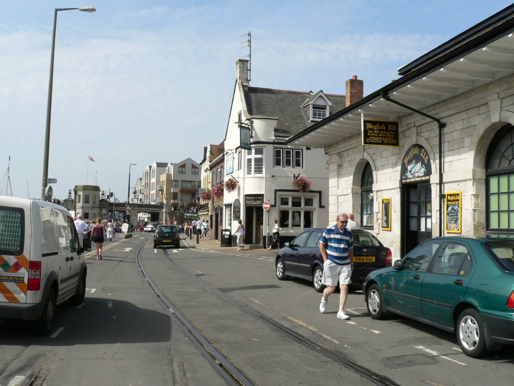 WQ-044W-01.jpg (162901 bytes)
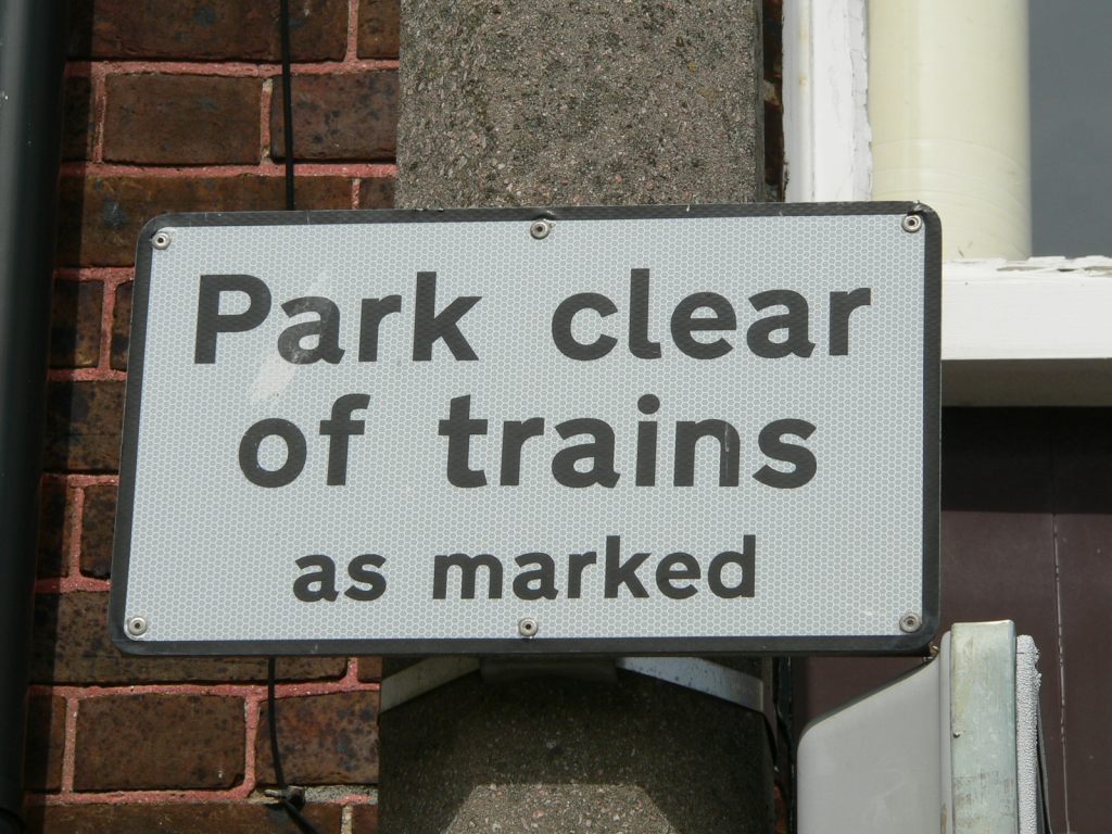 WQ-044sign-01.jpg (163122 bytes)
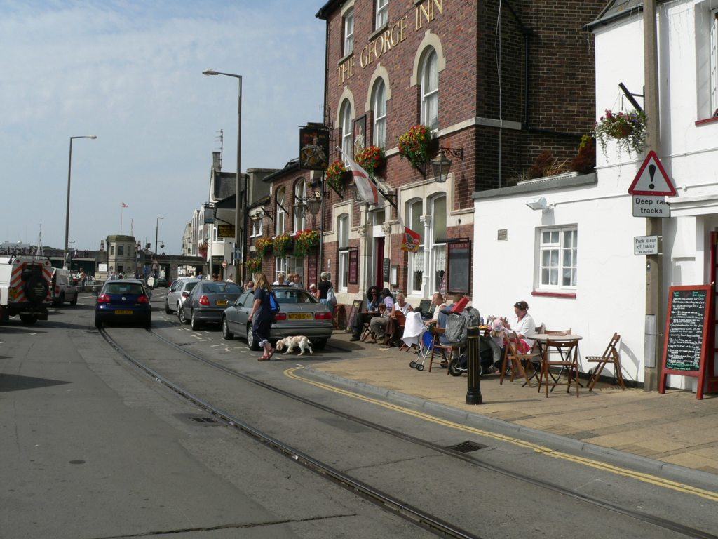 WQ-045W-01.jpg (161148 bytes)
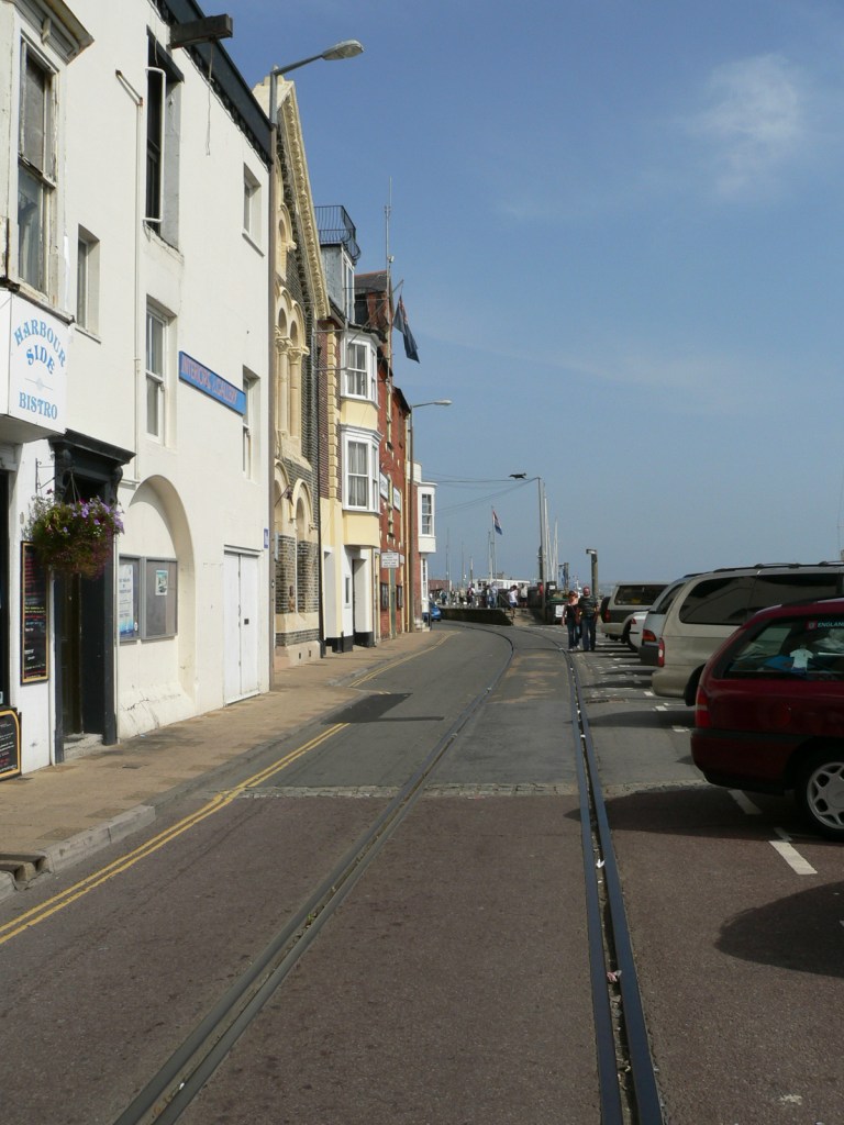 WQ-046E-01.jpg (160151 bytes)
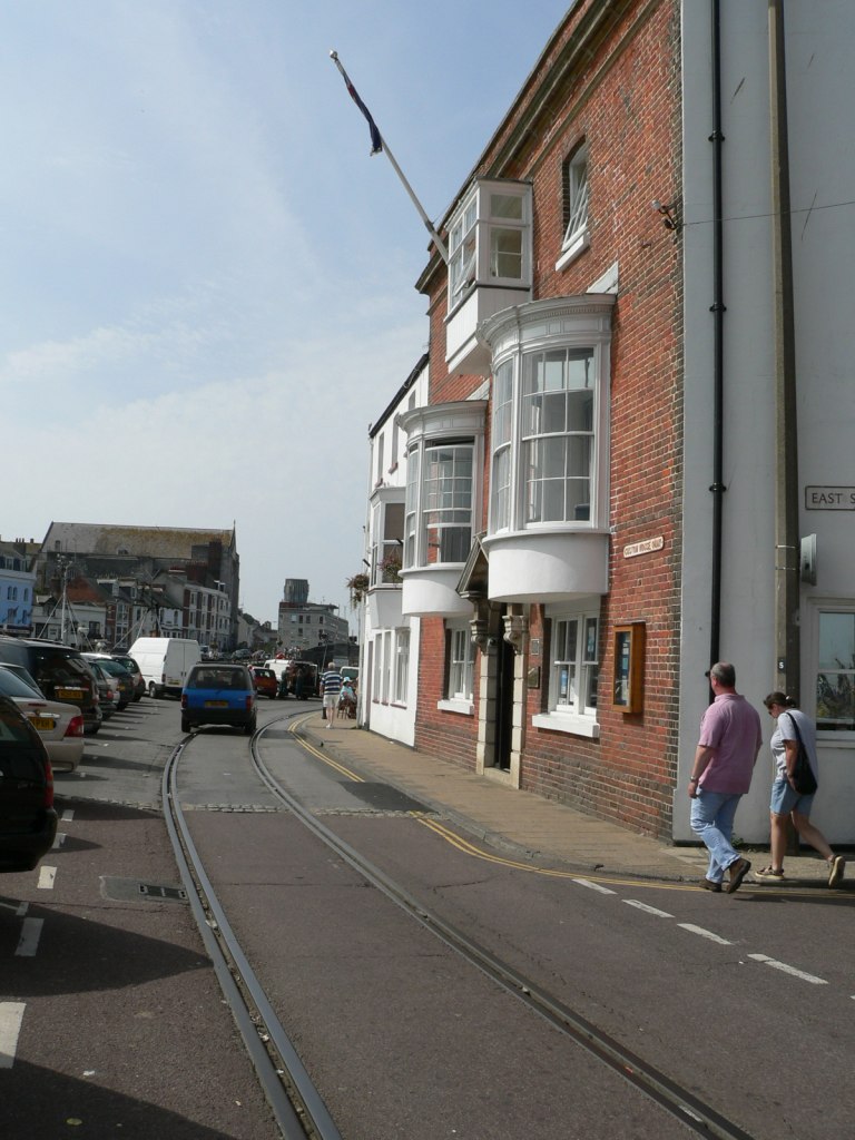 WQ-046W-01.jpg (163315 bytes)
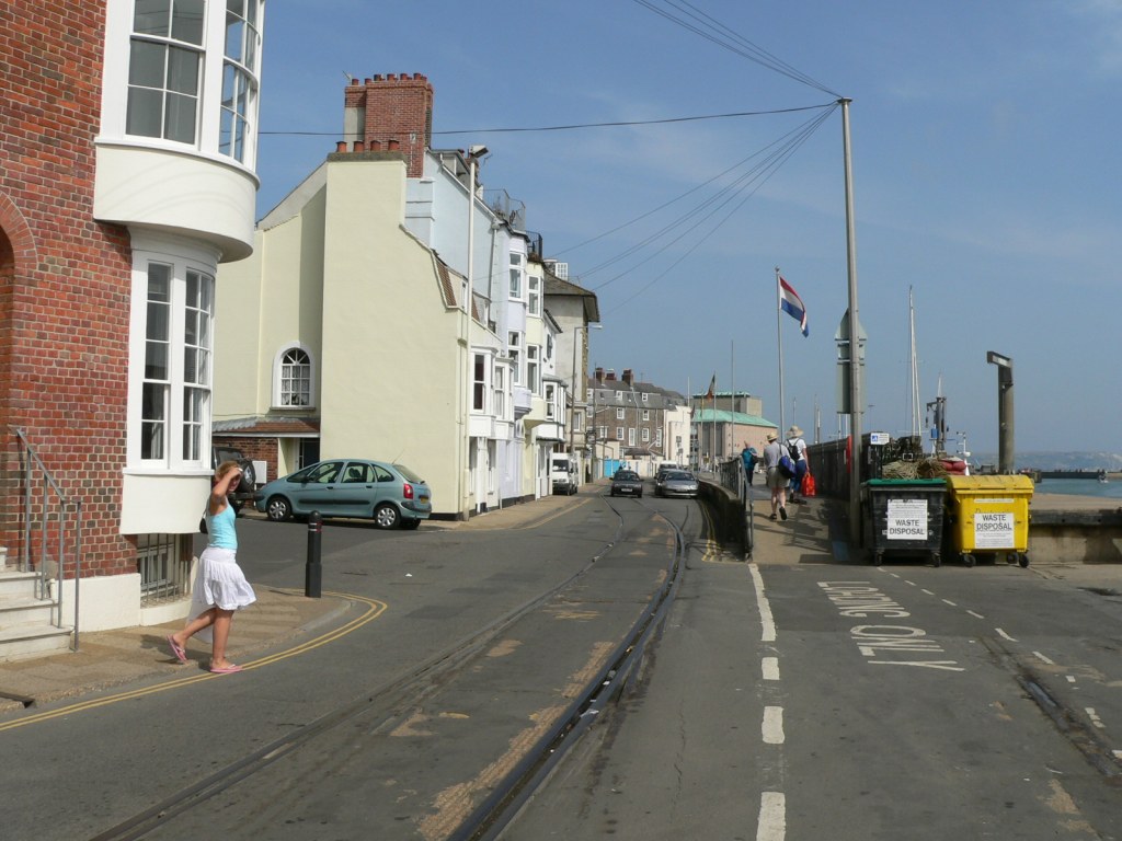 WQ-047E-01.jpg (163452 bytes)
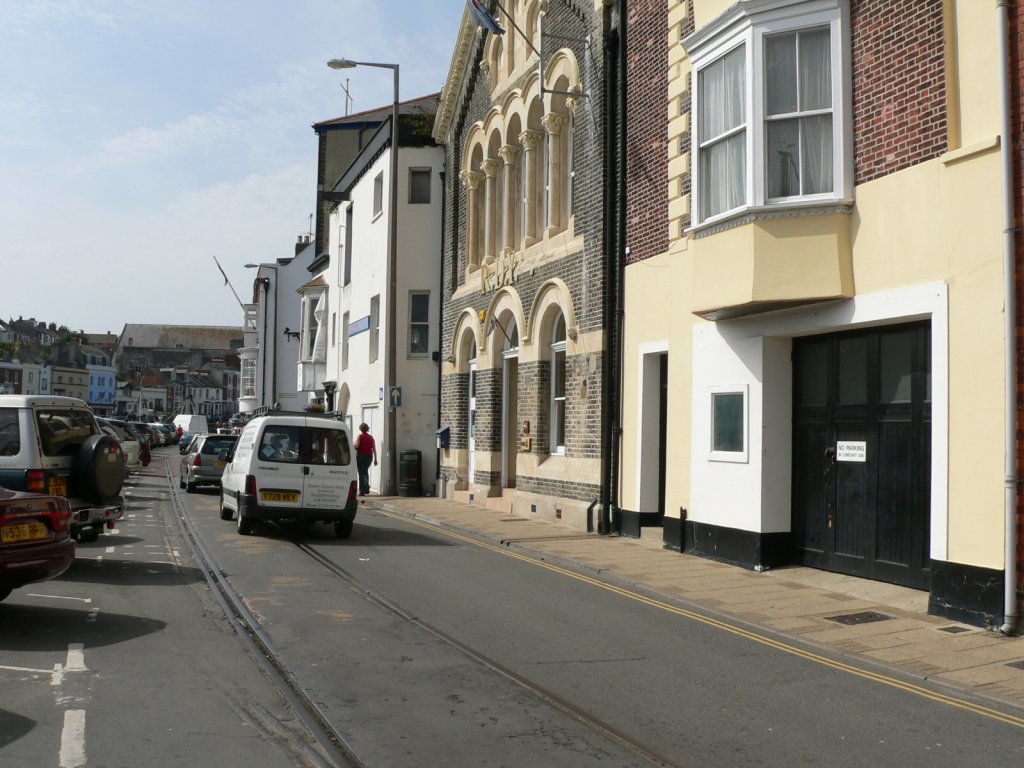 WQ-047W-01.jpg (161673 bytes)
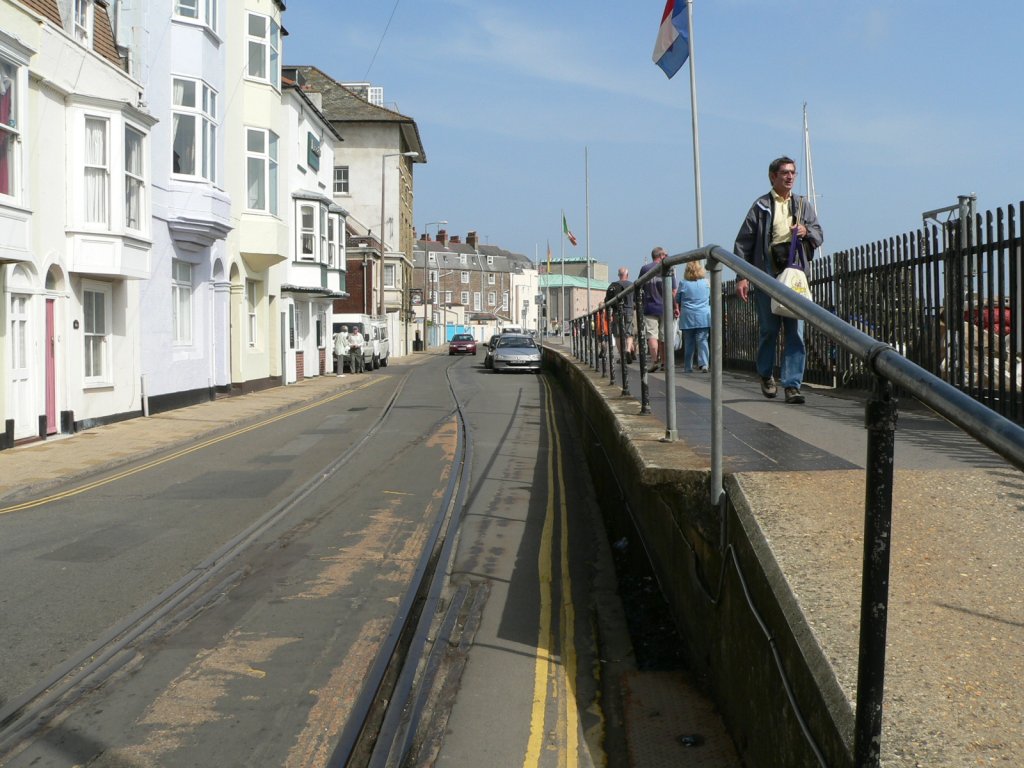 WQ-048E-01.jpg (163465 bytes)
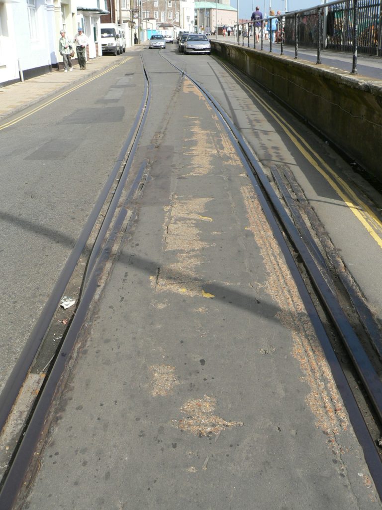 WQ-048rails-01.jpg (160734 bytes)
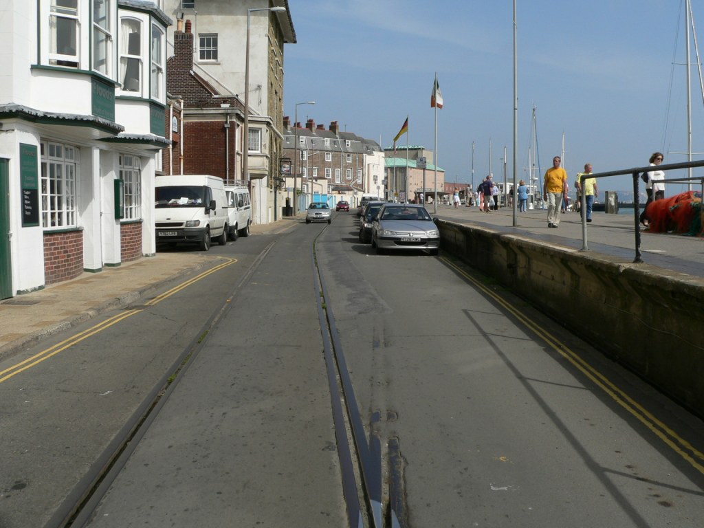 WQ-049E-01.jpg (160072 bytes)
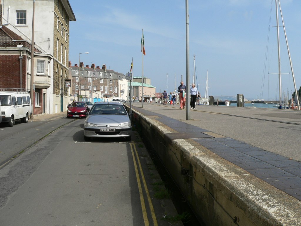 WQ-050E-01.jpg (156288 bytes)
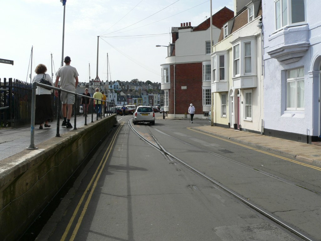 WQ-050W-01.jpg (161481 bytes)
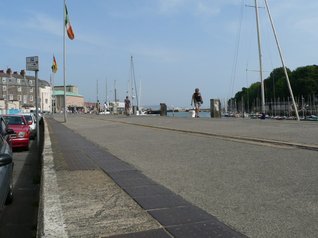 WQ-051E-01.jpg (158425 bytes)
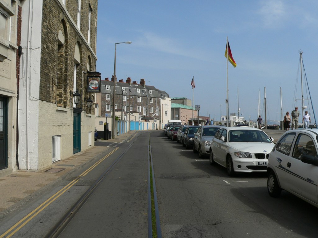 WQ-052E-01.jpg (159853 bytes)
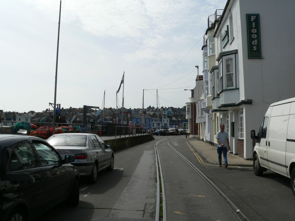 WQ-052W-01.jpg (163617 bytes)
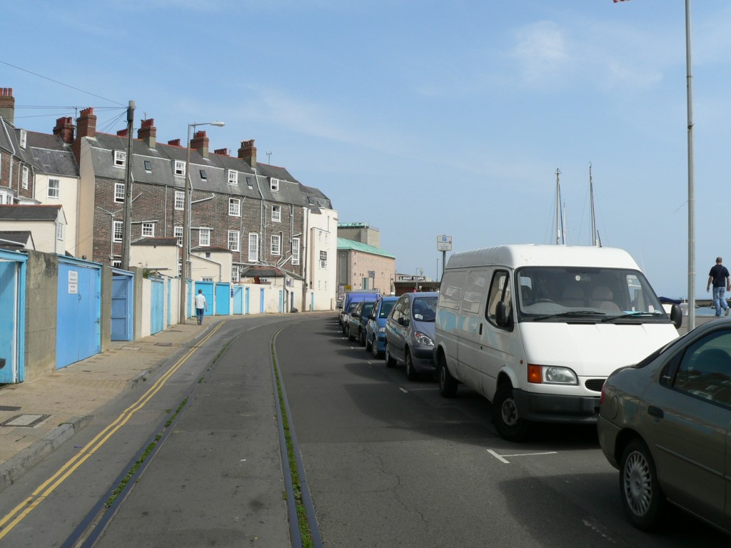 WQ-053E-01.jpg (156774 bytes)
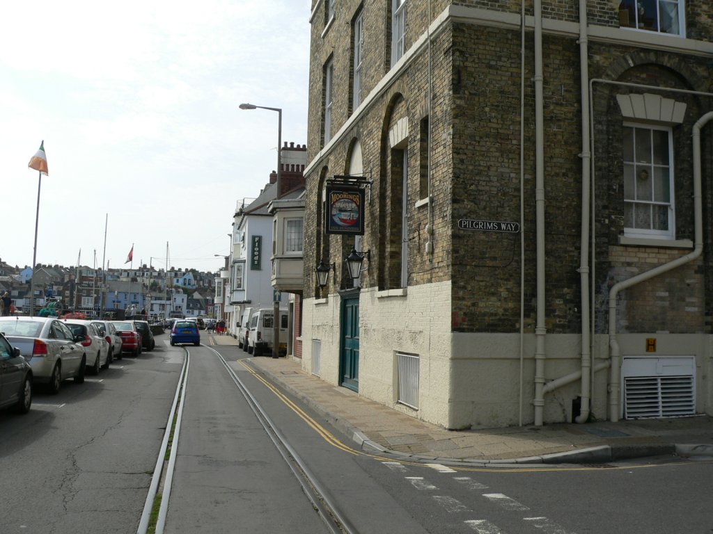 WQ-053W-01.jpg (159107 bytes)
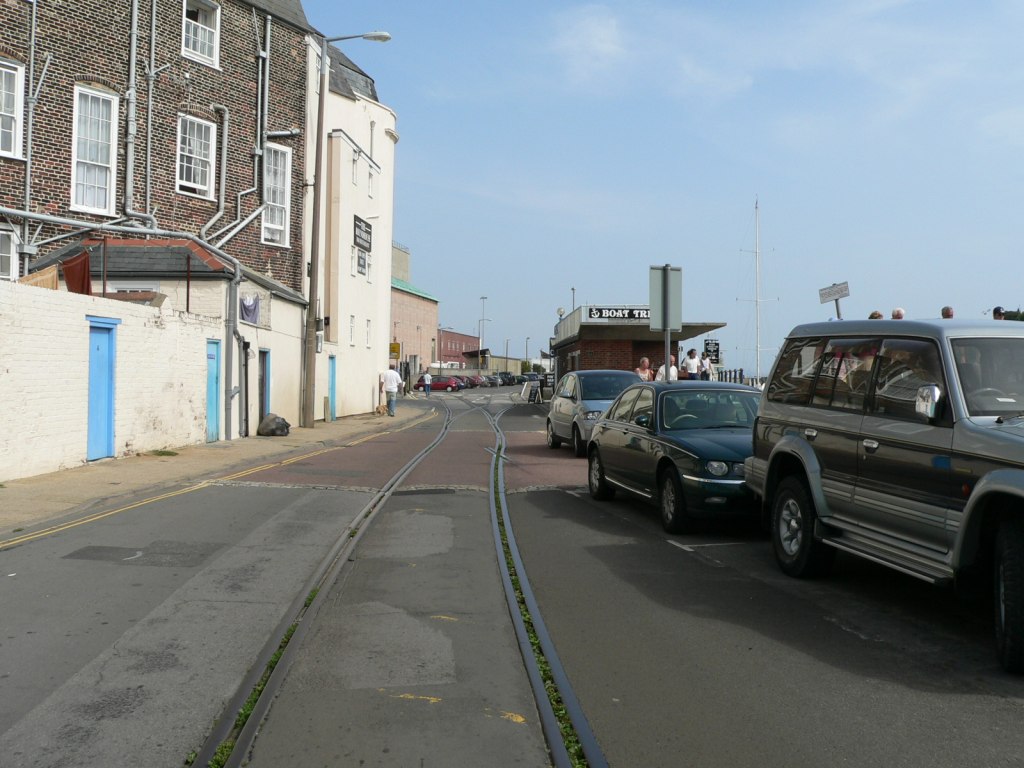 WQ-054E-01.jpg (158211 bytes)
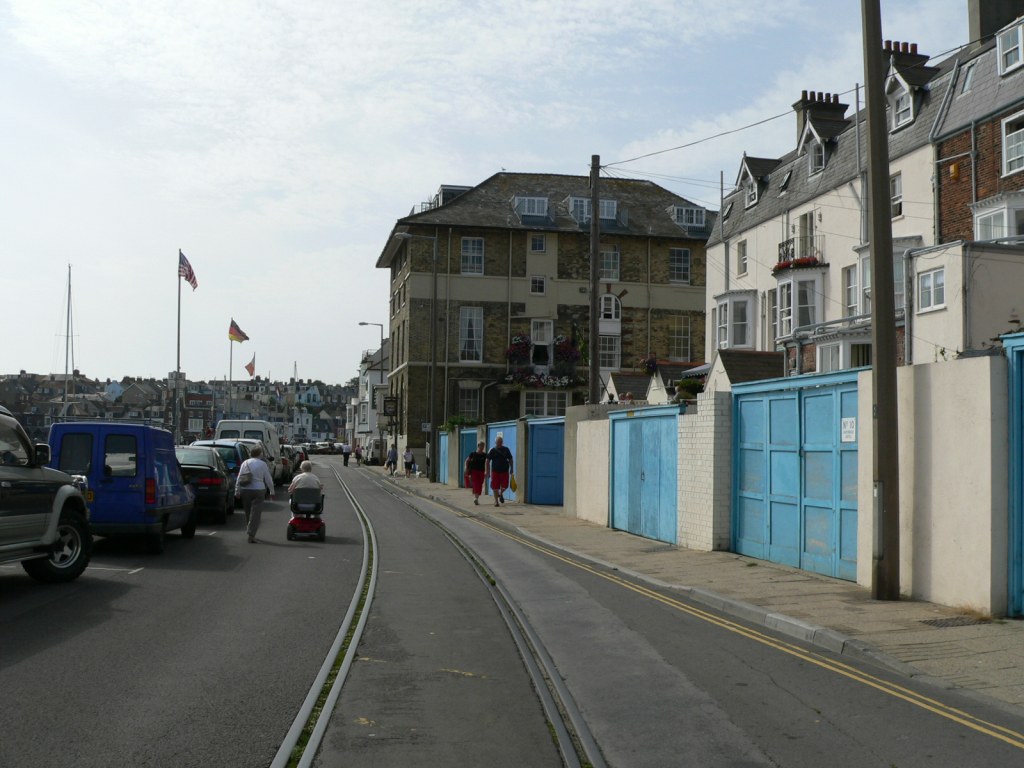 WQ-054W-01.jpg (158330 bytes)
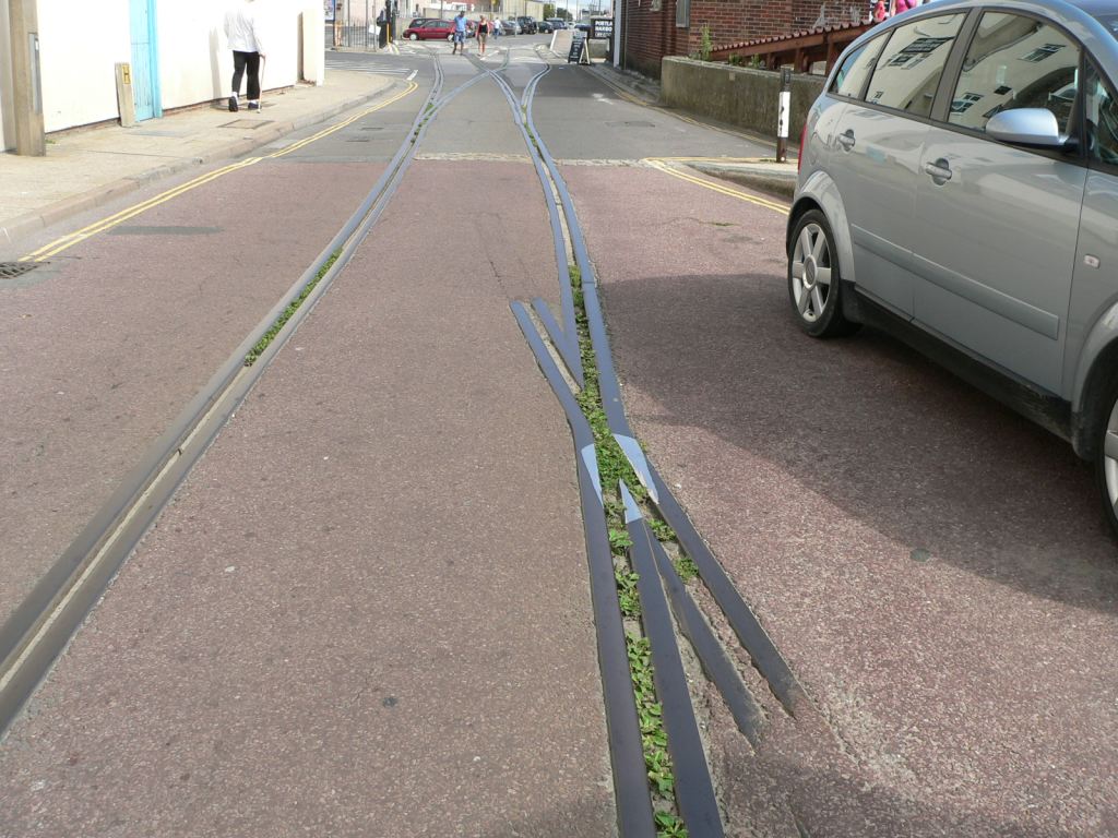 WQ-055rails-01.jpg (159881 bytes)
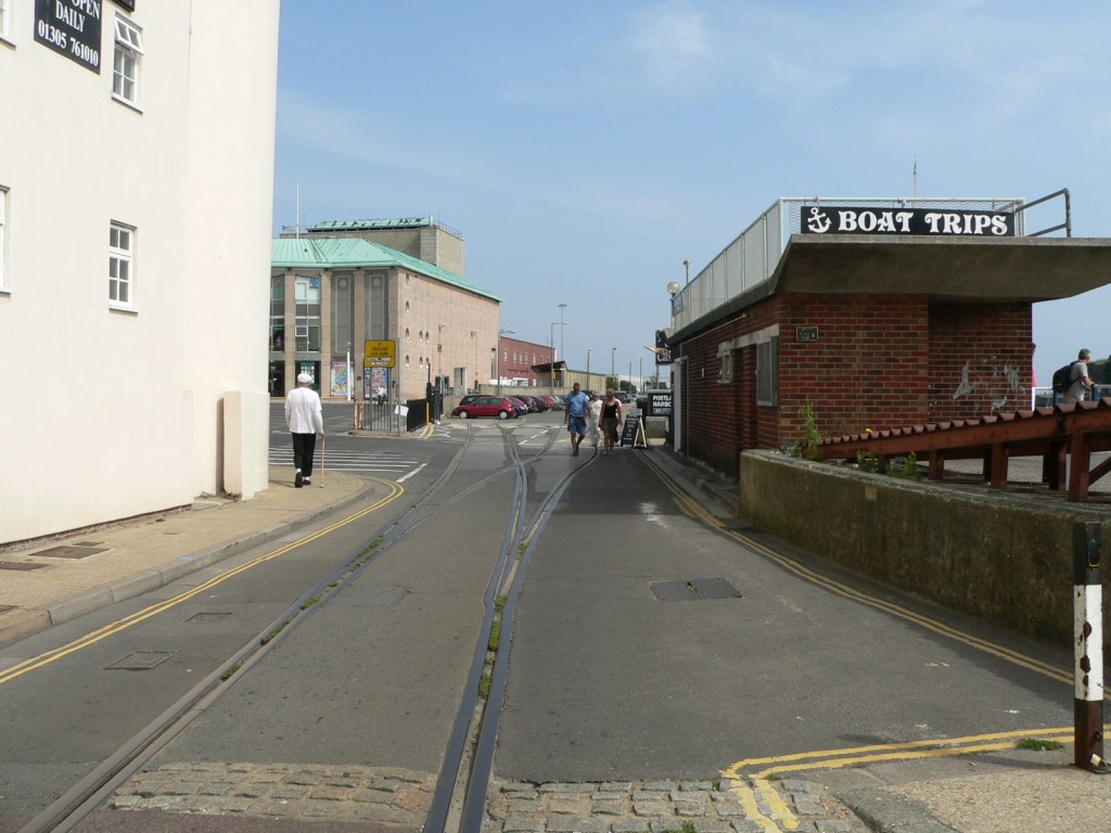 WQ-056E-01.jpg (157579 bytes)
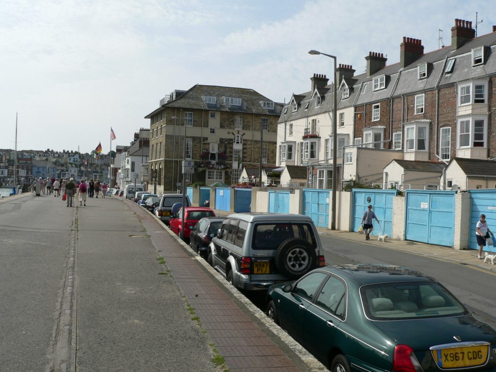 WQ-057W-01.jpg (160776 bytes)
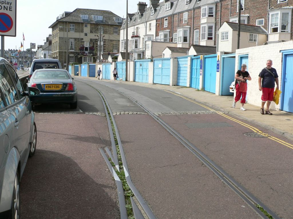 WQ-058W-01.jpg (163346 bytes)
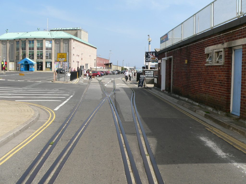 WQ-059E-01.jpg (159058 bytes)
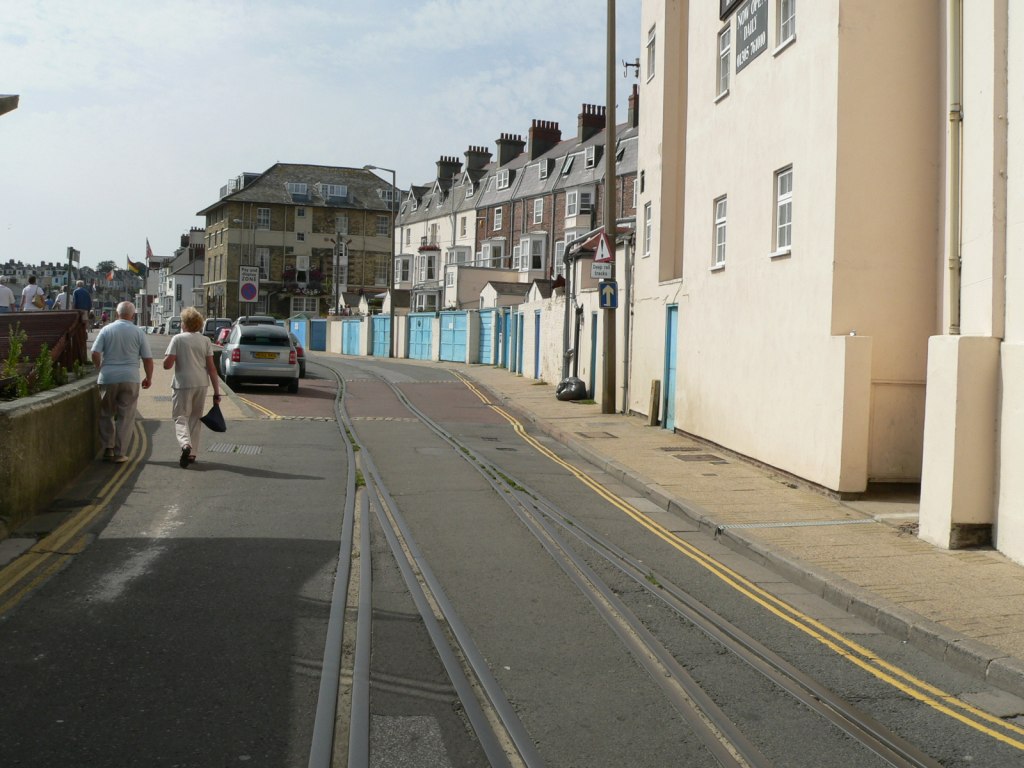 WQ-059W-01.jpg (157007 bytes)
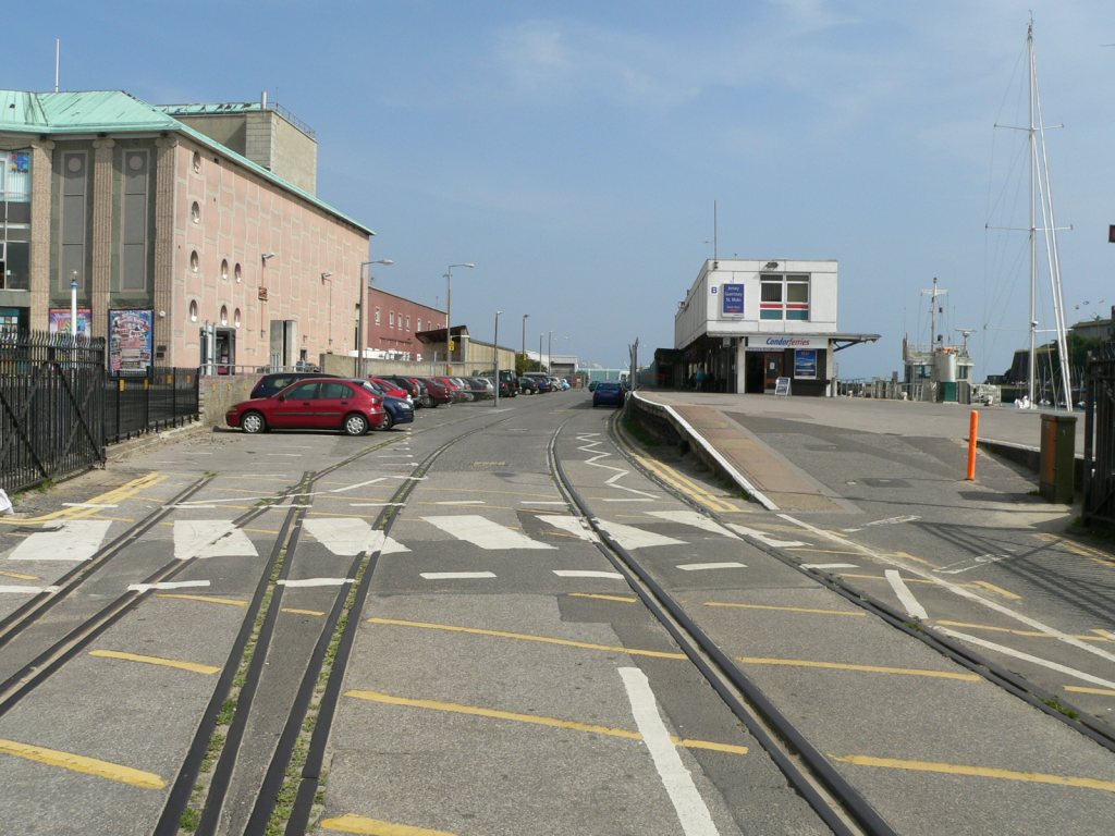 WQ-060E-01.jpg (160233 bytes)
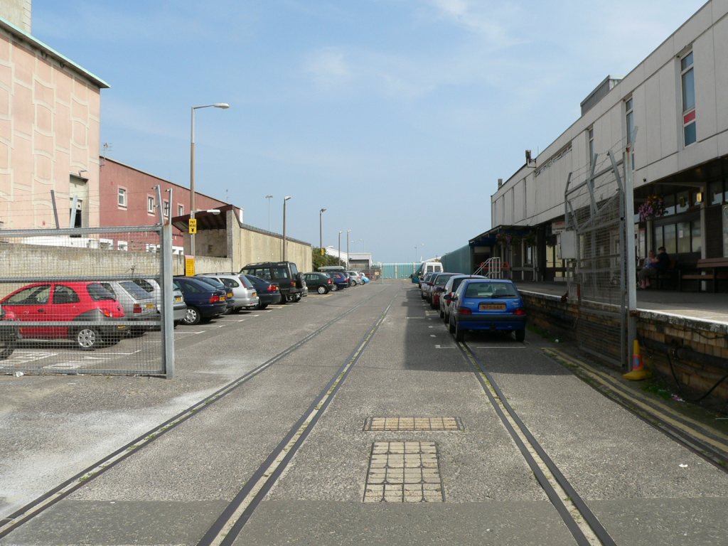 WQ-061E-01.jpg (162713 bytes)
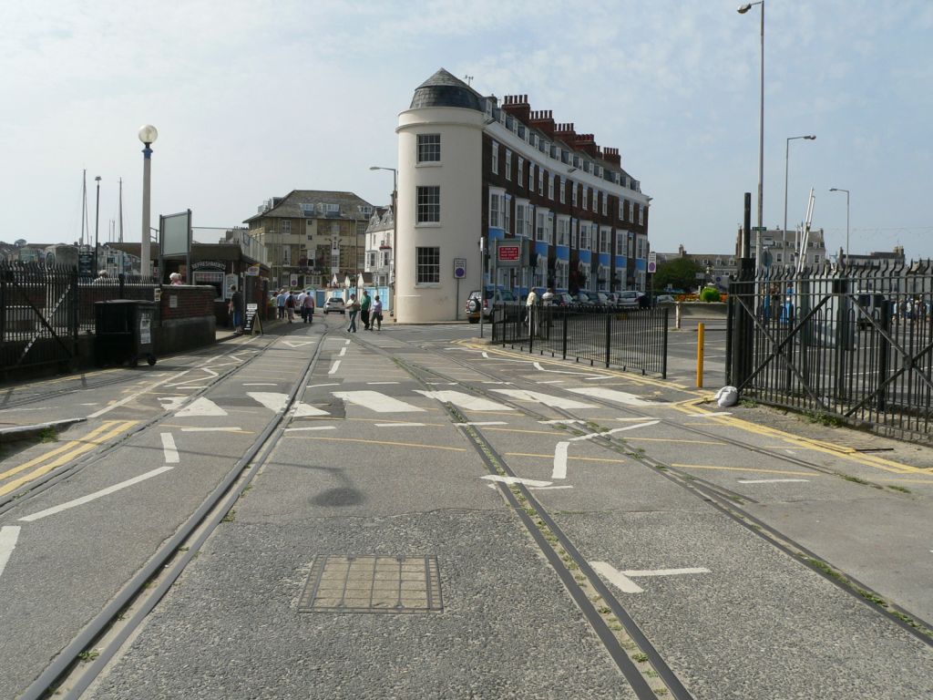 WQ-061W-01.jpg (162105 bytes)
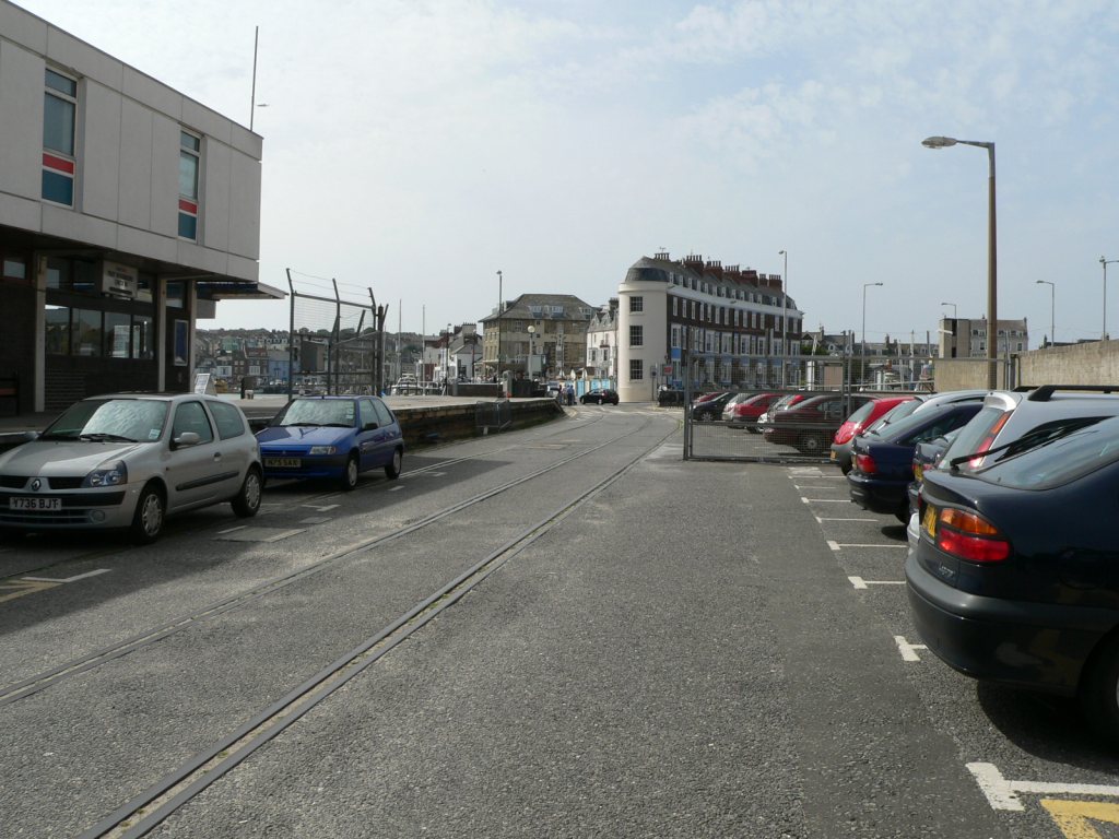 WQ-062W-01.jpg (160901 bytes)
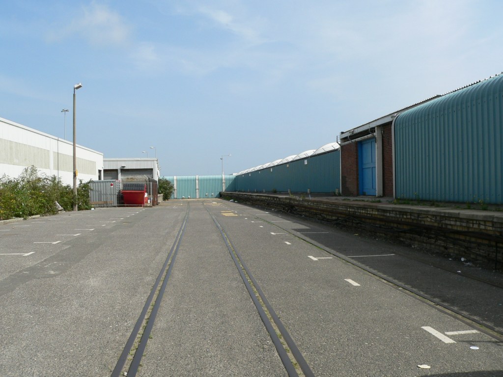 WQ-063E-01.jpg (159187 bytes)
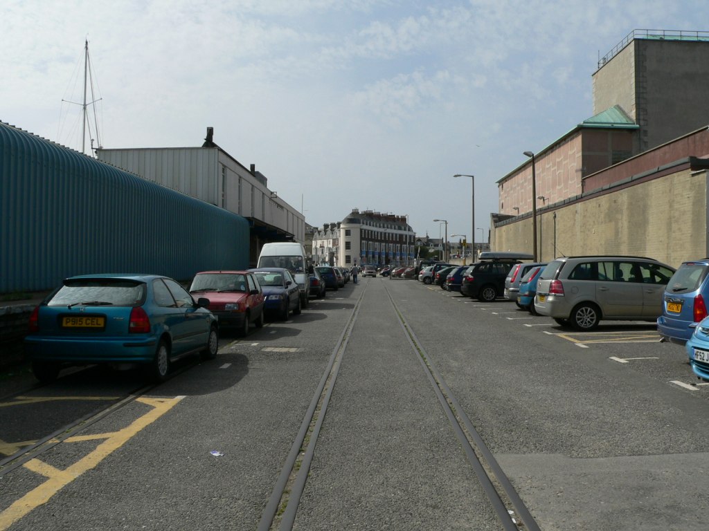 WQ-063W-01.jpg (162211 bytes)
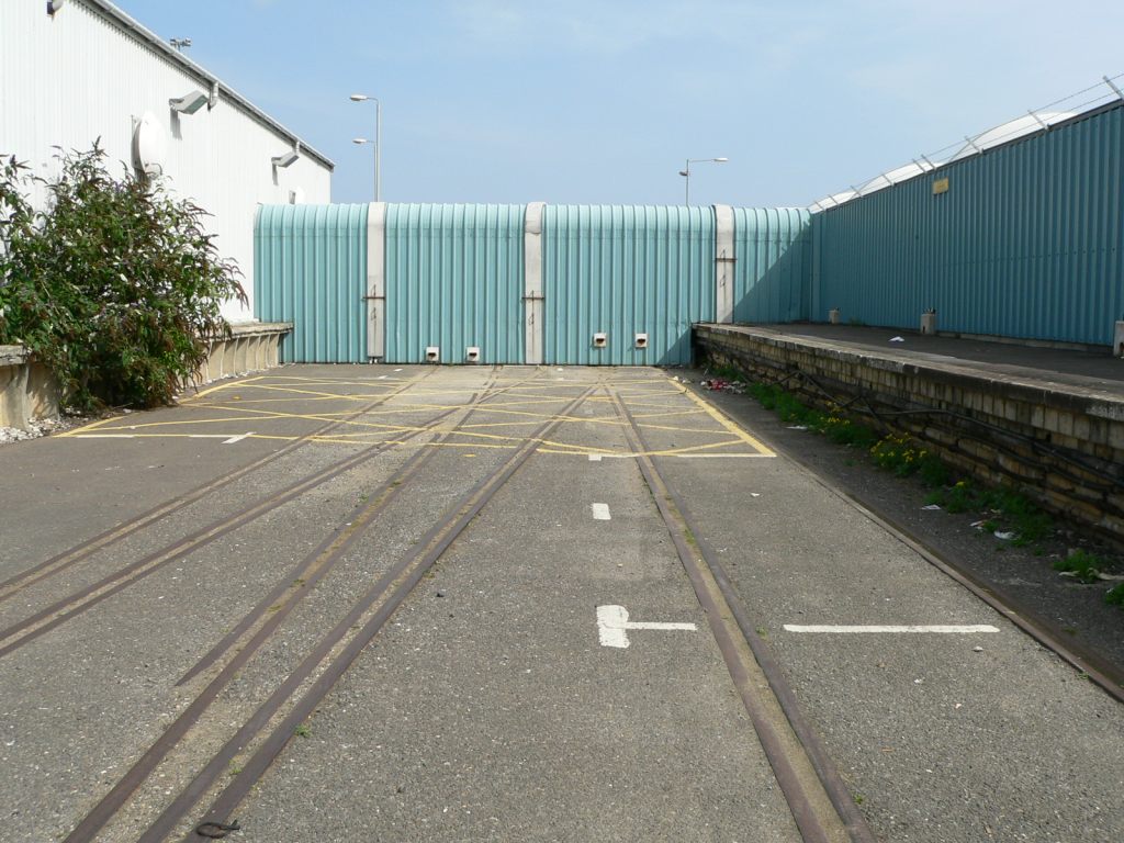 WQ-064E-01.jpg (163600 bytes)
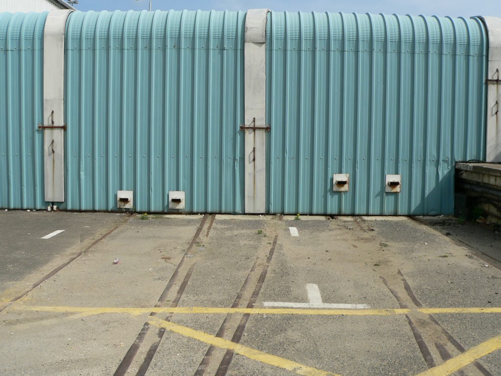 WQ-065E-01.jpg (158566 bytes)
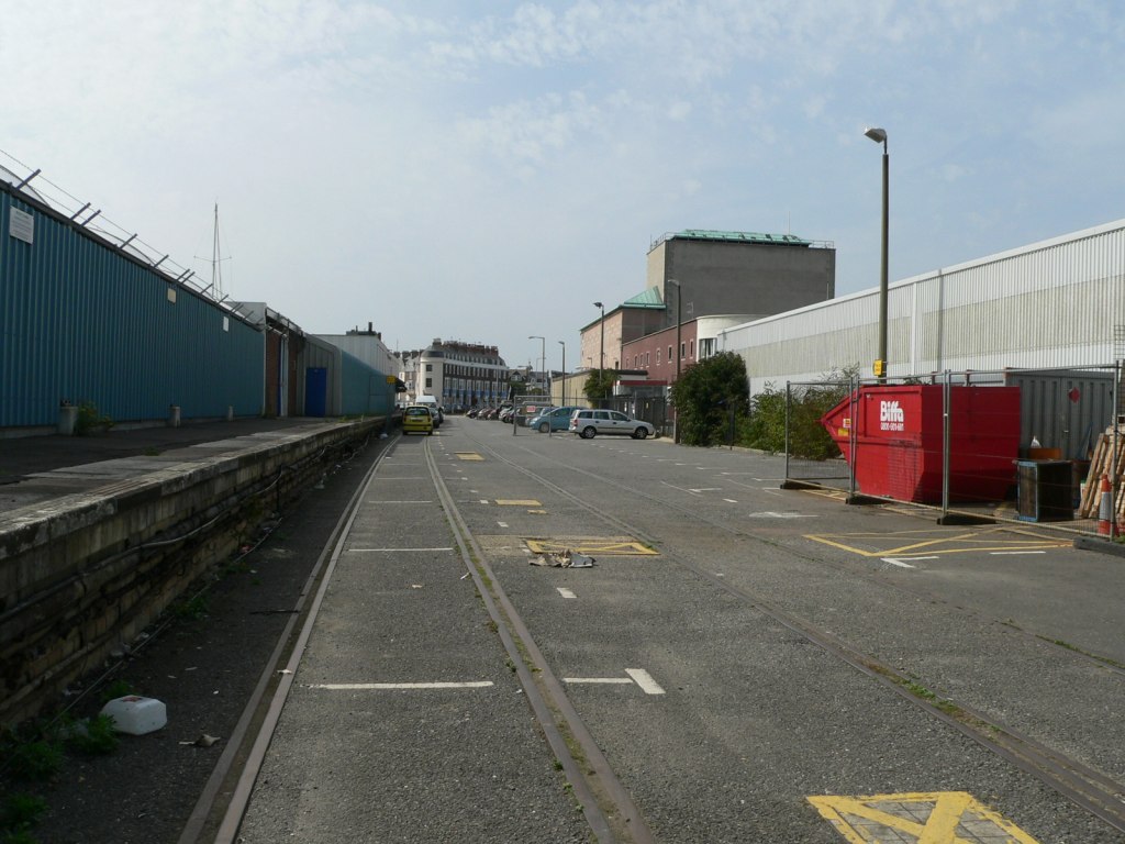 WQ-065W-01.jpg (157964 bytes)